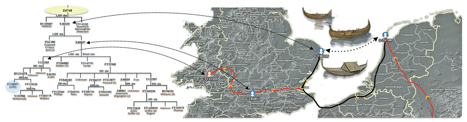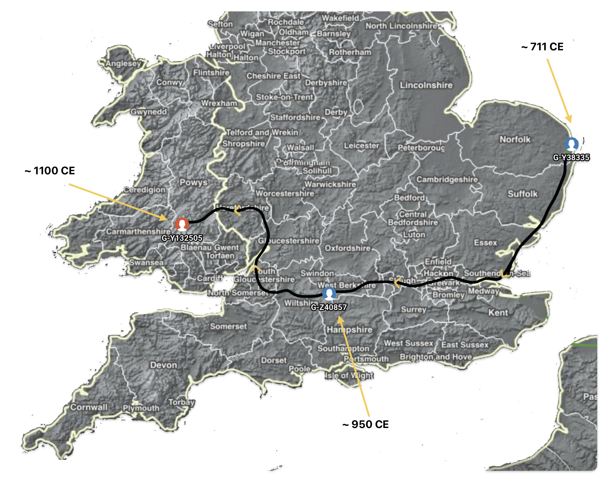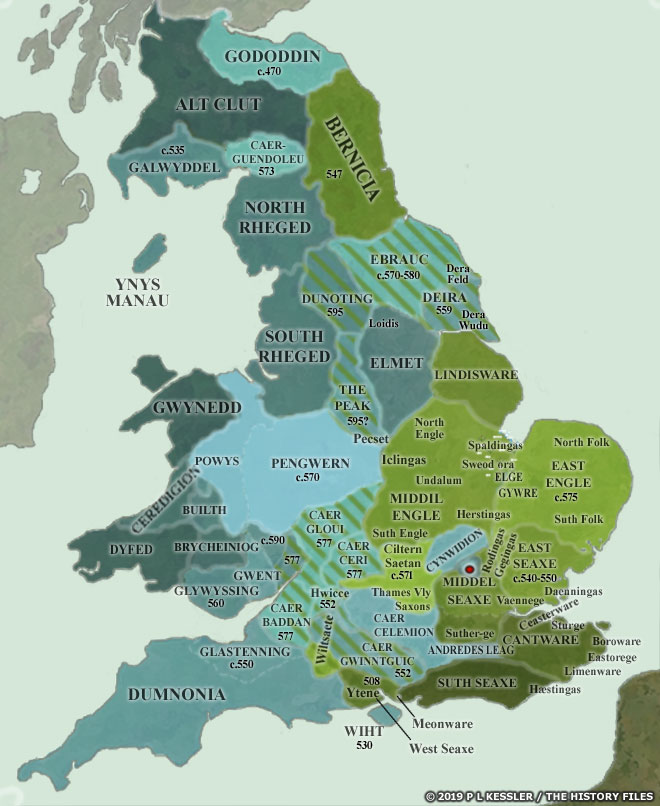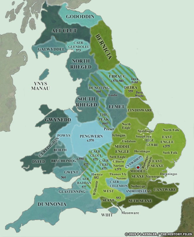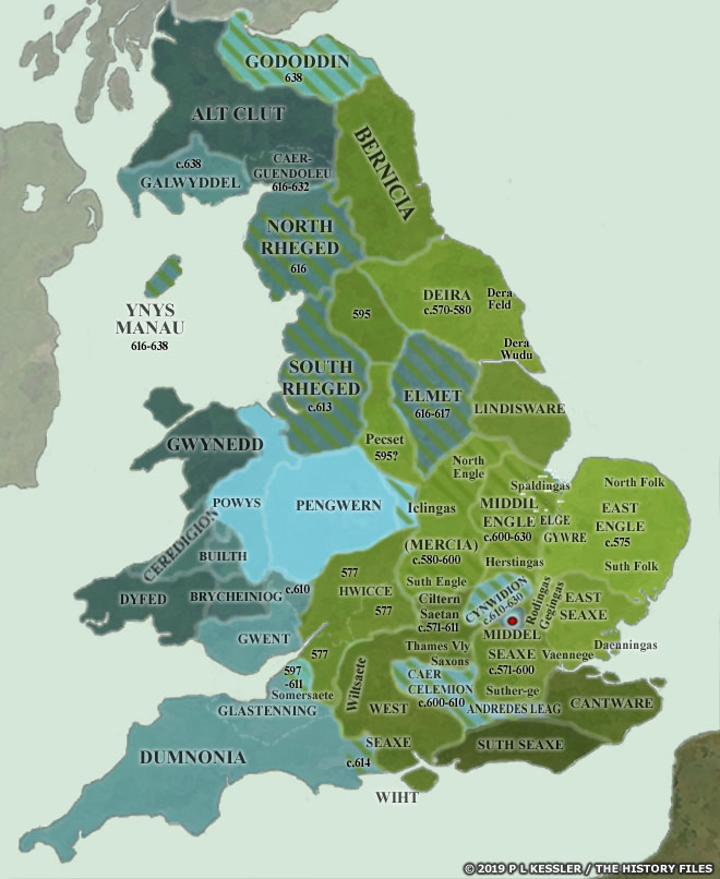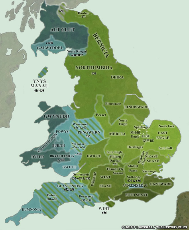

The most recent common ancestor (MRCA) ancestor of the YDNA haplogroup G-Z40857 is a direct, albeit historically remote, ancestor of the Griff(is)(es)(ith) paternal line. This ancestor lived about 1,000 years ago. Based on available genetic data and historical research, this male ancestor is thought to have lived in the Kingdom of Wessex before the Norman invasion. The descendants of the MRCA of G-Z40857 were part of a YDNA genetic expansion that migrated westward from south central Wessex into the border line areas that were inhabited by Anglo-Saxon and Celtic-Briton (Welsh) groups.
This individual who was perhaps self identified as an Anglo-Saxon, was a forefather of generations that ‘became’ identified as Welsh.
The expansion of the paternal family tree of this ancestor and its subsequent migration of descendants just before the time of the Norman invasion and through what is known as the Welsh Marches era. This individual who was perhaps self identified as an Anglo-Saxon, was a forefather of generations that ‘became’ identified as Welsh. The initial expansion of the haplogroup branches associated with these specific G haplogroup lineages is evident between 1000–1500 CE and are linked to this ancestor.
This story focuses on the social context of this most recent common ancestor of Haplogroup G-Z40857. The story itself is the ‘tip of the iceberg’. Most of what follows in this story are footnotes that provide additional information. The long and involved footnotes are provided as source material, explanations for various historical facts and my historical correlations with genetic material. The footnotes are provided if the reader wishes to go off on specific tangents.
The Social Context of the Common Ancestor of G-Z40857
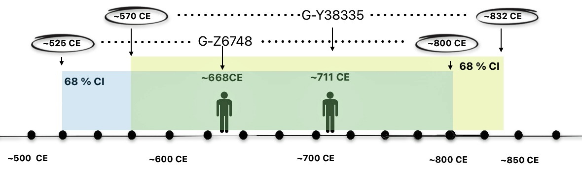
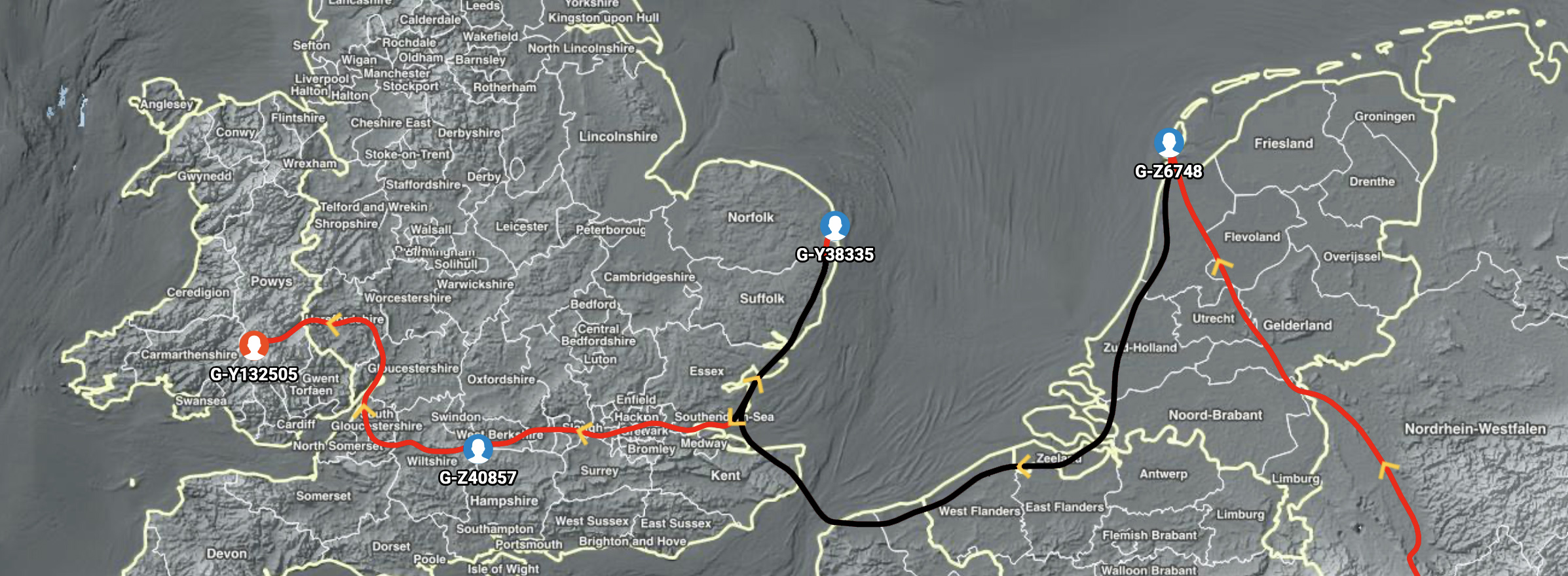
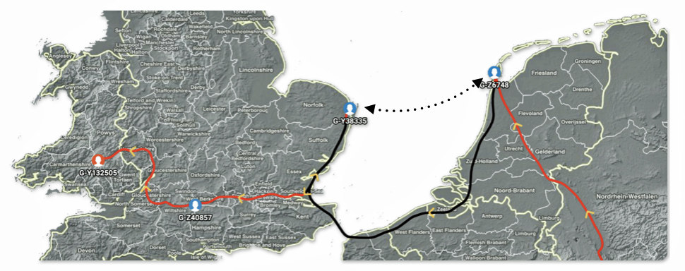
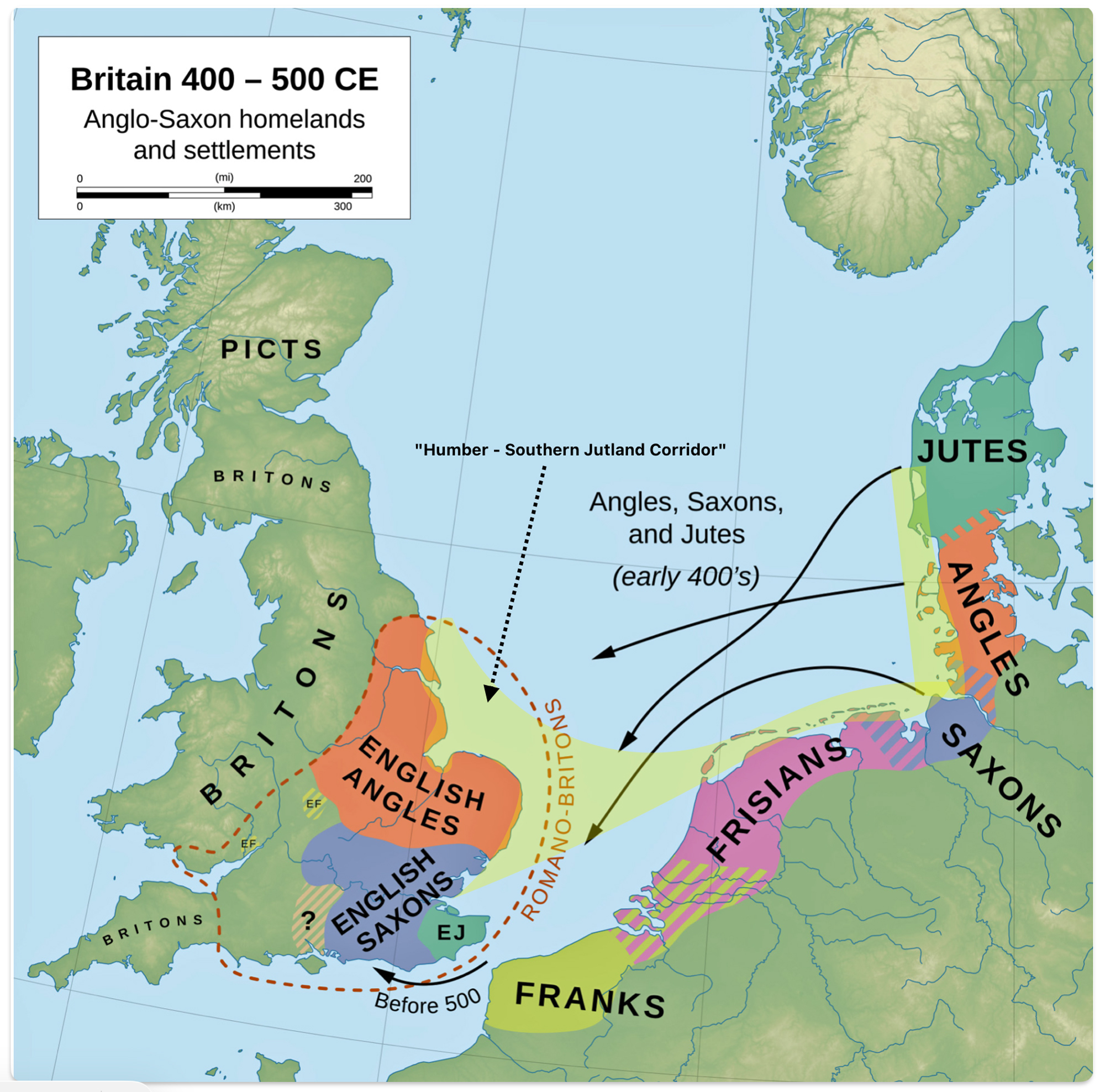
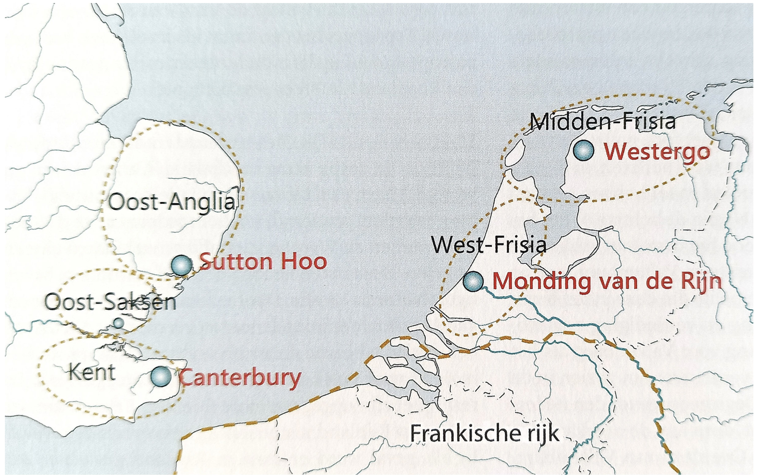
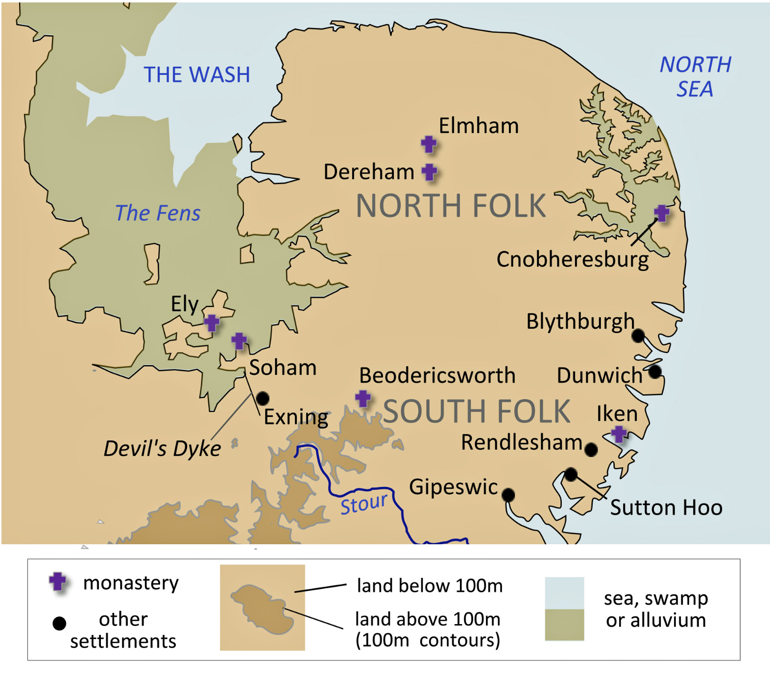
Based on available documentation, the MRCA of G-Z40857 was at the tail end of roughly eight generational gap in a genetic paternal line of descent. This eight generational gap reflects a migration path of YDNA ancestors from the Anglo-Saxon kingdom of East Anglia to the southern area of the kingdom of Wessex. This is where the ‘first wave’ of a star-like expansion of haplogroup branches associated with this paternal lineage starts to emerge.
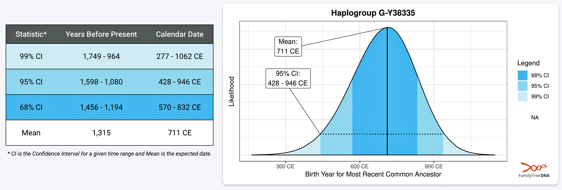
As indicated in a prior story [1], it is hypothesized that the MRCA of G-Z40857 lived in the southwestern area of the Kingdom of Wessex near the borderline area inhabited by Celtic Britannic groups that were identified as Welsh kingdoms. At the time of this ancestor’s estimated birth around 970 CE, Wessex was a powerful Anglo-Saxon kingdom in southern England that successfully fought off Viking invasions and laid the foundation for a unified English state. There is a 68 percent chance that he was born between 855 – 1070 CE (see illustration two). [2]
Illustration One: Scientific Details for the MRCA of G-Z40857

Living in Southern England in the historic heartland of Wessex during the reign of King Edgar the Peaceful (959–975 CE) offered a rare generation of exceptional stability. This stability was the result of a profound religious grip on daily life, a shifted agrarian hierarchy, increased administrative oversight of local rule, monetary standardization, the emergence of town markets and economic growth. Free from the devastating Viking invasions that plagued previous and subsequent eras, southern English society underwent structural changes that deeply impacted daily life. [3]
Wessex society under Edgar remained, to put it politely, sharply stratified: a small class of thegns (aristocrats) and greater nobility held land and military obligation (often owing service to the king). A broader class of free peasants (ceorls) worked land under various tenurial arrangements, and a substantial population of slaves and semi-free laborers existed at the bottom, particularly on large estates and monastic lands. Kinship and lordship bonds structured everyday social relations, with the church increasingly acting as a major lord in its own right due to the monastic land grants of the reform period during this time. [4]
The chart below (illustration two) depicts the social stratification and legal status that late Anglo-Saxon Wessex. This system of stratifying people was organized around the the law practice of weregild, “man-price,” the compensation owed for a person’s death or injury, and land tenure, drawn from the West Saxon law codes and the late Old English estate-management tract known as the Rectitudines Singularum Personarum. [5]
A key dynamic in this period was social mobility through the “promotion laws” (the Geþyncðo group). [6] A prospering ceorl [7], for example, who acquired five hides, a church, a kitchen, a bell-house, and a fortified gate could claim thegn-right, though hereditary confirmation typically required three generations of qualifying descendants. An hide was an administrative, fiscal, and military unit of land originally meant to be enough to support a single peasant family (roughly 60 to 120 acres of arable land). [8]
Illustration Two: Social Stratification in Wessex Circa 970 – 1000 CE [9]

We know little aside from estimating the birth and possible location of the MRCA of G-Z40857. It is likely that this individual was a Ceorls, part of the free peasantry. The Ceorls (free peasantry) is estimated to represent up to three quarters of the population in Wessex. It was the dominate social class, consistent with their role as the demographic backbone of the shire and hundred courts (see illustration three).
Illustration Three: Tree Map of the Social Stratification of the Anglo Saxon Society in Wessex Based on the on the Estimated Population between 970 and 1000 [10]

The area of each block in illustration three is proportional to that rank’s estimated share of the population. The illustration itself visually makes the central point of Anglo-Saxon social structure: this was a numerically narrow elite sitting atop a broad base of unfree and semi-free labor:
- Ceorls (free peasantry) dominate the area at roughly three quarters of the population, consistent with their role as the demographic backbone of the shire and hundred courts.
- Welsh and landless tenants (about fourteen percent) and theow/slaves (about ten percent) together made up close to a quarter of the population — legally free but marginal or wholly unfree.
- Thegns and the six-hynde rank combined occupy well under four percent of the population, and æthelings, ealdormen, and the king are statistically negligible — visible as slivers too narrow to label, which is itself the point: high wergild and high legal status corresponded to a vanishingly small number of people.
A View from a Broader Social Context
Since there is a sixty-eight percent probability that the MRCA of G-Z40857 was born between 855 and 1070 CE, the socio-historical context of his life and subsequent generations preceding this expansion could been associated with a wide range of social, cultural and historical circumstances. This time span runs from the height of the Viking assaults on Alfred’s kingdom through the Danish conquest [11] and into the eve of the Norman Conquest — roughly two centuries in which Wessex was transformed from a threatened regional kingdom into the administrative core of a unified English state (see illustration four).
Illustration Four: England 900 – 1000 CE

Academic peer reviewed literature depicts Wessex society across 855–1070 CE as one continuously reshaped by external military pressure (e.g. Viking raids, then Danish conquest [12] ) that drove the development of Wessex “from below” (e.g. hidage-based defense obligations [13] , burh-centered urbanization [14] , and increasingly codified legal and social stratification ). This was paired with periodic religious revival (e.g. the Benedictine reform under Edgar) that layered ecclesiastical landholding and moral authority onto secular hierarchy, and by the eleventh century, a manorial, lordship-based rural order was crystallizing that would carry largely intact, though reorganized, through the post-1066 Anglo-Norman world (see illustration five). [15]
Illustration Five: Political, Social, and Religious Influences on Wessex Society across 855–1070 CE [16]

It is conceivable that the MRCA of G-Z40857 or his immediate descendants lived after Edgar’s death in 975 CE. Despite earning the epithet “the Peaceful” for his politically stable rule, King Edgar’s marital and romantic relationships were highly unusual, deeply scandalous, and boundary-pushing for 10th-century Anglo-Saxon England. [17]
Edgar’s death immediately destabilized this peaceful time. His young sons Edward (the Martyr) and Æthelred were both minors, and the ensuing succession dispute split the nobility into factions. This period saw the so-called “anti-monastic reaction,” where nobles who had lost lands or influence during Edgar’s monastic reforms moved to reclaim estates from monasteries, particularly under the ealdorman Ælfhere in Mercia, though tensions rippled into Wessex as well, since many of the reformed houses (Winchester, Glastonbury, Abingdon) sat within or bordered Wessex proper. [18]
The murder of Edward the Martyr in 978 at Corfe (in Dorset, within Wessex) and the accession of the child-king Æthelred the Unready further destabilized elite politics, undermining the sense of order Edgar had cultivated and setting the stage for the weakened royal authority that would later struggle against renewed Viking incursions in Æthelred’s reign. [19]
Edgar had been the chief patron of the Benedictine monastic reform led by Dunstan, Æthelwold of Winchester, and Oswald of Worcester/York, which had redirected substantial estates and political power toward reformed monasteries. [20] With his strong hand removed, disgruntled nobles — chiefly Ealdorman Ælfhere of Mercia — moved to reclaim lands and expel monks the crown had installed, especially in Mercia, where “many monastic institutions were destroyed” and reformed communities were scattered. [21] It is worth noting that the surviving sources locate this dispossession specifically in Mercia rather than describing a comparable wave of monastery-sacking within Wessex itself. Wessex (Winchester above all, Æthelwold’s see) remained the reform’s institutional heartland and was largely spared the worst of the backlash, even as the political, spiritual social disruptions it generated was felt kingdom-wide.
For someone living in Wessex right after 975 CE, the social atmosphere was one of a contested royal succession playing out through aristocratic faction rather than open war. This was compounded by famine [22] and, within three years , the trauma of a king’s assassination on Wessex ground.
It is important to note virtually all surviving texts from this period (e.g. Anglo-Saxon charters [23], the Chronicle [24], etc.) were written by and for the clergy and aristocracy, and none of them describe peasant reactions directly. The Anglo-Saxon Chronicle records that “famine scoured the hills” in 975 and that 976 brought “the great famine” across England. [25]
No numerical death toll survives but historians treating this entry consistently note the effects were, in the chronicler’s words, ‘too evident to admit of mistake’. For the great majority of the population, who were subsistence farmers producing at or near the margin of survival, a bad harvest meant real hunger, higher mortality among the very young, old, and already weak, and depleted seed-grain that could compound hardship into a second year. This was the most immediate and universal way the crisis touched peasant life — arguably more consequential day-to-day than any court intrigue.
Peasants were socially and economically tied to lords, so a lord’s political fortune was never purely an elite affair. Late Anglo-Saxon rural society was organized around estates on which most people lived and worked, with obligations graded by tenure status. Because tenants’ rents, labor dues, and often their personal legal standing were bound to a specific lord or estate — not to an abstract “kingdom” — a change in who controlled that estate could change concrete things in a peasant’s life: which hall received their food-rent, which official set their labor schedule, whose court judged their disputes.
When ealdormen like Ælfhere [26] seized monastic estates or disputed land, tenants were transferred along with the land, not consulted about it. The dispossession of reformed monasteries in Mercia (and the broader climate of contested landholding after Edgar’s death) meant that peasants living on those estates suddenly found themselves under new lordship, with a new lord’s officials collecting dues and enforcing labor obligations. Land in this period was inseparable from the people working on it. A charter granting an estate transferred the tenants’ obligations along with the soil. So while a ceorl had no voice in whether Ælfhere or a monastery held their estate, the outcome directly determined who they owed rent and labor to, and disputes or forfeitures among the elite could mean abrupt, unpredictable shifts in that relationship.
Legal and political disorder also carried tangible risk down through the social order. The tenth century saw increasing use of forfeiture as a legal penalty,. Forfeiture proceedings against a landholder’s family could affect not just the accused but anyone who would have expected to inherit their position or tenancies. In a period when the throne itself changed hands amid dispute and then a king was murdered, the ordinary machinery of local justice, protection, and lordship (the things a peasant household relied on for basic security and dispute resolution ) became less predictable. A weakened or contested ealdorman was less able to guarantee protection against theft, violence, or arbitrary exaction by his own retainers. [27]
The Geographical Context of the Common Ancestor of G-Z40857
Based on estimates generated from the FamilyTreeDNA GlobetrekkerTM program (see illustration six) [28], the estimated location of the MRCA of haplogroup G-Z40857 is around the environs of the modern day border between the counties of Wiltshire and West Berkshire counties [29] or possibly around the modern border of West Berkshire and Hampshire counties [30] (see illustration seven).
Illustration Six: GlobetrekkerTM Estimated Location of G-Z40857 (with Modern Boundaries)

The Predictive Limitations of Phylogeographical Models
GlobetrekkerTM placements [31] of Haplogroups on a map should be treated as hypotheses generated from a specific, evolving statistical model. It is useful for suggesting candidate regions or corroborating other lines of evidence, but not as a standalone source for a migration claim, especially for periods or regions with thin ancient-DNA coverage or where there were large historical population movements. [32]
This border zone in the late Anglo-Saxon period sat within the heartland of Wessex, roughly bisected by the Winchester–Oxford route (the “wic herepath”) and the Kennet/Thames river system. A wic herepath is an Old English topographical term found in early medieval land charters. It refers to a specific type of highway or trade route in Anglo-Saxon England. Illustration seven identifies a number of possible locations where the common ancestor of haplogroup G-Z40857 may have lived.. [33]
Illustration Seven: Settlements near the Berkshire–Hampshire Border – Wessex C. 900–970 CE

The estimated general location of the MRCA of G-Z40857 during the reign of King Edgar (959 – 975 CE) and Æthelred the Unready (978 – 1016 CE) are highlighted in illustrations eight and nine. This region of Wessex was a dense patchwork of agrarian, rural manors. The manors were typically located along local rivers like the Kennet and the Dun that are located in southern England, primarily flowing through the counties of Wiltshire and Berkshire. Almost every successful manor featured a water-powered mill to grind grain.
Illustration Eight: Estimated Location of the MRCA of G-Z40857 During King Edgar’s Reign

Illustration Nine: Estimated Location of he MRCA of G-Z40857 During the Reign of Æthelred the Unready

Several medieval settlements and strategic towns existed around the modern Berkshire/Wiltshire border and surrounding areas around this time (based on information in the Domesday Book of 1086 CE). Most were fortified borough towns or trade hubs.
A manor was the basic unit of landholding and local administration in medieval England — an estate held by a lord, worked partly by his own labor force and partly by dependent tenants, and governed through its own court. It typically comprised a manor house or hall, a village or hamlet, arable land, meadow, pasture, and often woodland, mills, and waste. It could span a single parish or be scattered across several, see illustration ten. [34]
A manor denoted a unit of ownership and jurisdiction rather than a fixed geographic or settlement unit . The Hull Domesday Project notes that manors bore the names of the vills in which they lay, but vills were administrative units while manors were units of lordship, so the two did not always coincide. [35]
Illustration Ten: A Model Diagram of an Typical English Manor

Some rural Domesday manors (at the time of and after the Norman invasion) were completely absorbed as modern towns expanded over the centuries. [36] Following the 1066 conquest, a majority of Anglo-Saxon owners were stripped of these lands. The border manors were redistributed to Norman barons who managed them through local stewards. [37]
The 1000–1066 Window: Pre-Norman Conquest Demographic Expansion
The most recent common ancestor of haplogroup G-Z40857or his immediate descendants may have lived around 1000 CE and up to the Norman invasion. The decades around 1000–1050 CE represent a turning point in English rural demography that is directly relevant to the expansion of the descendants of G-Z40857. The period c. 950–1100 CE saw population growth across lowland England. This growth was driven by improved agricultural productivity and the consolidation of the open-field system associated with the manorial system. The ‘relative’ political stability of late Wessex kingship under Æthelred and Cnut also facilitated growth. [38]
Illustration Eleven: The Are and the Heavy Plough
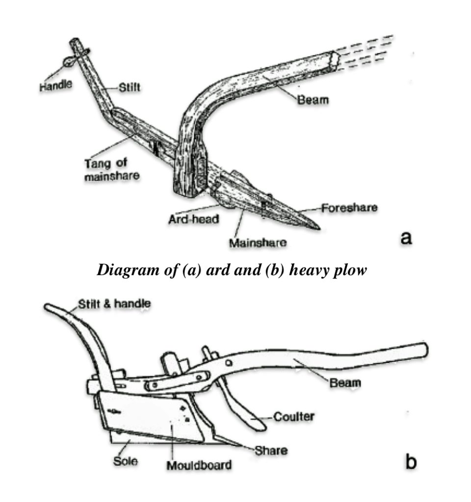
Before this era, Anglo-Saxon farming was largely based on scattered, individual hamlets. The period around 1000 CE saw the “nucleation” of villages and the rise of the open-field (or champion) system. [39] Peasants pooled their oxen to pull new, heavy wheeled plows capable of turning the rich, dense clay soils of lowland England (illustration eleven). [40] The introduction of systematic two-field or three-field crop rotations dramatically increased agricultural yields and reduced the risk of widespread famine. [41] (see table one). It is argued that this created conditions for food surplus which in turn triggered a population boom, allowed towns and cities to grow; and freed up labor for trade and craftsmanship.
Table One: Illustration of Three Field Crop Rotation
| Year | Field One | Field Two | Field Three |
|---|---|---|---|
| One | Fall Wheat & Rye | Spring Oats, Peas, Barley, Beans, Lentils | Fallow |
| Two | Fallow | Fall Wheat & Rye | Spring Oats, Peas, Barley, Beans, Lentils |
| Three | Spring Oats, Peas, Barley, Beans, Lentils | Fallow | Fall Wheat & Rye |
Demographic growth went hand-in-hand with the increased control of the social organization farming associated with the manorial system. While this reduced the personal freedom for peasants, the centralized control of the manor allowed for highly organized, large-scale grain production to feed a growing non-agricultural population. Independent freemen increasingly became unfree tenants (villeins or cottars) tied to a local lord’s manor.
Early medieval population figures to substantiate population increase are “educated guesswork”. No specific research source gives a measured or documented population figure for England between 850 and 1000. The data points are few and widely spaced. The estimates are typically built on economic indicators based on later time periods which risk circularity when used to interpret the same indicators in the past. Despite this lack of data and the limitations of backward projection of population figures, similar to the attempt of estimating the population sizes of specific social strata within the Kingdom of Wessex above (see illustration three), a plausible range of the population growth is provided in illustration twelve below.
Illustration Twelve: Back Projection and Plausible Range of Population Growth in Medieval England 850 – 1050 CE

The plausible range in illustration twelve, represented by the shaded region, is wide: roughly 0.6 to 1.6 million beginning around 850 CE and 1.1 to 2.1 million for c. 1000 CE under the growth scenarios in academic research. [42] The century and a half from 850 to 1000 is better understood through institutional and material change than through head counts.
Four developments, among perhaps others, had an appreciable impact on population growth:
Slow demographic recovery from a low point around 600 CE. The consensus among researchers is there was a post-Roman trough, then growth from the seventh or eighth century toward the approximate 2–2.5 million of Domesday England population figures. Rates in the tenth and eleventh centuries are put at roughly 0.35–0.47 percent a year in one recent reading of the literature (see footnote 41). That is a slow rate that compounds into large totals only over centuries.
A new urban network built on defended places. The burh network and its tenth-century commercial successors turned a few emporia into a network of over one hundred places by 1086. [43] Minted coin numbers rose from two named places in 871 CE to about ninety by the first half of the eleventh century. Historians use mint places as evidence of towns, and towns as a sign of population and economic growth. After Edgar’s coinage reform of the early 970s, every coin carried the moneyer’s name and the mint location. That gives a data map of where coins were struck (see illustration thirteen). [44]
Illustration Thirteen: English and Welsh minting places, c.973–1158 CE

Town Nucleation was a long, regionally uneven process. In discussions of medieval England, town or village nucleation refers to the historical process and settlement pattern where populations shifted away from scattered, isolated farmsteads (dispersed settlements) and clustered tightly together into centralized, compact communities. Rather than living on individual plots of land spread across the countryside, people moved toward a shared core. This core typically centered around a crucial local landmark—such as a church, manor house, monastery, market square, or a vital geographic feature like a river crossing or road junction. [45] The earliest town nucleations occurred at high-status centers in the seventh to ninth centuries. Based on archaeological research, most villages emerged in the eleventh and twelfth century. [46]
The emergence of the proto-manor. Proto-manors refer to the transitional, pre-Norman Conquest or early post-Roman land and administrative units that laid the groundwork for the classic feudal manor system. Over the ninth and tenth centuries, large regional territories often broke down or consolidated into smaller, localized administrative clusters centered around a lordly hall and a local church. Large multi-township estates fragmented into smaller, resident-lord manors. The first archaeologically distinctive aristocratic complexes appear in the tenth century, and private churches multiply after the 940s (see illustration fourteen). [47]
In a national survey of rural sites where medieval lords built both a residence and a church, referred to as ‘Where the Power Lies’ research project, archaeologists have documented the existence of 870 elite residences and 3,528 churches founded before 1200 CE in two sampled regions of England. The south-west region covered Devon, Dorset, Gloucestershire, Hampshire, Somerset, West Sussex and Wiltshire. The north-east region covered Lincolnshire and Yorkshire. About one third of residences lay within 250 meters of a church. Paired church–residence sites were relatively more common in thinly settled areas. About 37 percent of centers lay within 250 meters of a watercourse. About 10 percent lay near the boundaries of hundreds or wapentakes (local administrative districts). Because rivers often formed those boundaries, the boundary figure may partly reflect a pull toward water. [48]
Illustration: Fourteen: Distribution of pre-1200 lordly residences and churches/chapels in relation to the major watercourses of Wiltshire and Hampshire

Most Wessex town nucleation research sees estate lordship as the force behind planned villages. The “Where Power Lies” research finds that lordly centers, meaning a lord’s residence paired with a church, were more common in dispersed landscapes than in nucleated ones. Nucleated villages are concentrated in eastern Somerset, Dorset, south Wiltshire and parts of Hampshire.
In the Wiltshire and Hampshire areas of southwestern Wessex, specifically the area where it is believed the MRCA of G-Z40857 lived, this manorial form of agriculture increased and brought more land under cultivation and created denser village nucleation. For YDNA patterns, this created the potential for higher male reproductive success among the gebur (tenant farmer) class tied to specific manors.
If the G-Z50847 MRCA lived in this period, he and his immediate descendants may have been among the first generations of a kin group to benefit from the establishment of stable tenancy arrangements — a new manor, a newly cleared hide of woodland, or an inherited holding expanded through partible inheritance customs — that allowed multiple sons to establish independent households simultaneously. [49] This “simultaneous branching” of several reproductively successful male lines is the proximate genetic mechanism generating a star-like topology.
Travel Networks in Medieval Wessex
“From a detailed study of the documents and material culture, it can be inferred that roads and tracks of varying size and importance wove their way through the landscape of late Saxon Wessex, coming together with rivers and waterways to form a complex, hierarchical network.” [50]
Not only was this region of Wessex a dense patchwork of agrarian manors, scholars describe late Saxon Wessex (c. 950–1066) as having a dense, heavily used network of roads, tracks, river crossings and waterways, with some of it maintained or regulated by royal authority while other roads were managed by local manors and towns. The network combined prehistoric trackways, surviving parts of Roman roads, local lanes and newer links to burhs (an Anglo-Saxon fortified town or settlement), minsters (communal settlements of clergy), markets and bridges. Its basic layout of historically layered roadways was in place before the Norman invasion in 1066. [51] Much of the academic research argues that the network of roadways and water routes can only be understood by combining different research approaches: combining archaeological research, place-names analysis and documentary history [52]
“The physical means by which people, goods and ideas were moved around the early medieval landscape was clearly comprised of a dense network of purposeful routes, proficiently managed so that people of all classes were denied the inconvenience of ‘blundering through trackless woods’ in their need to get from A to B.” [53]
Late Anglo-Saxon England (late eighth century until the Norman Conquest in 1066 CE) possessed a functioning, hierarchical communications and transportation network. The Wessex–Wales interface was crossed by four broadly distinguishable systems: an inherited Roman and prehistoric overland skeleton of routes, a late Saxon overlay of herepaths and burh-to-burh links created under military pressure, local lanes and pathways and an increasingly important riverine and Severn Sea maritime corridor that connected Wessex and Mercia to the Welsh kingdoms. This navigation network of roadways and waterways provided a basis, aside from other larger scale push and pull factors, for the descendants of the MRCA of G-Z40857 to migrate westward from south central Wessex into the border line areas that were inhabited by Welsh groups and kingdoms.
“What can be said of the road network . . . is that there was clearly an expectation, on both the local level and amongst the ruling elites in the thirteenth and fourteenth centuries, for a standard of roads to serve not only the economic and social needs of the period but also, in the borderlands of Wales and Scotland, to support military campaigning and subjugation.
. . . There does seem however, to be a consensus amongst some commentators that an earlier developed network of roads provided the foundations for this later medieval system.” [54]
Various studies document the use of a range of terms that were used to describe different types of roads and pathways, including herepath, stræt, weg and hrycgweg (ridgeway), which shows that people distinguished between route types. The authors of various studies of late Anglo-Saxon roadways have different models of explaining or distinguishing different roads based on their general names (e.g. herepaths and strǣts, salt ways, etc). Many of the classification models of late Anglo-Saxon roads that are utilized by contemporary historians and archaeologists are influenced by an older scheme developed by G. B. Grundy, a charter scholar of the 1910s–30s. [55]
A charter scholar of the medieval era is a historian who specializes in studying and interpreting historical medieval charters—the formal legal documents and deeds used to grant land, rights, or privileges during the Middle Ages. Geographic boundaries preserved in large collections of charters can be studied to map out historical networks, political movements, and shifting land ownership.
Alex Langlands, British, and Jennifer MacDonald, a Canadian, are historians and archaeologists. Both completed their respective doctoral dissertations on communication and transportation networks in late Anglo-Saxon England. Table one below provides a comparison among these scholars’ interpretation of the usage of Anglo-Saxon words for roads with the influential work of G.B. Grundy.
Table One: Comparative View of Interpreting Medieval Terms for Roads by Grundy, MacDonald and Langlands
| Road Term | G.B. Grundy | Jenifer MacDonald | Alex Langlands |
|---|---|---|---|
| Herepath | Saxon through-road; also used for some ridgeways | Top-ranked highway, equal to strǣt | A distinct, standard West Saxon route type; probably planned, linked to defence and bridges |
| Strǣt | Roman made road | Top-ranked; usually Roman, also a town street | Shows the road was known to be Roman; not proof it was still busy |
| Weg | General word, usually local | Any size; rank depends on qualifiers and context | An existing open route, often steep; foot and pack traffic |
| Pæth | Not separated from other road words | Small track | A made or trodden route, possibly for carts |
| Hrycgweg | Prehistoric ridgeway | Not all were prehistoric | Ridgeway routes could later be called via publica, herepath or weg |
| Road Qualifiers | Not a focus in his work | Mainly show rank and destination | Mainly show function and change over time (wic, port, þeod, frið, eald) |
While there are differences in their research, MacDonald and Langlands agree on many observations about Anglo-Saxon routes and transportation networks. They both agree that:
- Wessex had a real network of roads. Both document a complex, ranked web of roads, tracks, rivers and seaways.
- The roads were ranked by importance. MacDonald ranking is influenced by Michael Aston’s four levels (national, provincial, regional, local). Langlands uses Michael Costen’s three groups (major routes, routes between local centers, routes to dependent estates) and Andrew Reynolds’ comparable categories. Both put herepaths near the top of the list as the most developed of the roadways. [56]
- Old routes stayed in use. MacDonald shows 14 or 15 stretches of Roman road still in use and warns that a road missing from the sources was not necessarily abandoned. Langlands also finds Roman roads and ridgeways embedded in the late Saxon network, and some Roman roads were called herepaths (“army paths”).
- This network was only partly inherited from Roman roads. MacDonald’s main aim is to prove that Roman roads continued in use. Langlands says Roman roads had mixed fates: some stayed in use, some were abandoned or robbed for stone, some became boundaries, and some were revived later. He writes that “It is at the crossing of rivers that the case for Roman road continuity is at its weakest“, and warns of “phases of redundancy and ‘rebirth‘”.
- Charter boundary clauses are the key source. Both treat these historical documents as the core source of evidence, and both are cautious about reading too much into the word eald (“old”) or into gaps in the record.
They however differ in scale and in orientation of their research. MacDonald builds a model of the whole travel system that is run from the top by the king. Langlands reconstructs individual routes on the ground up and revises several of MacDonald’s specific points (his work was completed about ten years after MacDonald’s ), especially on Roman roads, bridges and who controlled movement.
On most questions and aspects of their studies their findings fit together rather than conflict. [57] Their work is complimentary. Langlands work is a sound source for drawing individual attested route lines and bridges. MacDonald’s analysis and model of levels of roadways works well as a means of ranking those routes and showing who used each tier.
MacDonald’s five levels and Langlands’ route hierarchy classify different things. MacDonald ranks journeys by how far people traveled, how long they were away and what they needed along the way. Langlands ranks routes by what the charters call them, what they did, and which places they joined (see table two).
Table Two: The Differences Between the Communications and Route Schemes Developed by MacDonald and Langlands
| Characteristics | MacDonald’s five levels | Langlands’ route hierarchy |
|---|---|---|
| What is ranked | Journeys and the people making them | Routes: their names, function and physical form |
| Tiers | Five: local, regional, old kingdom, rest of England, abroad | Three, following Costen (major routes between central places, local routes between central places, routes to dependent estates), plus Reynolds’ comparable A/B/C levels |
| How a tier is defined | Distance, nights away, logistics, and who travelled | Road words (herepath “army path”, strǣt, weg, path, anstiga footpath), their qualifiers, and the places a route connected |
| Geography | Wessex in her full model; the five levels are her sketch for England as a whole | Ten study areas in Wessex |
| Water transport | Grows in importance at each level up | Mostly left aside; his data is overland |
The following illustration incorporates Langlands’ hierarchy of roads with each of MacDonald’s levels of travel. Each of their route classification models overlap to a degree at MacDonald’s local, regional and kingdom levels. Both also draw on Michael Costen’s grouping of routes. Langlands’ evidence does not really reach MacDonald’s two outer levels (rest of England and abroad), except for his trade routes.
Illustration Eleven: Anglo-Saxon Network of Travel and Communication Based on MacDonald’s Travel Levels and Langlands’ Roadway Tiers


Level Five: Abroad

The diagram shows MacDonald’s five levels of travel as nested levels with Langlands’ distinction of type of roads for each level (see also table three).
Table Three: Description of Each Travel Level
| Travel Level | Description |
|---|---|
| One: Local | Short trips from a home base to the fields, mill and church, or along town streets MacDonald: trips to fields, mill and church on paths, lanes, mill fords and cyric weg (“church way”) Langlands: gates, hedges and stiles controlled local movement, and some paths were closed to carts |
| Two: Regional | The longest trip there and back in one day. That is about 8–12 miles on foot or with a cart, 15–20 on horseback or by rowed boat, which usually reached the nearest burh (fortified town). MacDonald: the longest trip there and back in a day, reaching about as far as the nearest burh Langlands: no point in Wessex lay more than 20 miles from a burh, and farmers could cart surplus food there “at a day’s notice” |
| Three: Old Kingdom | Applies to any kingdom, such as Wessex, Mercia or Northumbria. These are journeys with nights away that stay inside one kingdom. MacDonald: overnight journeys on herepaths, strǣts, ridgeways and large wegs Langlands: herepaths form a uniform route type connecting “the main central places of Anglo-Saxon Wessex” |
| Four: Rest of England | Applies to routes that link kingdoms MacDonald: routes out of Wessex such as the Fosse Way, the Icknield Way and the Harroway Langlands: a wic herepath from Hamwic (Saxon Southampton) to the Upper Thames, and the London Way droving route |
| Five: Abroad | Applies to travel that incorporate land and sea routes MacDonald: overseas travel went mainly by sea Langlands: wic herepaths leading to the coastal trading ports, and possible Frankish traders at Clere |
It is apparent by various archaeological, place-name and documentary historical studies that a complex hierarchy of routes existed in the Anglo-Saxon landscape during this time period. This hierarchy of routes can be viewed on the basis of different characteristics: their social function, how they were constructed, geographic scale, economic purpose, and their distance, among other criteria.
MacDonald and Langlands’ research have direct relevance for understanding and developing an explanation of roadway influences that may have facilitated the western migration of YDNA descendants of haplogroup G-Z40857 from Wessex to Wales. Depending on their relative social position, the most recent common ancestor of G-Z40857 and his immediate descendants may have had a limited social radius for their daily mobility, perhaps in level one or two. There were perhaps a combination of push and pull factors that influenced their descendants to migrate westward to Welsh areas, beyond the described first three levels of travel.
Work in recent decades by both historians and archaeologists has also illuminated our understanding on the thirty-three major fortifications (burhs), listed in the early tenth-century Burghal Hidage [58], which were designed as part of a strategic system of defense to safeguard West Saxon control (and populations) in southern Britain. The Burghal Hidage is an Anglo-Saxon administrative document from the late ninth or early tenth century that lists a strategic network of over 30 fortified towns (burhs) in the Kingdom of Wessex and assigns specific hide-tax and garrison obligations to each. It was created during or shortly after the reign of King Alfred the Great, the system was designed to protect the kingdom against Viking incursions. The 33 fortified burhs were positioned roughly within a day’s ride of each other, ensuring that no subject was far from a safe place of refuge. Illustration twelve depicts the estimated location of the MRCA of haplogroup G-Z40857 and the estimated area where his descendants migrated three to five generations later.
Illustration Twelve: Roadway and Waterway Networks between Burghs

Traveling During this Time Period in Wessex
Jennifer MacDonald in her thesis sorts travelers into five groups: the traveling royal court, the military, religious travelers, and people traveling for work (traders, estate workers, people going to court). She also looks separately at the individual traveling alone.
The royal court moved according to well-established rights and privileges. Armies lived outside the normal rules and often fended for themselves. Most other travelers relied on themselves but were also regulated or restricted on the basis of their position in the feudal structure. Peasants had the least control. Nobles and the Church controlled their own travel and that of people beneath them, but depended on the king’s authority. Kings governed most of the system. Weather, the landscape, the Christian calendar and enemy armies stayed outside their control. How tightly travel was controlled shifted over time, and she reads those shifts as a sign of wider change between 850 and 1066.
Table Four: MacDonald’s Groups of Medieval Travelers in Wessex
| Group | Who | Support Received by the Group | Typical range | Control |
|---|---|---|---|---|
| Royal court | King, family, advisers, nobles, servants, animals | From royal estates, food rents (feorm), monasteries | Across Wessex and the south-east | Set rights and royal privileges |
| Wessex – English Military | English levies and war bands | Military obligation was directly tied to landownership., reciprocal lord – vessal loyalty The Select Fyrd formed the heavily armed backbone of the regional army. | Normally operating in level 3 | Mostly outside normal arrangements |
| Viking Military | Viking armies | Little regular supply; plunder, seized horses, payments | Vikings often operating in level 4 | Mostly outside normal arrangements |
| Religious | Bishops, clergy, monks, pilgrims, church-goers | Monastic hospitality, clergy bringing their own food, privileges | Local to Rome | Church rules, plus limits on hosts’ burdens |
| Work | Estate workers, traders, people attending courts | Lord, estate duties, markets | Mostly local and regional | Labour duties, registering with a reeve, tolls, set market towns |
| Individual | Stranger, exile, lone traveller | Little guaranteed | All travel levels | Distrusted by law; few rights |
MacDonald links the groups to her levels of travel. Farther journeys needed more support, and fewer people made them. The royal court and armies dominate long-distance travel. With the exception of fleeing invading groups or being drawn to other areas, workers and most individuals stay at local and regional levels. MacDo then ranks control by social level: peasants, secular elite, Church and king. She concludes the system was “evolving, hierarchical and controlled from above”.
The hierarchy of routes is directly related to the journeys individuals and specific groups of people made on them and the logistical requirements of the journeys. MacDonald notes that a twelfth century law book, the Leges Henrici Primi, also uses five tiers of distance or range of travel for how long someone had to answer a court summons and reflects practical realities of travel time based on the transportation infrastructure at the time :
- 7 days within the same county;
- 15 days from the next county;
- 3 weeks from the county beyond that;
- 4 weeks from anywhere else in England; and
- 6 weeks and a day from overseas. [59]
Conclusion
Based on currently available information on YDNA ancestors in the Griffis family tree, the Most Recent Common Ancestor (MRCA) associated with the haplogroup G-Z40857 holds a special place in the phylogenetic tree.
This individual and his kin group who were probably identified as Anglo-Saxon and were ancestors of subsequent generations that ‘became’ identified as Welsh. The expansion of the paternal family tree and the subsequent migration of his descendants into the Cymric Welsh area of the island were the result of this single founding individual or small kin-group. He and possibly a small group of kin achieved ‘reproductive success’ just before the time of the Norman invasion and through what is known as the Welsh Marches era.
It is hypothesized that the MRCA of G-Z40857 lived in the southwestern area of the Kingdom of Wessex. At the time of this ancestor’s estimated birth around 970 CE, Wessex was a powerful Anglo-Saxon kingdom in southern England that successfully fought off Viking invasions and laid the foundation for a unified English state.
There is roughly a 68 percent chance that he was born between 855 – 1070 CE. The possibility of this descendant, his kin, and immediate generations living within this two hundred year time span reflects a wide range of social, economic, cultural and experiences and influences. This time span runs from the height of the Viking assaults on Alfred’s kingdom through the Danish conquest and into the eve of the Norman Conquest — a time period in which Wessex was transformed from a threatened regional kingdom into the administrative core of a unified English state.
We know little aside from estimating the birth and possible location of the MRCA of G-Z40857. It is likely that this individual and his immediate descendants were part of the free peasantry. The Ceorls (free peasantry) is estimated to represent up to three quarters of this highly stratified population in Wessex. It was the dominate social class, consistent with their role as the demographic backbone of the medieval Anglo-Saxon society.
For the great majority of the population, who were subsistence farmers producing at or near the margin of survival, a bad harvest meant real hunger, higher mortality among the very young, old, and already weak, and depleted seed-grain that could compound hardship into a second year. This was the most immediate and universal way a crisis touched peasant life — arguably more consequential for day-to-day life than any court intrigue. However, peasants were socially and economically tied to lords, so a lord’s political fortune was never purely an elite affair. While a ceorl had no voice in whether a king, nobleman or a monastery held their estate, the outcome of power dynamics at the upper levels in society directly determined who they owed rent and labor to, and disputes or forfeitures among the elite could mean abrupt, unpredictable shifts in that relationship.
Based on estimates generated from the FamilyTreeDNA Globetrekker program, the estimated location of the MRCA of haplogroup G-Z40857 is that he, his family and possibly a generation after lived around the environs of the modern day border between the counties of Wiltshire and West Berkshire counties or possibly around the modern border of West Berkshire and Hampshire counties.
This region of Wessex was a dense patchwork of agrarian, rural manors. The decades around 1000–1050 CE represent a turning point in English rural demography that is directly relevant to the expansion of the descendants of G-Z40857. This period saw population growth across lowland England. This growth was driven by improved agricultural productivity and the consolidation of the open-field system associated with the manorial system.
The period around 1000 CE saw the “nucleation” of villages and the rise of the open-field (or champion) agricultural systems. Peasants pooled their oxen to pull new, heavy wheeled plows. Horses replaced the use of oxen to drive the plows. The introduction of systematic two-field or three-field crop rotations dramatically increased agricultural yields and reduced the risk of widespread famine. This created conditions for food surplus which in turn triggered a population boom, allowed towns and cities to grow; and freed up labor for trade and craftsmanship. Perhaps this ancestor or his kin became townspeople or acquired new skills.
Not only was this region of Wessex a dense patchwork of agrarian manors, this region also had a dense, heavily used network of roads, tracks, river crossings and waterways. This network combined prehistoric trackways, surviving parts of Roman roads, local lanes and newer links to burhs (Anglo-Saxon fortified towns or settlements), minsters (communal settlements of clergy), markets and bridges.
The border between Wessex and Wales was crossed by four broadly distinguishable systems: an inherited Roman and prehistoric overland skeleton of routes, a late Saxon overlay of roadways created under military pressure, local lanes and pathways and an increasingly important riverine and Severn Sea maritime corridor that connected Wessex and Mercia to the Welsh kingdoms. This navigation network of roadways and waterways provided a structural basis, aside from other larger scale push and pull factors, for the descendants of the MRCA of G-Z40857 to migrate westward from south central Wessex into the borderline areas that were inhabited by Welsh groups and kingdoms. Depending on their relative social position, the most recent common ancestor of G-Z40857 and his immediate descendants may have had a limited social radius for their daily mobility. However, there were perhaps a combination of push and pull factors that influenced their descendants to migrate westward to Welsh areas, beyond their typical range of travel.
Sources
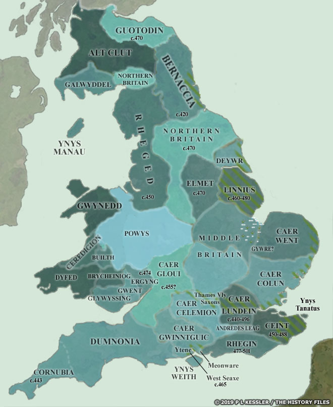
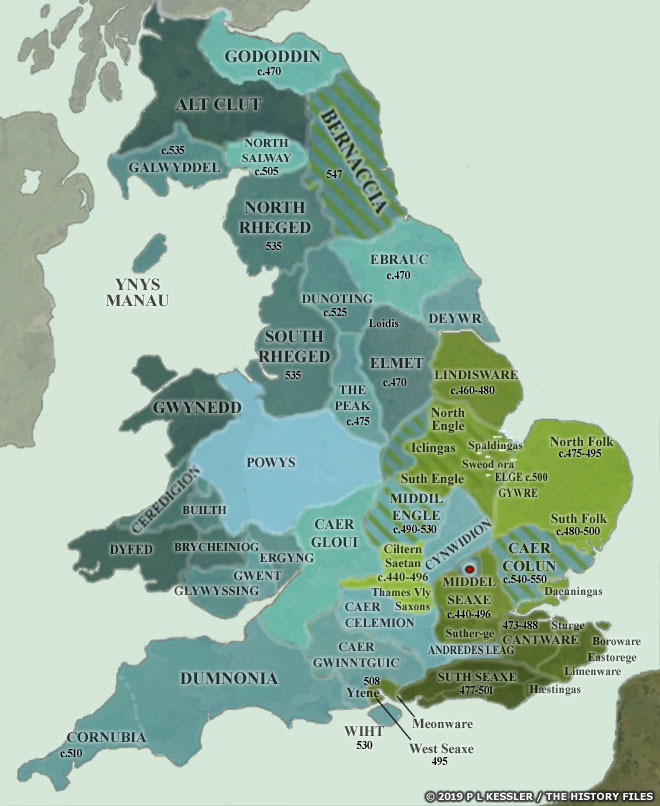
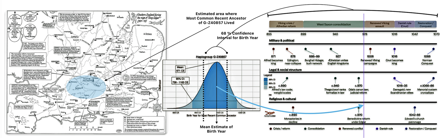
Feature Image: Every picture tells a story. The feature image consists of three images. The image on the left is a modified version of a map of Southern England During the Rule of Edgar. This image provides an estimate of where the most common recent ancestor of G-Z40857 may have lived. The middle image is a statistical distribution of the confidence intervals associated with the estimated birth date of the most recent common ancestor of haplogroup G-Z40857. It also provides a 68 percent confidence interval of when he lived. The image on the right hand side is a chart of major political, social, and religious aspects of Wessex society across 855–1070 CE, which represents a 68 percent likelihood time frame when this ancestor lived. For a larger sized view of the image.
Feature Image sources : (1) Southern England During the Rule of Edgar in Edgar, King of the English, ed. D. Scragg (Woodbridge, 2008), opp. p. xvi. https://dk.robinson.cam.ac.uk/sites/default/files/files/Edgar(1).jpg ; (2) Scientific Details for Haplogroup G-Z40857, 5 May 2026, FamilyTreeDNA, https://discover.familytreedna.com/y-dna/G-Z40857/scientific?section=tmrca ; (3) The illustration is based on a number information from of sources, see footnotes 13 and 14.
See a Larger version of the Feature Banner
[1] Jim Griffis, The Significance of Haplogroup G-Z6748 and its Descendants: Bottlenecks, Migration, Founder Effects and Star-Like Expansion (Part One), 27 Jun 2026, Griffis Family: Selected Stories from the past, https://griffis.org/the-significance-of-haplogroup-g-z6748-and-its-descendants-bottlenecks-migration-founder-effects-and-star-like-expansion-part-one/
[2] See: Wessex, Wikipedia, This page was last edited on 26 August 2026, https://en.wikipedia.org/wiki/Wessex
Mark, Joshua, Kingdom of Wessex, 23 Nov 2018 World History Encyclopedia, https://www.worldhistory.org/Kingdom_of_Wessex/
Scientific Details for Haplogroup G-Z40857, 5 May 2026, FamilyTreeDNA,https://discover.familytreedna.com/y-dna/G-Z40857/scientific?section=tmrca
[3] Individuals living in Southern England during Edgar’s reign enjoyed a lifespan uniquely protected from war, but faced a highly stratified society. People answered to a strictly regulated network of local courts, paid heavier mandatory dues to an expanding network of monasteries, and adjusted to a system where the crown’s authority reached deeper into village life than ever before. The social context of this specific period was defined by several key historical characteristics.
1.The Monastic Grip on Daily Life: The most dramatic social change in Southern England was the English Benedictine Reform, aggressively driven by Edgar and his close ally, Dunstan, the Archbishop of Canterbury. [a]
- The New Landlords: Local secular landowners were forced to surrender vast estates to newly established Benedictine monasteries. If someone was a peasant in Hampshire or Wiltshire, their landlord likely shifted from a local nobleman to a strict abbot.
- Social Fractures: This aggressive seizure of land created massive legal disputes and local ‘score-settling’ that erupted into violence immediately after King Edgar died. The nobility immediately used force to reclaim their ancestral properties. Factions led by figures like Ælfhere, Ealdorman of Mercia, began violently expelling monks, destroying monasteries, and taking back their lands.
- Financial Burden: Edgar’s laws were the first in England to strictly enforce penalties for failing to pay tithes and Peter’s pence (direct taxes to the Roman Catholic Church). This legally bound the agrarian population’s finances directly to church institutions.
2. A Shifted Agrarian Hierarchy: The vast majority of the population lived in rural communities, but the nature of farming and social status was actively changing. [b]
- Loss of Peasant Freedoms: Agriculture flourished in the late tenth century due to the breakup of massive royal estates into smaller, individual manors. However, these new manorial lords demanded heavy labor services from the local population, driving a noticeable decline in the freedom of ordinary peasants and sharpening the social hierarchy. This localized score-settling instantly combined with a bitter succession crisis. The anti-monastic faction backed Edgar’s younger son, Æthelred (the Unready), while the pro-monastic faction backed his eldest son, Edward (the Martyr).
- The Open-Field System: This era marked the birth of nucleated villages and the early open-field system. Neighbors were increasingly forced to cooperatively farm large communal fields rather than isolated plots, heavily standardizing daily life and communal dependency. This shift heavily standardized daily life. It fostered a deep communal dependency, as a poor decision by one neighbor could ruin the yield for the entire village, transforming rural England into a highly cooperative, tightly regulated society.
3. Structural Security and Local Rule: For an ordinary resident, the state or kingdom became more visible and uniform under Edgar’s heavy administrative oversight. [c]
- The Rise of Shires and Hundreds: Edgar fully formalized the division of Southern England into shires (counties) and hundreds (smaller subdivisions). Hundreds were administrative, judicial, and fiscal subdivisions of a shire (county). Though the concept originated slightly earlier, King Edgar formalized their use across a newly unified England through a legal code known as the Hundred Ordinance. The hundreds provided the basis for land assessment and taxation, justice and local law, and military justice and conscription. Local courts (hundred moots) met regularly to settle property rights, theft, and tracking down criminals, bringing a newfound sense of legal predictability to everyday disputes.
- Naval Conscription: While Southern England was peaceful, it was heavily policed. Edgar maintained a massive naval fleet funded by “ship-soke” obligations, meaning coastal and regional communities were burdened with building and maintaining royal warships to deter Danish raiders.
4. Economic Standardization and Urbanization; Edgar’s administrative reforms deeply impacted local trade, markets, and monetary trust. [d]
- Reformation of the coinage system: Edgar completely reformed the coinage system, ensuring that no village was further than 15 miles to 30 miles from a royal mint. This eliminated regional, debased currencies and meant even low-level rural trade could rely safely on the uniform silver penny. It should be noted that in secondary research sources there is a discrepancy worth flagging: some sources indicate the radius to be 30 miles while others mention 15 miles.
- Burhs to Boomtowns: Southern fortified towns (burhs) originally built by Alfred the Great for defense evolved entirely into productive commercial hubs. The wealthy elite in Southern England, for example, could readily purchase imported luxuries like wine, silk, and exotic spices brought in by foreign merchants.
Notes for Footnote 3:
[3a] Edgar, King of England, Wikipedia, This page was last edited on 27 August 2026, https://en.wikipedia.org/wiki/Edgar,_King_of_England
English Benedictine Reform, Wikipedia, This page was last edited on 27 June 2026, https://en.wikipedia.org/wiki/English_Benedictine_Reform
Cubitt, C. The tenth-century Benedictine Reform in England. Early Medieval Europe, 6: 77-94, 1997 . https://doi.org/10.1111/1468-0254.00004 ; https://www.academia.edu/53967639/The_tenth_century_Benedictine_Reform_in_England
Barrow J. The Chronology of the Benedictine ‘Reform.’ In: Scragg D, ed. Edgar, King of the English 959–975: New Interpretations. Boydell & Brewer; 2008:211-223. https://www.cambridge.org/core/books/abs/edgar-king-of-the-english-959975/chronology-of-the-benedictine-reform/65C8C1C356817100295121A55A17A390
Williams, Ann, King of the English, 959–975, The English Historical Review, Volume CXXIV, Issue 508, June 2009, Pages 672–674, https://doi.org/10.1093/ehr/cep116
Robertson, N. The Benedictine Reform: Current and Future Scholarship. Literature Compass, 3: 282-299, 2006, . https://doi.org/10.1111/j.1741-4113.2006.00319.x
English Benedictine Reform, Wikipedia, This page was last edited on 27 June 2026, https://en.wikipedia.org/wiki/English_Benedictine_Reform
Britannica Editors. “Edgar”. Encyclopedia Britannica, 4 Jul. 2026, https://www.britannica.com/biography/Edgar-king-of-England . Accessed 3 Aug 2026.
Edward the Martyr, Wikipedia, This page was last edited on 12 June 2026, https://en.wikipedia.org/wiki/Edward_the_Martyr
[3b] Edgar, King of England, Wikipedia, This page was last edited on 27 August 2026, https://en.wikipedia.org/wiki/Edgar,_King_of_England
English Benedictine Reform, Wikipedia, This page was last edited on 27 June 2026, https://en.wikipedia.org/wiki/English_Benedictine_Reform
Edward the Martyr, Wikipedia, This page was last edited on 12 June 2026, https://en.wikipedia.org/wiki/Edward_the_Martyr
[3c] Abels, Richard, King Edgar the Peaceful and the Economy of Anglo Saxon England, YouTube, https://youtu.be/nKLLuXcwvH0?si=QGa5GnGC42Vzg_yP
Abels, Richard, Lordship and Military Obligation in Anglo-Saxon England. Berkeley and Los Angeles: University of California, 1988
[3d] King Edgar the Peaceful: The Forgotten Anglo-Saxon Ruler Who Shaped England, 15 Jun 2023, Discovery, https://www.discoveryuk.com/monarchs-and-rulers/king-edgar-the-peaceful-the-forgotten-anglo-saxon-ruler-who-shaped-england/
Pagan H. The Pre-Reform Coinage of Edgar. In: Scragg D, ed. Edgar, King of the English 959–975: New Interpretations. Boydell & Brewer; 2008:192-208. https://www.cambridge.org/core/books/abs/edgar-king-of-the-english-959975/prereform-coinage-of-edgar/BA0F07064598BE0A15075A8D33E3DB96
Naismith, R. G. R. The Currency of Power in Late Anglo-Saxon England. History Compass, 17(7), Article e12579. 2019, https://doi.org/10.1111/hic3.12579
Naismith Rory. The Historian and Anglo-Saxon Coinage:: The Case of Late Anglo-Saxon England. In: Naismith R, Woodman DA, eds. Writing, Kingship and Power in Anglo-Saxon England. Cambridge University Press; 2017:162-180. https://www.cambridge.org/core/books/abs/writing-kingship-and-power-in-anglosaxon-england/historian-and-anglosaxon-coinage/EAE59A5273A95A07CC8468417516321B
History of the English penny (c. 600 – 1066), Wikipedia, This page was last edited on 10 August 2026, https://en.wikipedia.org/wiki/History_of_the_English_penny_(c._600_–_1066)
Screen, Elina, Anglo-Saxon law and numismatics: A reassessment in the light of Patrick Wormald’s the Making of English Law, British Numismatic Society, Vol. 77, (2007) posted at Medievalist.net, https://www.medievalists.net/2012/10/anglo-saxon-law-and-numismatics-a-reassessment-in-the-light-of-patrick-wormalds-the-making-of-english-law/
Lyon, Stuart, Anglo-Saxon Numismatics, https://www.britnumsoc.org/publications/Digital%20BNJ/pdfs/2003_BNJ_73_6.pdf
[4] Thegn, Wikipedia, This page was last edited on 27 March 2026, https://en.wikipedia.org/wiki/Thegn
Anglo-Saxon Social Organisation, Regia Anglorum, https://regia.org/research/history/Saxons1.htm
[5] Weregild means “man-price” or blood money, referring to the legal monetary value placed on a person’s life in ancient Germanic and Anglo-Saxon law.
Weregild, Wikipedia, This page was last edited on 1 June 2026, https://en.wikipedia.org/wiki/Weregild
Britannica Editors. “wergild”. Encyclopedia Britannica, 24 Nov. 2011, https://www.britannica.com/topic/wergild
Harvey, P. D. A. “Rectitudines Singularum Personarum and Gerefa.” The English Historical Review, vol. 108, no. 426, 1993, pp. 1–22. JSTOR, http://www.jstor.org/stable/573547.
Lemanski, Stanley Jay, The Rectitudines Sigularum Pesonarum: A Pre- and Post Conquest Text, Dec 2009, PhD Dissertation, University of Akron, The-Rectitudines-Singularum-Personarum-a-Pre-And-Post-Conquest-Text
The Rectitudines singularum personarum: A Pre- and Post-Conquest Text, Medievalist.net, https://www.medievalists.net/2012/02/the-rectitudines-singularum-personarum-a-pre-and-post-conquest-text/
[6] In medieval Anglo-Saxon England, a five-hide unit meant an area of land responsible for providing one fully armed soldier for the king’s military levy, known as the fyrd. Originally, a single “hide” was the amount of productive land needed to support one free peasant household or family (traditionally estimated at around 120 acres, though actual physical sizes varied based on soil quality and region). Over time, the hide stopped being just a physical size and became an assessment unit used to calculate taxes (like the geld), food rents, and public duties such as bridge repair and fortress upkeep.
Geþyncðo: (meaning “Dignities”) is an early 11th-century Old English legal text detailing social status, rank, and how a person could rise through the social classes in late Anglo-Saxon England.
See:
Hide (unit), Wikipedia, This page was last edited on 4 August 2026, https://en.wikipedia.org/wiki/Hide_(unit)
Shire Organization, Ousekjarr, https://www.ousekjarr.org/index.php/history/179-shire-organisation
Britannica Editors. “hide”. Encyclopedia Britannica, 20 Jul. 1998, https://www.britannica.com/topic/hide-English-land-unit
hides, Hull Domesday Project, https://www.domesdaybook.net/domesday-book/data-terminology/weights-measures/hides
Rochelle, Mercedes, What was an Anglo-Saxon Hide?, Historical Britain: The History Behind the Story, https://historicalbritainblog.com/what-was-an-anglo-saxon-hide/
Geþyncðo, Wikipedia, This page was last edited on 31 August 2026, https://en.wikipedia.org/wiki/Geþyncðo
[7] A ceorl (pronounced “see-awrl” or ‘chāorl’) was a free peasant of the lowest rank in Anglo-Saxon England.
ceorl noun, Merriam-Webster, https://www.merriam-webster.com/dictionary/ceorl
ceorl, Oxford Reference, https://www.oxfordreference.com/display/10.1093/oi/authority.20110803095558961
[8] This requirement is outlined in an early 11th-century Anglo-Saxon legal tract known as Geþyncðo (also spelled Gethynctho, meaning “Of People’s Ranks” or “Promotions”), which was drafted by Archbishop Wulfstan of York.
“And if a ceorl prospered, that he possessed fully five hides of his own, a church and kitchen, bell-house and burh-gate [fortified gatehouse], a seat and a special office in the king’s hall, then he was entitled to the rights of a thegn.“ – Anglo-Saxon Social Organisation, Regra Anglorum, https://regia.org/research/history/Saxons1.htm
This tract is famous among medieval historians because it shows that nobility in late Anglo-Saxon society was not strictly determined by birth. An ordinary free peasant (ceorl) could elevate their legal status and weregild (man-price) to that of an aristocrat (thegn) by accumulating sufficient wealth, land, and civic responsibilities
See also:
Thegn, Wikipedia, This page was last edited on 27 March 2026, https://en.wikipedia.org/wiki/Thegn
Anglo-Saxon law, Wikipedia, This page was last edited on 16 May 2026, https://en.wikipedia.org/wiki/Anglo-Saxon_law
Purkiss, Richard,, The status of thegn in late Anglo-Saxon England. Early Medieval Europe, 34: 323–352, 2026, . https://doi.org/10.1111/emed.70025
Williams, Ann, Earls, ceorls, thegns and lords, https://www.academia.edu/28737571/Earls_ceorls_thegns_and_lords
Williams, Ann, The World before Domesday: The English Aristocracy, 90 – 1066, London: Continuum Books, 2008, https://books.google.com.lb/books?id=lYCvAwAAQBAJ&pg=PR3&hl=ar&source=gbs_selected_pages&cad=1#v=onepage&q&f=false
hide, Sizes, https://www.sizes.com/units/hide.htm
Hide (unit), Wikipedia, This page was last edited on 4 August 2026, https://en.wikipedia.org/wiki/Hide_(unit)
[9] Structure of the hierarchy:
- The king sat outside the wergild scale entirely, as sole hereditary head of the House of Wessex, though the witan (council of nobles) formally confirmed succession among royal kin. [9a]
- Æthelings and ealdormen — royal kinsmen and the king’s shire viceroys — held the top thegnly wergild of 1,200 shillings and commanded the fyrd (militia) and shire justice. [9b]
- Thegns, the “twelfhynde” class, formed the backbone of the military and administrative order. By Archbishop Wulfstan’s Geþyncðo (c. 1002–1023), a thegn nominally held at least five hides, though scholarship shows the property qualification was often looser in practice; roughly 2,000 landowners held this rank across Wessex and Mercia. [9c]
- A six-hundred-shilling (“syxhynde”) rank occupied intermediate ground between thegn and ceorl; notably, a Welshman who acquired five hides of land reached only this tier — half the wergild of an Englishman of equivalent thegnly land, reflecting Ine of Wessex’s earlier legal tariff that valued Britons at half the Saxon rate. [9d]
- Ceorls, the “twyhynde” free peasantry valued at 200 shillings, made up the bulk of the population and were internally graded by tenure — from the relatively privileged rent-paying geneat, through the cottar, down to the heavily labor-bound gebur — as detailed in the Rectitudines [9e]
- Welsh and landless freemen occupied the lowest free tier, with wergild scaled to landholding: 120 shillings for a hide, 80 for a half-hide, and 60 for none — the same value as a slave, though they retained legal freedom [9f]
- Theow (slaves) stood outside the wergild system altogether — killing one required only compensating the owner at market value — yet they retained customary provisioning rights (corn, meat, an acre for personal cultivation) and could earn money toward manumission, per the Rectitudines. [9g]
Notes for Footnote 9:
[9a] Anglo-Saxon Social Organisation, Regia Anglorum, https://regia.org/research/history/Saxons1.htm
[9b] Anglo-Saxon Social Organisation, Regia Anglorum, https://regia.org/research/history/Saxons1.htm
[9c] Purkiss, Richard. The status of thegn in late Anglo-Saxon England. Early Medieval Europe, 34: 323–352, 2026, . https://doi.org/10.1111/emed.70025.
Geþyncðo, Wikipedia, This page was last edited on 31 August 2026, https://en.wikipedia.org/wiki/Geþyncðo
Sukhino-Khomenko, Denis. “Sociology of Late Anglo-Saxon Thegns: from ‘Servants’ to ‘Highborn’?” Sociology of Late Anglo-Saxon Thegns: from ‘Servants’ to ‘Highborn’?, 2016. https://www.academia.edu/17347260/Sociology_of_late_Anglo_Saxon_thegns_from_servants_to_highborn_
Sukhino-Khomenko, Denis. Military Nobility in Anglo-Saxon England, 900-975: Specialist Thesis (a 5-Year Programme), Defended at the Faculty of History (Department of Medieval and Early Modern History) of the Lomonosov Moscow State University. https://www.academia.edu/27081728/Military_nobility_in_Anglo_Saxon_England_900_975_Specialist_thesis_a_5_year_programme_defended_at_the_Faculty_of_History_Department_of_Medieval_and_Early_Modern_History_of_the_Lomonosov_Moscow_State_University
Thegn, Wikipedia, This page was last edited on 27 March 2026, https://en.wikipedia.org/wiki/Thegn
Anglo-Saxon Social Organisation, Regia Anglorum, https://regia.org/research/history/Saxons1.htm
Purkiss, R. (2026) The status of thegn in late Anglo-Saxon England. Early Medieval Europe, 34: 323–352. https://doi.org/10.1111/emed.70025.
Whitelock, Dorothy, English Historical Documents c 500 – 1042, New York: Oxford University Press, 1955, https://ia802908.us.archive.org/27/items/ine-albert-laws/September%2015%20Laws%20of%20Ine_text.pdf
[9d] Lindsay Faull, Margaret, ‘The Semantic Development of Old English wealth’, Leeds Studies in English, n.s. 8, (1975), 20-44, https://digital.library.leeds.ac.uk/133/1/LSE1975_pp20-44_Faull_article.pdf, https://ludos.leeds.ac.uk/R/-?func=dbin-jump-full&object_id=121818&silo_library=GEN01
Ine of Wessex, Wikipedia, This page was last edited on 3 July 2026, https://en.wikipedia.org/wiki/Ine_of_Wessex
[9e] Hudson, John, ‘Status’, The Oxford History of the Laws of England: 871-1216, The Oxford History of the Laws of England (Oxford
, 2012; online edn, Oxford Academic, 20 Sept. 2012), https://doi.org/10.1093/acprof:oso/9780198260301.003.0008
Anglo-Saxon Social Organisation, Regia Anglorum, https://regia.org/research/history/Saxons1.htm
Lemanski, Stanley Jay, The Rectitudines singularum personarum: A Pre- and Post-Conquest Text, 2009, Doctor of Philosophy, University of Akron,
https://etd.ohiolink.edu/acprod/odb_etd/etd/r/1501/10?clear=10&p10_accession_num=akron1258399847
[9f] Anglo-Saxon Social Organisation, Regia Anglorum, https://regia.org/research/history/Saxons1.htm
Hudson, John, ‘Status’, The Oxford History of the Laws of England: 871-1216, The Oxford History of the Laws of England (Oxford
, 2012; online edn, Oxford Academic, 20 Sept. 2012), https://doi.org/10.1093/acprof:oso/9780198260301.003.0008
Andrew Reynolds and Alex Langlands, Social Identities on the Macro Scale: A Maximum View of Wansdyke, in people and Space in the Middle Ages, 300 – 130, pp 13 – 44, Brepols Publishewrs, 2006, DOI: https://doi.org/10.1484/M.SEM-EB.3.3746
[9g] While Roman law completely dehumanized slaves as instrumentum vocale (“talking tools”), Anglo-Saxon medieval law viewed the theow through a dual lens: property in criminal liability, but a human soul with customary baseline rights in Christian social practice.
The theow (enslaved person) occupied a complex position in Anglo-Saxon society:
- Outside the Wergild System: They did not have a personal wergild (man-price). If a theow was killed, the perpetrator did not pay blood-money to the victim’s family; instead, they paid a wite (fine) to the king and compensation (bot) to the owner for the loss of property.
- Customary Rights: Despite being legal property, customary law and documents like the Rectitudines outlined specific provisions they were entitled to, including a set amount of food (harvest rations) and certain personal liberties.
- Path to Freedom: They could hold personal property or earnings in practice, allowing some to purchase their own manumission (freedom) or be freed by a master’s will.
Medieval jurists defined a person’s legal status by their obligations, their monetary worth (or lack thereof), and their relationship to a lord. Here is how the legal status of a theow was codified across historical texts:
1. Defined by Value (Wergild vs. Angyld)
In Anglo-Saxon law codes, such as the Laws of Ine (c. 689) and the Laws of Æthelberht (c. 602), a free person was defined by their wergild (the price paid to their family if they were killed).
- A theow legally had no wergild.
- Instead, they were legally defined as property with an angyld (market value). If a theow was killed, the law treated it like destruction of property; the killer had to pay the owner a compensation fee (bot), usually ranging between 50 and 60 shillings depending on whether the slave was English or Welsh.
2. Defined by Punishment and Bodily Liability
The law strictly separated free men from theowas based on how they were punished for crimes:
- The “Skin-Price” (Hydgyld): While a free man could clear his name by taking a solemn oath or paying a monetary fine, a slave’s primary legal asset was their body. If a theow committed a crime, the legal punishment was typically flogging. However, the laws of Ine explicitly noted a slave could pay a hydgyld(literally “skin-price,” usually 12 shillings) to “buy back their skin” and avoid the whipping.
- Executing judicial orders: If a master forced a slave to work on a Sunday, the Laws of Ine mandated that the slave was automatically made free, and the master had to pay a fine.
3. Defined by Customary Rights (Rectitudines)
The Rectitudines Singularum Personarum (c. 1000), acted as an estate management law manual. It legally bounded the lord to provide for the slave. It defined the theow‘s legal right to sustenance:
- Food rations: It explicitly dictates that a male slave must receive a specific allotment of corn and meat per year.
- The Customary Acre: It established their right to a small plot of land for personal cultivation, which legally enabled them to generate the private income needed to eventually purchase their manumission.
Briggs, Chris, Peasants and the law in medieval England, The Cambridge Group for the History of Population and Social Structure (CAMPOP), https://www.campop.geog.cam.ac.uk/blog/2025/04/10/law-in-medieval-england/
Cedric , Selected Laws Of Ine, 688-695, 2012, The History of England, https://thehistoryofengland.co.uk/resource/selected-laws-of-ine-688-695/
1911 Encyclopædia Britannica/Anglo-Saxon Law, Wikisource,This page was last edited on 9 May 2020,, https://en.wikisource.org/wiki/1911_Encyclopædia_Britannica/Anglo-Saxon_Law
Whitelock, Dorothy, English Historical Documents, C. 500-1042 (English historical documents), Eyre & Spottiswoode, 1955, https://archive.org/details/englishhistorica0000doro/page/n11/mode/2up
Weregild, Wikipedia, This page was last edited on 11 September 2026, https://en.wikipedia.org/wiki/Weregild
Norðleoda laga, Wikipedia, This page was last edited on 1 January 2026, https://en.wikipedia.org/wiki/Norðleoda_laga
Hudson, John, ‘Status’, The Oxford History of the Laws of England: 871-1216, The Oxford History of the Laws of England (Oxford, 2012; online edn, Oxford Academic, 20 Sept. 2012), https://doi.org/10.1093/acprof:oso/9780198260301.003.0008
[10] A caveat on the numbers: No census survives for Wessex during the 970–1000 CE period. The portrayal of the relative population size of each of the social classes are a composite estimate built from the closest quantifiable proxy — the Domesday Book population breakdown of 1086 (villani ~40 percent, bordarii/cottars ~32 percent, freemen/sokemen ~14 percent, servi ~10 percent of ~268,984 recorded individuals) — combined with qualitative accounts of the small size of the thegnly class (an estimated ~2,000–5,000 thegns across England).
Since Domesday postdates this period by roughly a century and reflects post-Norman Conquest administrative categories, one should treat the proportions as illustrative rather than a precise tenth-century counts. The social structure was almost certainly comparable in shape, though exact percentages likely shifted somewhat between 970 and 1086, particularly for the slave population, which some regional Domesday entries (e.g., Shropshire, ~19 percent) show varying well above the 10 percent national average.
See:
Argue about: The Normans, InfoBank: Conquest Context, Historic Royal Places, https://www.hrp.org.uk/media/1975/teach305-argueaboutnormansteachersinfobank.pdf
The Domesday Book, 2014, BBC, https://www.bbc.co.uk/history/british/normans/doomsday_01.shtml
D C Cox, J R Edwards, R C Hill, Ann J Kettle, R Perren, Trevor Rowley, P A Stamper, ‘Domesday Book: To 1300’, in A History of the County of Shropshire: Volume 4, Agriculture, ed. G C Baugh, C R Elrington (London, 1989), British History Online https://www.british-history.ac.uk/vch/salop/vol4/pp26-71 https://www.british-history.ac.uk/vch/salop/vol4/pp26-71
Halsall, Paul, Medieval Sourcebook: Slavery in Anglo-Saxon England: Various Texts, Fordham University, https://sourcebooks.web.fordham.edu/source/angsax-slavery.asp
[11] The Danish Conquest of England took place between 1013 and 1016, leading to a period of Scandinavian rule under Sweyn Forkbeard and his son, Cnut the Great.
Key Events of the Danish Conquest:
Sweyn’s Invasion (1013): Danish King Sweyn Forkbeard invaded England with a large fleet, forcing the Anglo-Saxon King Æthelred the Unready to flee to Normandy. Sweyn was accepted as king but died just five weeks later.
Cnut’s Return (1015–1016): Sweyn’s son, Cnut the Great, returned with a formidable force of around 10,000 men to reclaim the throne against Æthelred and later his successor, Edmund Ironside.
The Battle of Assandun (1016): Cnut decisively defeated Edmund Ironside on October 18, 1016, leading to a treaty dividing the kingdom.
Unification Under Cnut: After Edmund died shortly after the battle, Cnut became the undisputed King of all England, ruling a vast North Sea Empire that included Denmark and Norway.
Restoration: Danish control over England lasted until 1042, ending with the death of Harthacnut, after which the English crown reverted to the Anglo-Saxon royal line under Edward the Confessor.
Parker, Eleanor, The Danish Conquest: 1000 Years, , Medievalist.net, https://www.medievalists.net/2014/08/danish-conquest-1000-years/
Cnut’s invasion of England, Wikipedia, This page was last edited on 22 August 2026, https://en.wikipedia.org/wiki/Cnut%27s_invasion_of_England
Bender, Brandon, Cnut the Great, 24 Feb 2026, World History Encyclopedia, https://www.worldhistory.org/Cnut_the_Great/
History Profiles, The Duel For England | Edmund Ironside & Cnut the Great, Youtube, https://youtu.be/FQLDDHFJ7_M?si=P4L6niVjb_zeWVJD
[12] Between 850 and 1000 CE, Wessex transformed from a vulnerable Anglo-Saxon kingdom into the bedrock of a unified England, navigating a brutal era of Viking raids and near-total Danish conquest.
The Era of Escalation (850–870)
- Shift to settlement: Vikings stopped launching hit-and-run summer raids and began staying through the winter.
- The Great Heathen Army: Landing in 865, this massive coalition of Scandinavian warriors quickly toppled the kingdoms of Northumbria, East Anglia, and Mercia. By 870, only Wessex stood independent.
Alfred the Great and the Danish Incursion (871–899)
- The invasion of Wessex: In 871, the Danes struck deep into Wessex. After a series of bloody battles, the newly crowned King Alfred was forced to buy a temporary peace.
- The Brink of Ruin (878): A surprise winter attack by the Danish leader Guthrum forced Alfred into hiding in the marshes of Athelney. Wessex was almost entirely occupied by the Danes.
- The Turning Point: Alfred rallied the Wessex levies and decisively defeated the Danes at the Battle of Edington (878).
- The Danelaw: The Treaty of Alfred and Guthrum divided England. The Danes took the north and east (the Danelaw), while Alfred retained Wessex and western Mercia.
- Military revolution: Alfred secured Wessex by building a network of fortified towns (burghs) and creating England’s first standing navy.
The West Saxon Counter-Offensive (900–954)
- Reclaiming territory: Alfred’s successors—Edward the Elder and his sister Æthelflæd—used the burgh system to aggressively push north into Danish territory.
- The First King of England: In 927, Alfred’s grandson Æthelstan conquered York, effectively ending autonomous Danish rule in the north and establishing a unified English kingdom rooted in West Saxon power.
The Second Viking Wave (980–1000)
- Renewed onslaught: After decades of peace, a second, highly organized wave of Scandinavian raids began during the reign of Æthelræd the Unready.
- Danegeld: Lacking the military cohesion of Alfred’s era, the English government began paying massive tributes in silver (Danegeld) to buy off invaders like Olaf Tryggvason and Sweyn Forkbeard.
- The Prelude to Conquest: By 1000, these relentless Viking raids and crippling payments exhausted Wessex’s wealth, setting the stage for Sweyn Forkbeard’s eventual conquest of England a decade later.
Viking Activity in the British Isles, Wikipedia, https://en.wikipedia.org/wiki/Viking_activity_in_the_British_Isles
James, Edward, Overview: The Vikings, 800 to 1066, 29 Mar 2011, BBC, History, https://www.bbc.co.uk/history/ancient/vikings/overview_vikings_01.shtml
[13] In early medieval Wessex, hidage-based defense obligations were a highly sophisticated system of taxation and military conscription. Organized primarily during the late ninth century by King Alfred the Great to counter the threat of Viking invasions, the system transformed traditional land management into a ‘proto-state’ like system for national security. [13a]
A hide was originally defined as an amount of land sufficient to support a single family household. Rather than measuring physical acreage, it served as a unit of administrative and fiscal value. In the Anglo-Saxon military state, one hide of land was legally responsible for providing one soldier to the crown. [13b]
Every free landholder in Wessex owed specific obligations to the king based on their total hidage. These were known as the trinoda necessitas (“three necessities”): [13c]
- Fyrd-færeld: Supplying soldiers for the field army (the fyrd). Typically, five hides of land were expected to pool resources to equip and provision one fully armed, long-term soldier for royal expeditions.
- Burh-bot: Providing manual labor to build and maintain the fortifications of defensive towns (burhs).
- Brycg-bot: Building and repairing bridges, which were vital for the rapid movement of the military
The operational peak of this system is preserved in a famous early tenth-century administrative document known as the Burghal Hidage. It records a network of roughly 33 fortified settlements (burhs) strategically spaced across Wessex so that no resident was more than a single day’s ride from safety. [13d]
To ensure these fortresses could withstand siege warfare, West Saxon planners developed a strict mathematical formula to calculate exactly how many men—and thus how many hides of land—were required to defend each burh’s perimeter: [13e]
“If every hide is represented by one man, then every pole of wall can be manned by four men. Then for twenty poles of wall, eighty hides are required.” [13f]
An Anglo-Saxon pole (or perch) was roughly 5 meters (16.5 feet). The mathematical breakdown worked as follows: [13g]
- 1 Pole of Wall required 4 Men to defend it.
- Because 1 Man = 1 Hide, 1 Pole of Wall required the tax revenue and manpower of 4 Hides of surrounding land.
- Therefore, 1 Hide of land was responsible for garrisoning and maintaining approximately 1.25 meters (about 4 feet) of the town wall.
Using this blueprint, a large fortress like Wallingford or Winchester, which featured 2,400 poles of fortification, was allocated 2,400 hides of supporting regional land. This meant the local region had to supply a rotating garrison force of 2,400 men to man and maintain those specific walls.
Summary of Hidage Defense Obligations
| Obligation Type | Ratio | Purpose |
|---|---|---|
| Garrison Duty (Burh-bot) | 1 Man per 1 Hide | Maintaining and defending a specific 4-foot section of a local fort’s wall. |
| Field Army (Fyrd) | 1 Fully-Equipped Soldier per 5 Hides | Mobilizing a professional force for active offensive campaigns or rapid response. |
| Civil Infrastructure | Assessed across all hidage | Repairing bridges (brycg-bot) for swift military communication and movement. |
Notes for Footnote 13:
[13a] Terry Bailey, King Alfred the Great: Warrior, Scholar, and Father of the English Nation, 11 Jun 2025, History is Now Magazine, https://www.historyisnowmagazine.com/blog/2025/6/11/king-alfred-the-great-warrior-scholar-and-father-of-the-english-nation
[13b] Hide (unit) Wikipedia, This page was last edited on 4 August 2026, https://en.wikipedia.org/wiki/Hide_(unit)
Bachrach, David, Burghal Hidage and Assault Forces in Medieval Siege Warfare, The Medievalist.net, https://www.medievalists.net/2026/04/burghal-hidage-and-assault-forces-in-medieval-siege-warfare/
Bernard S. Bachrach and Rutherford Aris, “Military Technology and Garrison Organization: Some Observations on Anglo-Saxon Military Thinking in Light of the Burghal Hidage, Technology and Culture 31.1 (1990), 1-17. https://www.jstor.org/stable/3105758
[13c] Government in Anglo-Saxon England, Wikipedia, This page was last edited on 28 August 2026, https://en.wikipedia.org/wiki/Government_in_Anglo-Saxon_England
Fyrd, Wikipedia, This page was last edited on 30 January 2026, https://en.wikipedia.org/wiki/Fyrd
Burghal Hidage, Wikipedia, This page was last edited on 28 March 2026, https://en.wikipedia.org/wiki/Burghal_Hidage
[13d] Burghal Hidage, Wikipedia, This page was last edited on 28 March 2026, https://en.wikipedia.org/wiki/Burghal_Hidage
Wessex, Wikipedia, This page was last edited on 26 August 2026, https://en.wikipedia.org/wiki/Wessex
[13e] Bachrach, David, Burghal Hidage and Assault Forces in Medieval Siege Warfare, The Medievalist.net, https://www.medievalists.net/2026/04/burghal-hidage-and-assault-forces-in-medieval-siege-warfare/
Bachrach, David, Burghal Hidage and Assault Forces in Medieval Siege Warfare, The Medievalist.net, https://www.medievalists.net/2026/04/burghal-hidage-and-assault-forces-in-medieval-siege-warfare/
[13f] Bachrach, David, Burghal Hidage and Assault Forces in Medieval Siege Warfare, The Medievalist.net, https://www.medievalists.net/2026/04/burghal-hidage-and-assault-foces-in-medieval-siege-warfare/
[13g] Defence and Security , Florilegium Urbanum, http://users.trytel.com/tristan/towns/florilegium/gvdef_i.html
Burghal Hidage – 890AD to 920AD, VillageNet, https://villagenet.co.uk/?h=10
Bachrach, David, Burghal Hidage and Assault Forces in Medieval Siege Warfare, The Medievalist.net, https://www.medievalists.net/2026/04/burghal-hidage-and-assault-forces-in-medieval-siege-warfare/
[14] Burh-centered urbanization refers to the deliberate transformation of Anglo-Saxon military fortresses (burhs) into permanent, economically vibrant towns during the ninth and tenth centuries. The emerging ‘urban’ centers were Initiated by King Alfred the Great to defend the Kingdom of Wessex against Viking invasions. This policy inadvertently laid the blueprint for modern English urban planning. What began as an integrated defensive system evolved into a networks of administrative, financial, and commercial hubs.
Alfred’s defensive blueprint was heavily spatial. He established a network of roughly 33 fortified sites across Wessex—as detailed in the early 10th-century administrative document, the Burghal Hidage. Burhs were strategically spaced approximately 20 miles apart. This geometry ensured that no resident in Wessex was more than a day’s march (about 20 miles) from a fortified place of refuge. To expedite building, the West Saxons heavily reused older landscapes. They refurbished walled Roman towns (like Winchester and Exeter) and re-fortified Iron Age hillforts, capitalizing on existing defensive geography and major transport routes like rivers and Roman roads.
Unlike organic rural settlements, major burhs were deliberately designed with a proto-urban architecture.
- Grid Street Systems: Large-scale burhs—such as Winchester, Wallingford, and Wareham—were laid out using regular, rectilinear grid patterns of streets.
- Burgage Plots: Long, narrow strips of land (burgage plots) were drawn out from the main streets to accommodate houses, workshops, and markets.
- Intended Density: The grid was not just for military maneuvers, it was structured to accommodate dense civilian populations to sustain the town’s maintenance and defense.
Urbanization required a shift from purely agrarian life to centralized commerce. The kings of Wessex utilized royal leverage to force trade into these secure zones:
- The Royal Minting Monopoly: King Æthelstan later codified a strict decree that no coinage could be struck outside a burh. By concentrating minting within the walls, the crown guaranteed coin safety while securing taxation revenues.
- Market Incentives: In exchange for providing mandatory defense forces, settlers were granted free plots of land inside the walls. The safety of the earthwork and palisade defenses naturally attracted merchants, artisans, and farmers looking to trade agricultural surpluses.
Not all burhs successfully transformed into towns. While some became major medieval municipalities, others remained isolated forts or faded entirely as strategic priorities shifted.
Examples of Divergent Evolutionary Paths of Burhs
| Burh Category | Primary Function | Examples | Urban Outcome |
|---|---|---|---|
| Reutilized Roman Civitates | Strategic hubs capitalizing on existing stone walls and road intersections. | Winchester, Exeter | Evolved into major medieval cities and ecclesiastical centers. |
| New Planned Lowland Towns | Built ad novum on open sites or promontories near key river crossings. | Wallingford, Wareham | Successfully developed into vibrant market towns; original earthworks remain remarkably intact. |
| Purely Military / Fortified Garrisoneers | Isolated strongholds built strictly to fill geographic defensive gaps. | Eashing, Chirbury | Faded out of use or reverted to open fields once regional threats diminished (e.g., Eashing was replaced by nearby Guildford). |
Through this deliberate ‘hybridization of military engineering and commercial clustering’ , the Wessex monarchy established a permanent framework of governance and trade that survived long after the Viking threat subsided, ultimately birthing the English “borough” (burh) system.
See:
Burghal Hidage, Wikipedia, This page was last edited on 28 March 2026, https://en.wikipedia.org/wiki/Burghal_Hidage
Burh, Wikipedia, This page was last edited on 2 July 2026, https://en.wikipedia.org/wiki/Burh
Hall, R. A., ‘Burhs and Boroughs: Defended Places, Trade, and Towns. Plans, Defences, and Civic Features’, in David A. Hinton, Sally Crawford, and Helena Hamerow (eds), The Oxford Handbook of Anglo-Saxon Archaeology (2011; online edn, Oxford Academic, 18 Sept. 2012), https://doi.org/10.1093/oxfordhb/9780199212149.013.0031
Winchester, Wikipedia, This page was last edited on 20 August 2026, https://en.wikipedia.org/wiki/Winchester
Exeter, Wikipedia, This page was last edited on 9 September 2026, https://en.wikipedia.org/wiki/Exeter
Wallingford, Oxfordshire, Wikipedia, This page was last edited on 2 August 2026, https://en.wikipedia.org/wiki/Wallingford,_Oxfordshire
Wareham, Dorset, Wikipedia, This page was last edited on 7 August 2026, https://en.wikipedia.org/wiki/Wareham,_Dorset
Category:Eashing, Wikipedia, This page was last edited on 25 March 2026, https://commons.wikimedia.org/wiki/Category:Eashing
Chirbury, Wikipedia, This page was last edited on 27 July 2025, https://en.wikipedia.org/wiki/Chirbury
[15] The academic literature depicting and discussing Wessex society across 855–1070 CE, see for example:
Stuart Brookes and Andrew Reynolds, The Origins of Political Order and the Anglo-Saxon State, Archaeology International No. 13/14, 2009-2011, 84-93 DOI: http://dx.doi.org/10.5334/ai.1302
Vincent Delabastita and Sebastiaan Maes, The Feudal Origins of Manorial Prosperity: Social Interactions in Eleventh-Century England, The Journal of Economic History, Vol. 83, No. 2 (June 2023) https://www.cambridge.org/core/services/aop-cambridge-core/content/view/6335BAEF06DE6376D71A645FDACA9701/S0022050723000116a.pdf/div-class-title-the-feudal-origins-of-manorial-prosperity-social-interactions-in-eleventh-century-england-div.pdf
Southern British Perspectives on the Agency of Early Medieval Rulers’ Residences, Norwegian Archaeological Review, 54:1-2, 1-28, DOI: 10.1080/00293652.2021.1910337 https://www.tandfonline.com/doi/pdf/10.1080/00293652.2021.1910337?needAccess=true
Eric Grynaviskia and Sverrir Steinsson, Wisdom Is Welcome Wherever It Comes From: War, Diffusion, and State Formation in Scandinavia, International Organization 77, Spring 2023, pp. 294–323, https://www.cambridge.org/core/services/aop-cambridge-core/content/view/9BDB1A19D1D9FCFDE62C23EC1327AFA9/S0020818323000061a.pdf/div-class-title-wisdom-is-welcome-wherever-it-comes-from-war-diffusion-and-state-formation-in-scandinavia-div.pdf
Baker, John and Stuart Brookes, Explaining Anglo-Saxon Military Efficiency: The Landscape of Mobilization, Anglo-Saxon England, vol. 44, 2016, pp. 221–58. JSTOR, https://www.jstor.org/stable/26332283
Graham, R., The Intellectual Influence of English Monasticism between the Tenth and the Twelfth Centuries, Transactions of the Royal Historical Society (New Series, Vol. 17, pp. 23–65, 1903
Andrew Reynolds and Alex Langlands, Social Identities on the Macro Scale: A Maximum View of Wansdyke, in people and Space in the Middle Ages, 300 – 130, pp 13 – 44, Brepols Publishewrs, 2006, M.SEM-EB.3.3746
Graham, R. “The Intellectual Influence of English Monasticism between the Tenth and the Twelfth Centuries.” Transactions of the Royal Historical Society, vol. 17, 1903, pp. 23–65. JSTOR, https://doi.org/10.2307/3678137
Anna Grzymala-Busse, Beyond War and Contracts: The Medieval and Religious Roots of the European State, Annual Review of Political Science, 2020.23:19–36, https://www.annualreviews.org/docserver/fulltext/polisci/23/1/annurev-polisci-050718-032628.pdf?expires=1788646042&id=id&accname=guest&checksum=BE2EF8175521E951F45E55EFCBDD08D1
George Harris, Domestic Everyday Life, and Manners and Customs in this Country, from the Earliest Period to the End of the Eighteenth Century.
Harris George. Domestic Every-day Life, and Manners and Customs in this Country, from the Earliest Period to the End of the Last Century. Transactions of the Royal Historical Society. 1877;5:83-116. doi:10.2307/3677948 https://www.cambridge.org/core/journals/transactions-of-the-royal-historical-society/article/abs/domestic-everyday-life-and-manners-and-customs-in-this-country-from-the-earliest-period-to-the-end-of-the-last-century/081AA45C2F9228DD01D0D53B787E3F0A
Thomas Mark G, Stumpf Michael PH, Härke Heinrich. Evidence for an apartheid-like social structure in early Anglo-Saxon England. Proc Biol Sci. 2006 Oct 22;273(1601):2651-7. doi: 10.1098/rspb.2006.3627. PMID: 17002951; PMCID: PMC1635457. https://pmc.ncbi.nlm.nih.gov/articles/PMC1635457/
Wright, Duncan, Tasting Misery Among Snakes:The Situation of Smiths in Anglo-Saxon Settlements, Papers from the Institute of Archaeology 20 (2010): 131-136, doi:10.5334/pia.346
Burh, Wikipedia, This page was last edited on 2 July 2026, https://en.wikipedia.org/wiki/Burh
Ancient borough, Wikipedia, This page was last edited on 11 July 2026, https://en.wikipedia.org/wiki/Ancient_borough
Hall, R. A., ‘Burhs and Boroughs: Defended Places, Trade, and Towns. Plans, Defences, and Civic Features’, in David A. Hinton, Sally Crawford, and Helena Hamerow (eds), The Oxford Handbook of Anglo-Saxon Archaeology (2011; online edn, Oxford Academic, 18 Sept. 2012), https://doi.org/10.1093/oxfordhb/9780199212149.013.0031
Haslam, Jeremy, The burh of Wallingford and its context in Wessex, 2009, The Medievalist.net, https://www.medievalists.net/2012/05/the-burh-of-wallingford-and-its-context-in-wessex/
Edward the Confessor, Wikipedia, This page was last edited on 25 August 2026, https://en.wikipedia.org/wiki/Edward_the_Confessor
Cnut, Wikipedia, This page was last edited on 3 September 2026, https://en.wikipedia.org/wiki/Cnut
Danegeld, Wikipedia, This page was last edited on 24 June 2026, https://en.wikipedia.org/wiki/Danegeld
Manorialism, Wikipedia, This page was last edited on 20 August 2026, https://en.wikipedia.org/wiki/Manorialism
[16] The chart is based on a number of sources (see also footnote 15):
The following are a few highlighted sources:
Military and political organization:
Baker, John, and Stuart Brookes. “Explaining Anglo-Saxon Military Efficiency: The Landscape of Mobilisation.” Anglo-Saxon England 44 (2015): 221–58. https://discovery.ucl.ac.uk/1471696/
Baker and Brookes examine how late Anglo-Saxon England mobilized armies for defense, moving beyond the usual focus on economic logistics to ask how forces were physically assembled across the landscape. Using place-name evidence for muster sites alongside administrative geography, they trace a shift from ad hoc, shire-level mobilization in the eighth and earlier ninth centuries toward a more localized system organized around hundreds and fortified strongholds (burhs) by the tenth century. This directly informs the chart’s “Military & political” lane: the Burghal Hidage network (886–99) was not simply a defensive measure but part of a broader reorganization of how West Saxon society was structured to produce and supply soldiers, tying military obligation to specific units of land.
Brookes, Stuart, and Andrew Reynolds. “The Origins of Political Order and the Anglo-Saxon State.” Archaeology International, no. 14 (2011): 84–93. https://www.scienceopen.com/document_file/4528f8de-8f9a-4883-a76e-8d9076abde49/ScienceOpen/10.5334_ai.1312.pdf
This article summarizes the “Landscapes of Governance” project, which combines archaeological and linguistic evidence to trace the emergence of English state institutions between 400 and 1066 CE. Brookes and Reynolds argue that the formation of ‘territorial coherence’, rule of law, and government accountability left physical traces in the landscape — particularly at sites of political assembly recorded in Domesday Book’s hundreds and wapentakes. Wapentakes functioned as local courts for justice, tax collection, and military organization. Their account is useful for connecting historical conditions between the illustration’s legal and military lanes. It frames West Saxon consolidation (927 onward) as a process visible in both governance structures and physical space.
Williams, Thomas J. T. “Landscape and Warfare in Anglo-Saxon England and the Viking Campaign of 1006.” Early Medieval Europe 23, no. 3 (2015): 329–59. https://onlinelibrary.wiley.com/doi/abs/10.1111/emed.12107
Williams proposes a method for reading early medieval battlefields through place-names, topography, and textual evidence, using the 1006 Viking campaign in the upper Kennet valley as a case study. The article shows how royal ideology, superstition, and the symbolic meaning of place shaped where and how violence was enacted in late Anglo-Saxon England. This supports the chart’s “renewed Viking assault” era band (1006 onward), situating the resumed conflict within a longer interpretive tradition about how the West Saxon elite understood and represented warfare in the landscape.
Legal structure:
Roberts, Edward. “Bishops, Canon Law and Governance in Tenth-Century England: The Constitutiones of Oda of Canterbury.” Journal of Ecclesiastical History 76, no. 1 (2025): 25–54. https://www.cambridge.org/core/services/aop-cambridge-core/content/view/4EC376ABE0BD945DDF36D34C451AE0CE/S0022046924000915a.pdf
Roberts reassesses Archbishop Oda of Canterbury’s Constitutiones (issued 941–58 CE), arguing that canon law played a larger and more direct role in shaping tenth-century English governance than previously recognized. Oda’s statutes reveal a system of collaborative justice between secular and ecclesiastical elites. This is the chart’s key source for the “c.970 — Oda’s canon law; judicial reform” event. Although the underlying Constitutiones themselves date to Oda’s tenure (941–58 CE), the chart places the marker at around 970 CE to align with the broader mid-to-late-tenth-century wave of judicial reform under Edgar, of which Oda’s work was an important precedent.
Buckstaff, Florence G. “Married Women’s Property in Anglo-Saxon and Anglo-Norman Law and the Origin of the Common-Law Dower.” Annals of the American Academy of Political and Social Science 4 (1893): 233–64.https://zenodo.org/record/2121586/files/article.pdf
Although this study is over a century old, it remains a foundational reference for the legal status of women’s property in Anglo-Saxon England. She traces continuity from Germanic legal custom through the Kentish laws of Æthelberht, showing that married women held recognized rights to a “morning gift” and could dispose of property at will, with husbands unable to alienate a wife’s property without her consent. Widows were typically entitled to half their husband’s estate. Buckstaff argues that these rights narrowed after the Norman Conquest, when the morning gift was replaced by a fixed one-third dower controlled jointly rather than independently. This source underlies the illustration’s “c.955 — Female landholder property rights persist” marker, and its argument about post-Conquest narrowing reinforces the chart’s broader claim that 1066 marked a tightening of social and legal structures across multiple domains, not only for peasants.
Social structure:
Hadley, Dawn M., Julian D. Richards, Elizabeth Craig-Atkins, and Gareth Perry. “Torksey after the Vikings: Urban Origins in England.” The Antiquaries Journal 103 (2023): 102–34.https://doi.org/10.1017/S0003581522000269
This paper examines what happened at Torksey (Lincolnshire) after the Viking Great Army’s winter camp of 872–3 moved on, using magnetometer survey, metal-detector survey, fieldwalking, and targeted excavation of a kiln and cemetery. The authors find that the camp catalyzed genuine urban and industrial development: a substantial Late Saxon pottery industry emerged and stable isotope analysis of human remains from the associated cemetery shows the population included non-locals. The authors argue this evidence requires revising standard models of Late Saxon urbanism, which have tended to credit royal/ecclesiastical initiative rather than the disruptive-but-generative effect of Viking activity itself. While Torksey lies in the Danelaw rather than Wessex proper, the study is directly relevant to the illustration’s Social – Urban row: it offers a documented mechanism — population influx, craft specialization, non-local settlers identified isotopically — for exactly the kind of “burh-to-market-town” growth (c. 886–950 CE) the chart depicts for Wessex’s own defended settlements.
Maes, Sebastiaan, and Vincent Delabastita. “The Feudal Origins of Manorial Prosperity: Social Interactions in Eleventh-Century England.” Journal of Economic History 83, no. 2 (2023): 464–500.https://doi.org/10.1017/S0022050723000116
Using Domesday Book data reinterpreted as a network of manors linked by common ownership structure, Maes and Delabastita find that manorial prosperity in 1086 was closely tied to the fortunes of a manor’s feudal peers — evidence of “external economies of scale” driven by shared management practices and knowledge transfer within the feudal system, even after controlling for agricultural and geographic factors. This econometric study grounds the illustration’s “1086 — Boroughs recorded as distinct in Domesday” marker. Domesday’s value lies not just as a snapshot but as a structured dataset revealing how thoroughly the feudal-manorial network had organized economic life by the time of the survey, including a measurable distinction between urban (borough) and rural assessment categories.
The study also grounds the chart’s marker “c. 1042–86 — Manorial lordship fixed in Domesday”: the finding that manorial value depended on ties within the feudal ownership network is direct evidence that by 1086 rural society had been reorganized around lordship bonds rather than the older ceorl/thegn free-tenure model that is implied by earlier law codes.
Raffield, Ben. “The Slave Markets of the Viking World: Comparative Perspectives on an ‘Invisible Archaeology.'” Slavery & Abolition 40, no. 4 (2019): 682–705. https://doi.org/10.1080/0144039X.2019.1592976
Raffield addresses the puzzle that, despite abundant textual evidence for Viking-Age slave trading, no archaeological “slave market” has been conclusively identified. He argues the concept should be broadened beyond formal marketplaces to include individual farmsteads, halls, the booths of itinerant traders at public assemblies, harbours, wharves, and informal beach markets — an “invisible archaeology” distributed across many small-scale sites rather than concentrated in one visible location. This supports the illustration’s Urban-row marker on the slave trade’s contraction under Cnut (1016–35 CE). If slave trading was diffuse and opportunistic rather than institutionally centralized, its decline would be gradual and uneven rather than marked by a single dateable event, consistent with how the illustration frames it.
Burns, James. “‘Slaves’ and ‘Slave Owners’ or ‘Enslaved People’ and ‘Enslavers’?” Transactions of the Royal Historical Society 34 (2024): 1–24. https://www.cambridge.org/core/services/aop-cambridge-core/content/view/8442245D3523F8DB72C653A7EE9FB5C7/S0080440123000282a.pdf
Burns’ article focuses on the ongoing historiographical debate over terminology for historical slavery, arguing from an early medieval European perspective that “enslaved person” and “enslaver” — terms drawn from transatlantic slavery studies — do not transfer cleanly to contexts like Anglo-Saxon England, where individuals sometimes sold themselves into slavery and where the analytical distinction between forced and voluntary servitude is less clear-cut. He recommends “slave” and “slave owner” (or “slaveholder”) remain defensible terms for the early medieval period specifically, while acknowledging their limitations. This source is cited not for a factual claim about ninth-century Wessex but as the historiographical basis for the illustration’s terminology choice in the Social row (“Slavery active; captive/debt trade,” 9th c.), and as a caution that slavery in this period took varied legal forms — captivity, debt bondage, and self-sale — rather than a single uniform status.
Bassett, Steven. “The Hidation of the Hwicce: Investigating Its Halving between the Eighth Century and 1086.” Anglo-Saxon England 51 (2023): 165–97. https://doi.org/10.1017/S0263675123000017
Bassett reconstructs the hidage assessment (a unit tying land to royal obligations, including military service) of the kingdom of the Hwicce, a sub-kingdom later absorbed into Mercia, showing that its total hidage was roughly halved between the late seventh/eighth century and 1086 — a reduction of about half in the Hwicce’s core territory and around two-thirds in the neighboring Magonsæte. While the Hwicce lay outside Wessex proper, the study’s method — comparing charter and lease evidence against the fixed Domesday endpoint — offers a template for reading structural change in land-based obligation over exactly the period the illustration chart covers.
Religious and cultural change:
Graham, Rose. “The Intellectual Influence of English Monasticism between the Tenth and the Twelfth Centuries.” Transactions of the Royal Historical Society, n.s., 17 (1903): 23–65.https://archive.org/stream/TransactionsOfTheRoyalHistoricalSociety1904VolXVII2ndSeries
This study traces English monasticism from its low point at the start of the tenth century through its revival under Dunstan and Æthelwold and its further expansion after the Norman Conquest under Lanfranc’s Benedictine reforms. Graham situates monastic houses as centers of both religious and secular learning — the primary sites where history-writing, Latin literacy, and political ideology were cultivated and transmitted. This supports the chart’s “c.890 — Monasteries in decline” and “c.970 — Benedictine reform under Edgar” markers, framing Dunstan and Æthelwold’s tenth-century revival as a recovery from a genuine prior collapse rather than simple continuous growth, with a further intensification after 1066 rather than a rupture.
See also:
Wessex, Wikipedia, This page was last edited on 26 August 2026, https://en.wikipedia.org/wiki/Wessex
Mark, Joshua, Kingdom of Wessex, 23 Nov 2018, World History encyclopedia, https://www.worldhistory.org/Kingdom_of_Wessex/
Doom Book, Wikipedia, This page was last edited on 26 November 2025, https://en.wikipedia.org/wiki/Doom_book
Law of Æthelberht, Wikipedia, This page was last edited on 28 April 2026, https://en.wikipedia.org/wiki/Law_of_Æthelberht
Roberts, E. Bishops, Canon Law and Governance in Tenth-Century England: the Constitutiones of Oda of Canterbury. The Journal of Ecclesiastical History. 2025;76(1):25-54. doi:10.1017/S0022046924000915, https://www.cambridge.org/core/journals/journal-of-ecclesiastical-history/article/bishops-canon-law-and-governance-in-tenthcentury-england-the-constitutiones-of-oda-of-canterbury/4EC376ABE0BD945DDF36D34C451AE0CE
Danegeld, Wikipedia, This page was last edited on 24 June 2026, https://en.wikipedia.org/wiki/Danegeld
Manoralism, Wikipedia, This page was last edited on 20 August 2026, https://en.wikipedia.org/wiki/Manorialism
[17] His relationships stood out for three primary reasons:
1. The Abduction of a Nun (Wulfthryth): Edgar’s second major relationship was with Wulfthryth, a novice or nun being educated at Wilton Abbey. Around 962, Edgar forcefully removed or abducted Wulfthryth from the convent to live with him. They had a daughter together, Edith (who, along with her mother, would ironically later be canonized as a saint). After a couple of years, Wulfthryth refused to remain with Edgar, returning to the abbey to take holy vows and eventually become the Abbess. [17a]
2. Overlapping Spouses and Canon Law Defiance: Edgar’s consecutive unions created severe legal and religious friction with the Church during a time of intense monastic reform. [17b]
- The First Wife Dilemma: Edgar’s first relationship was with Æthelflæd “the Fair”. Historians are still unsure if they were ever legally married or if Edgar divorced and set her aside to pursue other women.
- The Living Ex-Spouse Problem: Anglo-Saxon custom traditionally permitted remarriage if a spouse entered a religious community. However, a strict interpretation of Christian canon law explicitly forbade remarriage while a former spouse was still living. Because both of his earlier partners (Æthelflæd and Wulfthryth) were alive and living in nunneries when Edgar married his final wife, the Church viewed his subsequent marriage as legally and spiritually precarious.
3. Murder Accusations and the “Hunting Accident” (Ælfthryth)
Edgar’s third and final marriage to Ælfthryth in 964 or 965 was preceded by a dramatic, legendary scandal. [17c]
- The Betrayal: According to medieval chroniclers, Edgar heard of Ælfthryth’s legendary beauty and sent his close confidant, Ealdorman Æthelwald, to court her on his behalf. Entranced by her himself, Æthelwald lied to the King—claiming she was “ugly and misshapen”—and married her instead.
- The Revenge: When Edgar discovered the truth, Æthelwald conveniently died in a mysterious “hunting accident”. Edgar immediately stepped in to marry the newly widowed Ælfthryth, leading to widespread rumors that the King had orchestrated the murder of his own friend
- The Aftermath: They had a daughter together, Edith (who, along with her mother, would ironically later be canonized as a saint). After a couple of years, Wulfthryth refused to remain with Edgar, returning to the abbey to take holy vows and eventually become the Abbess.
- The Scandal: Around 962, Edgar forcefully removed or abducted Wulfthryth from the convent to live with him.
Elevating the Role of “Queen”
Despite the chaos of how their relationship began, Edgar’s marriage to Ælfthryth changed English history. In the West Saxon tradition, kings’ wives were rarely titled or treated as official sovereigns; they were simply called “the king’s wife.” [17d]
However, during Edgar’s spectacular second coronation at Bath Abbey in 973, Ælfthryth was formally anointed and crowned alongside him. This groundbreaking ceremony effectively established the formal political office of the “Queen of England,” giving her unprecedented institutional power.
Footnotes for 17:
[17a] English and British royal mistresses, Wikipedia, This page was last edited on 20 July 2026, https://en.wikipedia.org/wiki/English_and_British_royal_mistresses
[17b] Connolly, Sharon Bennett, England’s First Queen, the Original Wicked Stepmother? , 9 Oct 2016,
JuliaH, More on Saxon kings and their wives, 17 Sep 2019, The History jar, https://thehistoryjar.com/2019/09/17/more-on-saxon-kings-and-their-wives/
[17c] Zimmerman, Madison, Aelfthryth, England’s First Queen, Historic UK, https://www.historic-uk.com/HistoryUK/HistoryofEngland/Aelfthryth/
[17d] Edgar, King of England, Wikipedia, This page was last edited on 27 August 2026, https://en.wikipedia.org/wiki/Edgar,_King_of_England
Roach, Levi, Ælfthryth: England’s first queen, 19 May 2017, History Extra, https://www.historyextra.com/period/anglo-saxon/aelfthryth-englands-first-queen/
Zimmerman, Madison, Aelfthryth, England’s First Queen, Historic UK, https://www.historic-uk.com/HistoryUK/HistoryofEngland/Aelfthryth/
[18] Williams, Ann, The World before Domesday: The English Aristocracy, 90 – 1066, London: Continuum Books, 2008, https://books.google.com.lb/books?id=lYCvAwAAQBAJ&pg=PR3&hl=ar&source=gbs_selected_pages&cad=1#v=onepage&q&f=false
Stephenson, R. (2017). Benedictine Reform. In The Encyclopedia of Medieval Literature in Britain (eds R. Rouse, S. Echard, H. Fulton, G. Rector and J.A. Fay). https://doi.org/10.1002/9781118396957.wbemlb220
Williams, Ann, Edgar, King of the English, 959–975, The English Historical Review, Volume CXXIV, Issue 508, June 2009, Pages 672–674, https://doi.org/10.1093/ehr/cep116
Ælfhere, Ealdorman of Mercia, Wikipedia, This page was last edited on 29 October 2025, https://en.wikipedia.org/wiki/Ælfhere,_Ealdorman_of_Mercia
Brain, Jessica, Edward The Martyr, Historic UK, https://www.historic-uk.com/HistoryUK/HistoryofEngland/Edward-The-Martyr/
Edward the Martyr, Wikipedia, This page was last edited on 12 June 2026, https://en.wikipedia.org/wiki/Edward_the_Martyr
Britannica Editors. “Ethelred the Unready”. Encyclopedia Britannica, 5 Sep. 2026, https://www.britannica.com/biography/Ethelred-the-Unready
Britannica Editors. “Edward”. Encyclopedia Britannica, 14 Mar. 2026, https://www.britannica.com/biography/Edward-king-of-England-circa-963-978
Robertson, Nicola Jane, Sanctity in Tenth-Century Anglo-Latin Hagiography:Wulfstan of Winchester’s Vita Sancti EEthelwoldi and Byrhtferth ofRamsey’s Vita Sancti Oswaldi, PhD Thesis, The University of Leeds, Centre for Medieval Studies, 2003, https://etheses.whiterose.ac.uk/id/eprint/1766/1/uk_bl_ethos_396575.pdf
[19] Renewed Viking incursions heavily defined the long reign of Æthelred the Unready (Æthelred II) from 978 to 1016. Viking raids began along the English coast in the 980s after a long generation of peace. Raids grew into large-scale military assaults by the 990s, highlighted by the English defeat at the Battle of Maldon in 991. Æthelred and his advisers repeatedly paid vast sums of tribute money—known as Danegeld—to buy off the Viking raiders, which only emboldened further attacks. Continuous destruction wore down English defenses, leading Sweyn to conquer England by December 1013 and forcing Æthelred into temporary exile.
Brain, Jessica, Edward The Martyr, Historic UK, https://www.historic-uk.com/HistoryUK/HistoryofEngland/Edward-The-Martyr/
Britannica Editors. “Ethelred the Unready”. Encyclopedia Britannica, 5 Sep. 2026, https://www.britannica.com/biography/Ethelred-the-Unready
Æthelred the Unready, Wikipedia, This page was last edited on 25 August 2026, https://en.wikipedia.org/wiki/Æthelred_the_Unready
Cook, Susan D., Murder at Corfe: King Edward the Martyr, https://susandcook.com/murder-at-corfe-king-edward-the-martyr
Flantzer, Susan, Assignation of Edward the Martyr, King of the English (978), Unofficial Royalty, https://www.unofficialroyalty.com/assassination-of-saint-edward-the-martyr-king-of-the-english-978/
Firth, Matt, Wicked Queens and Martyred Kings – the 978 Assassination of Edward the Martyr, The Postgrad Chronicles, https://thepostgradchronicles.org/2017/02/18/a-brief-biography-of-edward-the-martyr/
[20] English Benedictine Reform, Wikipedia, This page was last edited on 27 June 2026, https://en.wikipedia.org/wiki/English_Benedictine_Reform
Edgar (r. 959-975), Royal UK, https://www.royal.uk/edgar-r-959-975
[21] Steed, Abigail Frances Georgina,’Vengeance is mine’: The Vengeance of Heaven and Earth in Anglo-Saxon and Anglo-Norman Society, c. 900 – c. 1150. Doctoral thesis, 2019 , Durham University, https://etheses.durham.ac.uk/id/eprint/13072/1/ASteed-Thesis-Final-2019.pdf
English Benedictine Reform, Wikipedia, This page was last edited on 27 June 2026, https://en.wikipedia.org/wiki/English_Benedictine_Reform
Ælfhere, Ealdorman of Mercia, Wikipedia, This page was last edited on 29 October 2025, https://en.wikipedia.org/wiki/Ælfhere,_Ealdorman_of_Mercia
Edgar dies, Edward (the Martyr), Edgar’s son, succeeds to England;Timeline: 975-9, Early-Medieval-England.net , http://www.anglo-saxons.net/hwaet/?do=get&type=chron&from=975&to=9
[22] In historical records, the year 975 CE marks the beginning of a devastating, multi-year regional famine that primarily struck northwestern Europe, with its worst documented impacts in England and Iceland. The Anglo-Saxon Chronicle records that almost immediately after Edgar’s death, a catastrophic famine broke out across the country. Chroniclers at the time viewed the sudden agricultural failure as a divine omen or cosmic punishment for the political chaos and anti-monastic reactions that followed the king’s death.
Hoyle R. Britain. In: Alfani G, Ó Gráda C, eds. Famine in European History. Cambridge University Press; 2017:146. https://www.cambridge.org/core/books/abs/famine-in-european-history/britain/A0AEB1C3C1A3E45666C5EDC5358515AD
Edward the Martyr, Wikipedia, This page was last edited on 12 June 2026, https://en.wikipedia.org/wiki/Edward_the_Martyr
Giles, A.L. ed, The Anglo-Saxon Chronicle, London: G. Bell and Sons, Lds, 1914, https://en.wikisource.org/wiki/The_Anglo-Saxon_Chronicle_(Giles), https://discovery.ucl.ac.uk/id/eprint/10110990/1/out.pdf
Walford, Cornelius, Famines of the World: Past and Present, London: Edward Standford, 1879, Page 6, https://books.google.com.jm/books?id=WA8qAAAAYAAJ&printsec=frontcover#v=onepage&q&f=false
[23] Anglo-Saxon charters are early medieval written legal documents from England, dating from the late seventh century to the Norman Conquest in 1066 CE. They primarily recorded the transfer or grant of land, property, and special privileges (like tax exemptions) from kings to nobles or the church. The main Types of Charters were:
- Wills: Documents recording the distribution of personal and familial property by churchmen or laypeople
- Diplomas (Royal Charters): Formal royal grants of land or rights, usually structured with religious invocations, the main transfer terms, and curses (anathemas) against anyone who broke the agreement.
- Writs: Administrative letters sent by the king to local officials, which later became common for conveying royal instructions.
Anglo-Saxon Charters, Wikipedia, This page was last edited on 27 September 2026, https://en.wikipedia.org/wiki/Anglo-Saxon_charters
[24] The Anglo-Saxon Chronicle is a collection of year-by-year historical records in Old English that details the history of early England from the Roman occupation up to the twelfth century. The first version was put together in the late 9th century (around A.D. 890) during the reign of King Alfred the Great. Copies of the original text were sent to various monasteries across England, where anonymous monks and scribes updated them independently for years. The records survive today in seven complete or fragmentary manuscripts, with the latest entries going up to the year 1154 CE.
The Chronicle is the single most vital primary source for understanding English history between the end of Roman rule and the Norman Conquest. Later entries were written by people who actually witnessed the events they described, including Viking invasions and royal successions. Written in Old English rather than Latin, it represents one of the earliest continuous national histories in a Western European local language.
The surviving versions of the Anglo-Saxon Chronicle exist across seven distinct, major manuscript groups, mostly named after their repositories or the regions where they were updated.
1. The Parker Chronicle (or Winchester Chronicle) is:
- Located in the Corpus Christi College, Cambridge;
- is the oldest surviving manuscript of the Chronicle; and
- was likely written in Winchester and is famously tied to the court of King Alfred the Great. It ends in 1070 CE.
2. The Abingdon Chronicle I is:
- located in the British Library, London;
- is a tenth-century copy of an earlier compilation; and
- covers history from the Roman invasion up to the year 977 CE, written by a single scribe.
3. Manuscript C: The Abingdon Chronicle II is
- located in British Library, London;
- features the “Mercian Register,” which highlights the deeds of Æthelflæd, Lady of the Mercians; and
- was copied at Abingdon Abbey and provides unique detail on the mid-eleventh century and ends abruptly in mid-sentence at the Battle of Stamford Bridge in 1066 CE.
4. Manuscript D: The Worcester Chronicle is
- located in the British Library, London;
- focuses heavily on northern English affairs and Scotland; and
- contains details about the Norm an Conquest from a northern perspective and continues until 1079 CE.
5. Manuscript E: The Peterborough Chronicle (or Laud Chronicle) is
- located in the Bodleian Library, Oxford;
- is the longest-running version of the Chronicle;
- shows the language shifting into Middle English; and
- was copied after a fire at Peterborough Abbey in 1116 CE. Scribes kept updating it until 1154 CE, making it an invaluable record of the transition from Old English to Middle English.
6. Manuscript F: The Canterbury Chronicle is
- located in the British Library, London;
- is a bilingual version written in both Old English and Latin; and
- produced at Christ Church, Canterbury around the year 1100; and
- it summarizes earlier entries and ends in 1058 CE.
7. Manuscript G (or A²): The Cottonian Fragment is
- located in the British Library, London.
- is a direct copy of the Parker Chronicle; and
- it was almost entirely destroyed in a fire in 1731 CE, leaving only three leaves behind.
Anglo-Saxon Chronicle, Wikipedia, Anglo-Saxon Chronicle, Wikipedia, https://en.wikipedia.org/wiki/Anglo-Saxon_Chronicle
[25] The Anglo-Saxon Chronicle documents severe hardships in 975 and 976, reflecting an elite clerical perspective that rarely captured the direct daily reactions of ordinary peasants. Monastic writers often framed these disasters as divine punishment rather than social or economic crises.
- Year 975: The Anglo-Saxon Chronicle records the death of King Edgar and subsequent turmoil, noting hardships in the countryside.
- Year 976: A great famine struck England due to terrible weather, causing widespread death.
Most peasants could not read or write. Records were kept by monks or commissioned by lords who cared more about royal success, church donations, and sin than lower-class perspectives
Historians combine these biased texts with archaeology, animal bones, and soil science to learn the truth about peasant life.
Hagen, Ann, Anglo-Saxon Food: Processing & Consumption, Masters Thesis, London: University College, https://discovery.ucl.ac.uk/id/eprint/10110990/1/out.pdf
William Farr, “The Influence of Scarcities and of the High Prices of Wheat on the Mortality of the People of England,” Journal of the Royal StatisticalSociety, February 16, 1846, Vol. IX, p. 158.
Anglo-Saxon Chronicle, Wikipedia, This page was last edited on 30 August 2026, https://en.wikipedia.org/wiki/Anglo-Saxon_Chronicle
Swanton, Michael, ed. (2000). The Anglo-Saxon Chronicles (revised paperback ed.). London, UK: Phoenix, 2000
The Anglo-Saxon Chronicle : Tenth Century, The Avalon Project: Documents in Law, History and Diplomacy, Yale Law School, accessed June 2026, https://avalon.law.yale.edu/medieval/ang10.asp
[26] Ælfhere, Ealdorman of Mercia, Wikipedia, This page was last edited on 29 October 2025, https://en.wikipedia.org/wiki/Ælfhere,_Ealdorman_of_Mercia
[27] “Aethelstan’s theft legislation is especially important. It made theft a felony, that is a crime not simply against the victim but against one’s lord, and hence king and state, whose punishment involved forfeiture of property and execution.”
“Dispossession and forfeiture were part of the legal process, for theft and other offenses, and their use increased during the tenth century. This affected not only the offender but also anyone who would have expected to inherit the confscated property.“
Redgate, A.E., Religion, Politics and Society in Britain, 800–1066, Oxford: Routledge, 2014, Page 45, 93, https://ndl.ethernet.edu.et/bitstream/123456789/34822/1/25%20pdf.pdf
[28] Globetrekker is a specialized mapping tool originally developed by FamilyTreeDNA (FTDNA) as an exclusive feature for their Big Y-DNA test customers. It visualizes ancestral migration paths on a global scale, tracing paternal lineage journeys from “Y-Adam” (the earliest common paternal ancestor, approximately 200,000 years ago) to the most recent known locations of direct paternal ancestors.
Estes, Roberta, Globetrekker – A New Feature for Big Y Customers From FamilyTreeDNA, 4 Aug 2023, DNAeXplained-Genetic Genealogy, https://dna-explained.com/2023/08/04/globetrekker-a-new-feature-for-big-y-customers-from-familytreedna/
Runfeldt, Goran, Globetrekker, Part 1: A New FamilyTreeDNA Discover™ Report That Puts Big Y on the Map, 31, Jul 2023, FamilyTreeDNA Blog, https://blog.familytreedna.com/globetrekker-discover-report
Maier, Paul, Globetrekker™, Part 2: Advancing the Science of Phylogeography, 15 Aug 2023, FamilyTreeDNA Blog, https://blog.familytreedna.com/globetrekker-analysis/
Vilar, Miguel, Globetrekker™, Part 3: We Are Making History, https://blog.familytreedna.com/globetrekker-history/
[29] Major settlement locations, as documented in the Doomsday Book, in this area include the following settlements.
The Domesday Book is a comprehensive manuscript record of a massive survey of much of England and parts of Wales, completed in 1086 by order of King William the Conqueror. While the Domesday book was completed about 100 years after the estimated birth of the MRCA of G-Z40857, these settlements may have existed during this time period.
- Hungerford (Berkshire): Positioned directly on the border, this was an emerging settlement that secured town rights and market charters in the centuries following the Domesday survey.
- Wallingford (Berkshire): A major borough and one of the largest and most prosperous towns in the kingdom, strategically important for its Thames crossing. The Normans built a massive royal castle here.
- Marlborough (Wiltshire): Located just over the border into Wiltshire, it is noted in the Domesday Book as a royal manor and a growing settlement.
- Wantage (Berkshire): A wealthy crown land and prominent town, famous as the birthplace of King Alfred the Great.
- Old Sarum (Wiltshire): Located just across the border, this was a major Domesday stronghold featuring a cathedral, castle, and bustling market before being relocated to modern-day Salisbury in the 13th century.
- Newbury (Berkshire): Recorded as a settlement under the Hundred of Thatcham, though it was relatively small in 1086, it grew into a significant market town shortly after the Domesday era.
- Inglefol (Hungerford Engleford): A rural estate that covered what is now the southern part of Hungerford town.
- Charlton: A small manor that eventually became Hopgrass and Charnham Street.
- Eddington: A rural Domesday settlement that now makes up the northern suburb of Hungerford.
See for references:
Domeday Manors, Hungerford Virtual Museum, https://www.hungerfordvirtualmuseum.co.uk
Manors and manorial records, The National Archives, https://www.nationalarchives.gov.uk/help-with-your-research/research-guides/manors/
Kresen Kernow guide to manors and the manorial system, https://kresenkernow.org/wp-content/uploads/2025/07/Kresen-Kernow-guide-to-manors-and-the-manorial-system.pdf
Manor, Hull Domesday project, https://www.domesdaybook.net/domesday-book/structure-of-domesday-book/manor
Domesday Book, Wikipedia, This page was last edited on 29 August 2026, https://en.wikipedia.org/wiki/Domesday_Book
West Berkshire HER, Heritage Gateway, https://www.heritagegateway.org.uk/Gateway/Results_Single.aspx?uid=MWB19896&resourceID=1030
Wallingford, Oxfordshire, Wikipedia, This page was last edited on 11 December 2025, https://en.wikipedia.org/wiki/Wallingford,_Oxfordshire
Powell-Smith, Anna, All Places, Open Domesday, https://opendomesday.org/place/ – This page simply lists all places mentioned in Domesday Book.
Powell-Smith, Anna, Map: England in 1086, Open Domesday, https://opendomesday.org/map/
MacDonald, Jennifer Ellen, Travel and the Cormnunications Network in Late Saxon Wessex: a Review of the Evidence, DPhil University of York, Centre for Medieval Studies, Oct 2001, https://etheses.whiterose.ac.uk/id/eprint/9828/
[30] Data on manoral sites below draws on Anglo-Saxon charter evidence, the Burghal Hidage, and modern academic landscape studies — notably Alex Langlands’ Winchester PhD thesis on travel and communication in this landscape. [30a]
| Settlement | Location | Role, 900–970 CE |
|---|---|---|
| Winchester | Hampshire | Royal capital of Wessex; largest burh (2,400 hides) |
| Wallingford | Berkshire | Chief Berkshire town, Ealdorman’s seat, Thames-crossing burh (2,400 hides) |
| Reading | Berkshire | River-confluence royal vill; site of 871 battle; later minster/nunnery |
| Old Basing | Hampshire | Royal estate; site of 871 battle |
| Highclere/Burghclere (Clere) | Hampshire, on border | Route junction/way-station, Winchester–Oxford corridor |
| Whitchurch | Hampshire | Test-valley ford settlement on the Winchester–Oxford route |
| Great Bedwyn / Chisbury | Wiltshire edge | Royal estate center / Burghal Hidage fort (Cissanbyrig) |
| Hurstbourne / St Mary Bourne | Hampshire | Minster and manorial estates in the Bourne valley |
| Crux Easton | Hampshire | Ridgeway estate, route terminology shift (via publica → herepath) |
The two shire “capitals” anchoring the border are Winchester and Wallingford.
- Winchester was the royal capital of Wessex and, by far, the most heavily fortified burh in the Burghal Hidage system, assessed at 2,400 hides. It anchored Hampshire’s administrative and ecclesiastical life (Old Minster, New Minster) and was the hub from which major routes radiated north toward the border and Oxford. [30b]
- Wallingford, though now in Oxfordshire, was the historic chief town of Berkshire and seat of its Ealdorman in this period. It was also assessed at 2,400 hides in the Burghal Hidage — tied with Winchester for the highest figure — reflecting its role guarding the lowest fordable crossing of the Thames and controlling movement between Wessex and Mercia. [30c]
Reading, sited on a gravel headland at the confluence of the Thames and Kennet, was first recorded as a royal vill in 870–871, when a Danish army invaded Wessex and made camp there. King Æthelred and his brother Alfred fought the unsuccessful first Battle of Reading against the Danes on 4 January 871 — the earliest documented reference to the town — after which the Danes held it until late 871. By the tenth century it hosted Reading Minster (St Mary’s), one of over 30 significant Anglo-Saxon minsters along the Thames, and documentary evidence suggests a female religious community was established there in the mid-to-late tenth century, under Edgar (959–978) or Æthelred II [30d]
Old Basing in northeast Hampshire, a royal estate by the ninth century known as Basengum, was the site of the Battle of Basing (c. 22 January 871), where a Viking army defeated Æthelred and Alfred shortly after Reading. It shows the campaign of 870–871 moved directly through this border corridor. [30e]
Highclere/Burghclere: Langlands’ research identifies Clere (Highclere and Burghclere) as sitting directly on the Hampshire–Berkshire border, at the junction of two major route systems:
- A north–south route (the wic herepath) linking Winchester to Oxford and the Upper Thames Valley, crossing the River Test at Whitchurch; and
- An east–west ridgeway across the North Hampshire Downs, passing the hillfort of Walbury. [30f]
Boundary clauses in charters (S 487, S 565, S 680, dated to 958) describe landmarks here such as the ceapmanna dell (“chapmen’s dell”) and portmanna dell (“portmen’s dell”), interpreted as a merchants’ gathering point at this crossroads — plausibly linked to a longer-distance trade corridor running from Hamwic (Anglo-Saxon Southampton) through Winchester to Oxford. Old Minster, Winchester held property at Clere in this period, likely as a way-station on the Winchester–Oxford route. Boundary clauses in historical charters are written descriptions of an estate’s perimeter, detailing physical landmarks and landscape features to define the exact limits of a land grant. Most famous in Anglo-Saxon charters from the 7th to 11th centuries, these clauses typically appended a Latin royal diploma or land lease
Whitchurch, first recorded in a charter dated 909 (S 378, though its authenticity is debated), sat at a key ford of the River Test on the Winchester–Oxford route. The survival of a ninth-century grave marker there supports its status as an important local central place in this corridor. [30g]
Great Bedwyn, Chisbury, and the Kinwardstone zone (Wiltshire edge of the border): Although technically in Wiltshire, this area bordered both Berkshire and Hampshire and formed part of the same defensive/administrative complex:
- Great Bedwyn functioned as a royal estate center and had urban status by the early-to-mid tenth century, evidenced by surviving guild statutes; by Domesday it had a mint and 25 burgesses.
- Chisbury, an Iron Age hillfort, is one of the fortified refuges established under Alfred’s defensive system. [30h]
Hurstbourne, St Mary Bourne, and Crux Easton: Royal and ecclesiastical estates cluster along the Bourne Rivulet valley in this border zone. Hurstbourne appears in a charter and again in King Alfred’s will; Hurstbourne Priors is considered the likely site of an early minster, while St Mary Bourne, lying on a Roman road, was a possible early manorial center. Crux Easton‘s 801 charter (S 268) describes a ridgeway there as a via publica (“public way”), later termed a herepath in a 931 charter (S 416, for the Ham estate) — terminology changes that scholars read as tracking the route’s shifting military/administrative status across the ninth and tenth centuries [30i]
Notes for footnote 30:
[30a] Burghal Hidage, Wikipedia, This page was last edited on 28 March 2026, https://en.wikipedia.org/wiki/Burghal_Hidage
Langlands, Alexander James, Travel and Communication in the Landscape of Early Medieval Wessex, 26 Jul 2013, https://research.winchester.ac.uk/en/studentTheses/travel-and-communication-in-the-landscape-of-early-medieval-wesse/
Volume 1 of 2: Text, https://research.winchester.ac.uk/ws/portalfiles/portal/2545564/Langlands_Alex_vol._1_PhD.pdf
Volume 2 of 2: Figures and Maps, https://research.winchester.ac.uk/ws/portalfiles/portal/2545565/Langlands_Alex_Vol2_PhD.pdf
MacDonald, Jennifer Ellen, Travel and the Cormnunications Network in Late Saxon Wessex: a Review of the Evidence, DPhil University of York, Centre for Medieval Studies, Oct 2001, https://etheses.whiterose.ac.uk/id/eprint/9828/
[30b] Burghal Hidage, Wikipedia, This page was last edited on 28 March 2026, https://en.wikipedia.org/wiki/Burghal_Hidage
[30c] Wallingford, Oxfordshire, Wikipedia, This page was last edited on 2 August 2026, https://en.wikipedia.org/wiki/Wallingford,_Oxfordshire
Burghal Hidage, Wikipedia, This page was last edited on 28 March 2026, https://en.wikipedia.org/wiki/Burghal_Hidage
[30d] Saxon nuns, Viking raiders and Norman invaders, 1 Aug 2025, Reading Museum, https://www.readingmuseum.org.uk/blog/saxon-nuns-viking-raiders-and-norman-invaders
[30e] Old Basing, Wikipedia, This page was last edited on 23 December 2025, https://en.wikipedia.org/wiki/Old_Basing6[21g] Langlands, Alexander James, Travel and Communication in the Landscape of Early Medieval Wessex, 26 Jul 2013, https://research.winchester.ac.uk/en/studentTheses/travel-and-communication-in-the-landscape-of-early-medieval-wesse/
[30f] Langlands, Alexander James, Travel and Communication in the Landscape of Early Medieval Wessex, 26 Jul 2013, https://research.winchester.ac.uk/en/studentTheses/travel-and-communication-in-the-landscape-of-early-medieval-wesse/
Anglo-Saxon charters, Wikipedia, This page was last edited on 27 September 2026, https://en.wikipedia.org/wiki/Anglo-Saxon_charters
Lowe, Kathryn A., The Development of the Anglo-Saxon Boundary Clause, Nomina 21,1998, 62 – 100, https://www.snsbi.org.uk/Nomina_articles/Nomina_21_Lowe.pdf
[30g] Langlands, Alexander James, Travel and Communication in the Landscape of Early Medieval Wessex, 26 Jul 2013, https://research.winchester.ac.uk/en/studentTheses/travel-and-communication-in-the-landscape-of-early-medieval-wesse/
[30h] Burghal Hidage, Wikipedia, This page was last edited on 28 March 2026, https://en.wikipedia.org/wiki/Burghal_Hidage
Langlands, Alexander James, Travel and Communication in the Landscape of Early Medieval Wessex, 26 Jul 2013, https://research.winchester.ac.uk/en/studentTheses/travel-and-communication-in-the-landscape-of-early-medieval-wesse/
[30i] Langlands, Alexander James, Travel and Communication in the Landscape of Early Medieval Wessex, 26 Jul 2013, https://research.winchester.ac.uk/en/studentTheses/travel-and-communication-in-the-landscape-of-early-medieval-wesse/
[31] Haplogroup locations in the FamilyTreeDNA (FTDNA) Globetrekker platform are not fixed known facts — they are statistically estimated positions, derived through a multi-step process.
Core data inputs for estimating the location of a given haplogroup are based on:
- Customer-reported “Earliest Known Ancestor” (EKA) coordinates — Every tester who has completed Big Y testing can enter a country and specific location for their earliest known direct paternal ancestor. These form the “leaf” anchor points of the Y-DNA tree, since each tester’s own terminal haplogroup is assumed to sit at (or near) their EKA location.
- Ancient DNA samples — Roughly 2,000 archaeologically-derived Y-DNA samples with known excavation locations and radiocarbon dates are folded in as additional, often more heavily weighted, anchor points.
- Roughly 100 manually curated anchor points for the oldest/deepest branches are placed using published anthropological and archaeological research.
Before any location is calculated, FTDNA runs several ‘sanity checks’: samples with implausible country/haplogroup combinations are dropped; EKA coordinates that conflict with the tester’s stated EKA country are filtered out (with a 500 km tolerance buffer); and branches are checked for continental outliers, discarding a lone sample far from the rest of its branch. Branches with only one geographically informative sample, or whose samples are dispersed more than 2,000 km apart, get collapsed rather than trusted.
For terminal (leaf) haplogroups — those with only individual testers/samples and no downstream subclades — the location is essentially the filtered EKA coordinate itself (or the ancient-DNA sample location, if applicable), adjusted with a “country frequency weight” so poorly-sampled countries aren’t drowned out by better-tested ones.
For every haplogroup upstream of the leaves, the location is computed as a weighted median of its immediate downstream branches’ locations — reflecting the assumption that ancestral populations sat roughly “central” to where their descendants ended up. Shorter branches (implying less elapsed time) are upweighted, since they are more informative about the parent’s true location; an “uncertainty weight” down-weights branches whose samples are geographically scattered.
For every haplogroup upstream of the leaves, the location is computed as a weighted median of its immediate downstream branches’ locations — reflecting the assumption that ancestral populations sat roughly “central” to where their descendants ended up. Shorter branches (implying less elapsed time) are upweighted, since they are more informative about the parent’s true location; an “uncertainty weight” down-weights branches whose samples are geographically scattered.
Locations are also spaced along each lineage according to TMRCA (time to most recent common ancestor) dating, so that a haplogroup’s estimated position falls at a sensible point in time between two anchored nodes, rather than being pinned only by genetic tree topology. This produces multiple independent path-coordinates per lineage, which are averaged via a method FTDNA calls “Mean Path Intersect” (MPI) to yield the final estimate — the spread of that estimate is displayed to users as a “hotspot”.
Any computed geographical point that lands over water is “snapped” back to the nearest plausible land mass, taking into account historical sea levels, ice-sheet extent, and continental shelf exposure at that time period. Migration paths between haplogroup points are then drawn using least-cost-path modeling that factors in slope steepness, coastal proximity, and ocean current direction/speed.
FTDNA is explicit that the whole system rests on the assumption that “present-day populations tend to live near their ancestral locations” — when a population relocated wholesale, or when EKA data for a branch is thin, sparse, or missing, the estimate becomes unreliable or unavailable. The company also states plainly that a Globetrekker result depends heavily on which testers have filled in accurate EKA data, so your own migration path is “mostly based on the information you and your Big Y matches have provided” rather than an independent scientific determination. Independent commentators have likewise noted the tool can struggle where ancient sample coverage is thin or where SNP identification in ancient remains is imprecise.
See:
Runfeldt, Goran, Globetrekker™, Part 1: A New FamilyTreeDNA Discover™ Report That Puts Big Y on the Map, 31 Jul , 2023, FamilyTreeDNA Blog, https://blog.familytreedna.com/globetrekker-discover-report/
Maier, Paul, Globetrekker™, Part 2: Advancing the Science of Phylogeography, 15 Aug 2023, FamilyTreeDNA Blog, https://blog.familytreedna.com/globetrekker-analysis/
Vilar, Miguel, Globetrekker™, Part 3: We Are Making History, https://blog.familytreedna.com/globetrekker-history/
Estes, Roberta, Globetrekker™ – A New Feature for Big Y Customers From FamilyTreeDNA, DNAeXplained – Genetic Genealology, 4 Aug 2023, https://dna-explained.com/2023/08/04/globetrekker-a-new-feature-for-big-y-customers-from-familytreedna/
Estes, Roberta, Ancient Connections: Where Archaeology Meets Your Ancestors, DNAeXplained – Genetic Genealology, 4 May 2026, https://dna-explained.com/category/migration-map/
Globetrekker Not Yet Ready to be Meaningful, GM3302, Blog Site accessed 4 https://sites.google.com/view/gm3302/blog/globetrekker-not-yet-ready-to-be-meaningful
Lian, New Globetrekker Feature, 1 Aug 2023, Groups, https://groups.io/g/R1b-U106/topic/new_globetrekker_feature/100494370?dir=asc
[32] The following is a synthesis of the acknowledged and observed limitations of the Globetrekker platform.
A. Sampling and reporting bias
- Minimum sample requirement. A haplogroup needs at least two testers who both have entered a location before Globetrekker can map it at all — many branches simply have no mappable estimate, and single-sample branches are discarded outright.
- Dependent on self-reported EKA data. Every terminal location on the map ultimately traces back to customers’ “Earliest Known Ancestor” entries. If testers enter inaccurate, vague, or aspirational (rather than evidence-based) EKA locations, the whole downstream estimate inherits that error. FTDNA itself warns that a result is “mostly based on the information you and your Big Y matches have provided,” not an independently verified fact.
- Uneven testing uptake across populations and regions. Some countries and lineages are far more heavily represented in FTDNA’s customer base (skewed toward US/UK/Western European testers) than others. FTDNA tries to compensate with a “country frequency weight” for under sampled countries, but this is a statistical patch, not a fix for the underlying gap.
B. The core structural assumption
Circularity/self-reinforcement risk. Because upstream haplogroup positions are computed from downstream ones (leaves → root), errors or biases at the leaf level propagate and compound upward through the tree.
“Populations stay near their ancestral homeland” assumption. The entire weighted-median/centroid approach assumes present-day (or historically-sampled) descendants cluster near where their ancestors actually lived. FTDNA explicitly flags that this breaks down for wholesale population relocations — colonization, mass migration, deportation, etc. — where the algorithm “will not be able to estimate the original location” accurately.
C. Ancient DNA limitations
- Sparse and unevenly distributed ancient samples. Only ~2,000 ancient Y-DNA samples are incorporated, concentrated wherever archaeological excavation and aDNA sequencing have historically occurred (heavily Europe/Eurasia), leaving many regions and time periods thin or unanchored.
- SNP-calling quality in ancient remains. Independent commentators note many ancient samples were sequenced with methods/coverage that don’t allow precise identification of terminal SNPs, which limits how confidently an ancient sample can anchor a specific haplogroup branch.
- Negative evidence is ignored. The tool doesn’t account for cases where a SNP has been searched for and not found in a well-sampled ancient population/region — information that could help rule out certain migration routes but currently plays no role in the model.
D. Only 100 ‘true’ anchors
Of tens of thousands of mapped haplogroups, only about 100 of the oldest/deepest branches are anchored using actual archaeological/anthropological research; the remaining approximate 50,000 are automatically, statistically placed. That means nearly the entire tree’s geography is inferential rather than directly evidenced.
E. Geometric model artifacts
- Land-snapping heuristics. When a computed centroid falls over water, it’s forcibly moved to the “closest remaining land chunk” — a reasonable-sounding rule that can nonetheless introduce artificial precision or push a point to a plausible-but-wrong coastline.
- TMRCA-based time-spacing uncertainty. Genetic age estimates (TMRCA) used to space haplogroups along a path carry their own statistical confidence intervals; errors in mutation-rate-based dating filter into the geographic placement.
- Large-country handling. Very large countries (e.g., Russia, at over 10,000,000 km²) require province-level rather than country-level data to even be included, meaning coarse self-reported locations from big countries may be excluded or distort weighting.
- “Hotspot” uncertainty is displayed but easy to overlook. FTDNA does show a spatial uncertainty ellipse (the “hotspot”) for each estimate, but users can easily read the plotted point as a precise historical fact rather than the center of a broad probability distribution.
See:
Runfeldt, Goran, Globetrekker™, Part 1: A New FamilyTreeDNA Discover™ Report That Puts Big Y on the Map, 31 Jul , 2023, FamilyTreeDNA Blog, https://blog.familytreedna.com/globetrekker-discover-report/
Maier, Paul, Globetrekker™, Part 2: Advancing the Science of Phylogeography, 15 Aug 2023, FamilyTreeDNA Blog, https://blog.familytreedna.com/globetrekker-analysis/
Vilar, Miguel, Globetrekker™, Part 3: We Are Making History, https://blog.familytreedna.com/globetrekker-history/
Estes, Roberta, Globetrekker™ – A New Feature for Big Y Customers From FamilyTreeDNA, DNAeXplained – Genetic Genealology, 4 Aug 2023, https://dna-explained.com/2023/08/04/globetrekker-a-new-feature-for-big-y-customers-from-familytreedna/
Estes, Roberta, Ancient Connections: Where Archaeology Meets Your Ancestors, DNAeXplained – Genetic Genealology, 4 May 2026, https://dna-explained.com/category/migration-map/
Globetrekker Not Yet Ready to be Meaningful, GM3302, Blog Site accessed 4 https://sites.google.com/view/gm3302/blog/globetrekker-not-yet-ready-to-be-meaningful
Lian, New Globetrekker Feature, 1 Aug 2023, Groups, https://groups.io/g/R1b-U106/topic/new_globetrekker_feature/100494370?dir=asc
[33] MacDonald, Jennifer Allen, Travel and the Communications Network in Late Anglo Saxon Wessex: a Review of the Evidence, Phil University of York, Centre for Medieval Studies, Oct 2001 , https://etheses.whiterose.ac.uk/id/eprint/9828/1/369323.pdf
[34] Kresen Kernow guide to manors and the manorial system , Kresen Kernow, https://kresenkernow.org/wp-content/uploads/2025/07/Kresen-Kernow-guide-to-manors-and-the-manorial-system.pdf
Manor, Hull Domesday Project, https://www.domesdaybook.net/domesday-book/structure-of-domesday-book/manor
Darby, Henry Clifford, Domesday England, New York: Cambridge University, 1977, https://archive.org/details/domesdayengland00hcda
Vill, Hull Domesday Project, https://www.domesdaybook.net/domesday-book/structure-of-domesday-book/vill
What is a Manor, Manors and manorial records, The National archives, Accessed 13 September 2026, https://www.nationalarchives.gov.uk/help-with-your-research/research-guides/manors/
[35] Peer-reviewed and archival scholarship has moved away from treating the manor as a purely Norman import. Manorial forms are attested before 1066 — the earliest identifiable charter evidence points to the St Germans estate as early as 936 CE, and Domesday Book (1086) itself lists manors understood to have existed in 1066, before the Conquest.
Historian M. A. Barg’s work on the Domesday Book and the 1279 Hundred Rolls similarly argued that villeinage as a socio-economic phenomenon predates the Conquest, contrary to the classic Vinogradoff/Kosminsky view that it was a Norman-era legal creation — Barg held that the Normans mainly formalized existing Anglo-Saxon arrangements through the later legal doctrines of Glanville (12th century) and Bracton (13th century). Anglo-Saxon estate organization drew on older “multiple estate” territorial structures — royal, fiscal, and juridical units that predate the manor as a legal category and that shaped the manor’s later regional variation, especially in the northern Danelaw. [35a]
Internally, manors divided land into two main categories:
- Demesne land — cultivated directly for the lord’s own benefit, worked by hired labor, servile labor dues, or a combination of both; [35b] and
- Tenant land — held by free tenants (freeholders) or unfree tenants (villeins, cottars, bordars), who owed the lord rent, labor services, or both. Legal status mattered enormously: villeins were tied to the land and subject to the lord’s manorial court, while freeholders — a group that by the 13th century increasingly included small merchants, craftsmen, and lesser knights living on manors without breaking their ties to them — had recourse to royal courts [35c]
Manors were farmed under the open-field system: arable land divided into two or three large fields, subdivided into scattered strips (selions) allocated among the lord’s demesne and tenant holdings, with common rights to pasture and woodland. This system required collective management of crop rotation and grazing, enforced through manorial bylaws.
Each manor had its own manorial court, which functioned as the principal instrument of authority and local dispute resolution. Historians distinguish three tiers: the court of honour (for the lord’s most important tenants owing knight service, sometimes spanning multiple manors), the court baron (for other free tenants), and the court customary/halmote (for unfree tenants). Jurisdiction covered land tenure, local contracts, and minor torts.
The Domesday Book (1086), commissioned by William the Conqueror, is the principal documentary source for the 11th-century manorial landscape, recording nearly all landholders in England (outside London and Winchester) along with resources such as ploughlands, meadow, mills, and population categories (villeins, bordars, slaves).
A quantitative economic-history study by Maes and Delabastita reinterprets the 11th-century feudal system as a network of manors linked through common ownership (shared tenants-in-chief and lords). Using the Hull Domesday Project database and spatial econometric methods, they find manorial prosperity was strongly tied to the fortunes of a manor’s “feudal peers,” driven mainly by productivity spillovers (information-sharing and reduced transaction costs) rather than simple economies of scale — manors in better-connected feudal networks in 1086 had grown substantially more in value since 1066, and effects were even larger for ecclesiastically owned manors [35d]
Subnotes for Footnote 35:
[35a] Barg’s reassessment of Anglo-Norman socio-economic history argued that villeinage substantially predated the Conquest. Villeinage is the historical feudal system of serfdom, defining the unfree legal status of a peasant and the specific land tenure by which they held property from a lord. A villein is a specific type of serf with particular obligations to a lord, often with some rights to the land they work.
His work emphasized the following historical realities:
Pre-Conquest Subinfeudation: Subinfeudation is a medieval feudal practice where a tenant sublet parts of their land to create new, smaller subordinate tenures. This system created a long chain of lords and vassals, reduced profits for top lords, and ended in England with the Statute of Quia Emptores in 1290.
Barg’s comparisons of the Domesday Book and later rolls revealed that subtenancy, rent relationships, and manorialization were already widespread well before the 11th century concluded, illustrating an natural evolution of the English countryside rather than a sudden legal imposition.
Continuity of Servitude: Barg demonstrated that the underlying socio-economic structures tying peasants to the land were deeply rooted in Anglo-Saxon society prior to 1066. The Norman Conquest did not invent villeinage; rather, it subjected the preexisting system to a more rigid, unified feudal framework.
Complex Freehold Differentiation: In his detailed studies of the 1279 records, Barg developed a cogent argument that the “freeholder” category was incredibly diverse. He identified distinct sub-groups within the free tenant class, including local gentry, clergy, craftsmen, and tradesmen, challenging the idea that all freeholders were direct cultivators.
See:
Barg, M A, The Social Structure of Manorial Freeholders: An Analysis of the Hundred Rolls of 1279, AgHistRev, 39, II, pp 108 – 115 , https://bahs.org.uk/AGHR/ARTICLES/39n2a2.pdf
Kresen Kernow guide to manors and the manorial system, https://kresenkernow.org/wp-content/uploads/2025/07/Kresen-Kernow-guide-to-manors-and-the-manorial-system.pdf
Hadley, Dawn M., Multiple estates and the origins of the manorial structure of the northern Danelaw, Journal of Historical Geography, 22, 1 (1996) 3-15, https://www.academia.edu/624787/Multiple_estates_and_the_origins_of_the_manorial_structure_of_the_northern_Danelaw
The Administrative and Manorial Framework, Early Medieval Surrey, 12 – 34, https://www.surreyarchaeology.org.uk/sites/default/files/EMedSry01_0.pdf
Manor, Hull Domesday project, https://www.domesdaybook.net/domesday-book/structure-of-domesday-book/manor
Manors and manorial records, The National Archives, https://www.nationalarchives.gov.uk/help-with-your-research/research-guides/manors/
Vinokurova, M.V.. M.A. Barg As a Researcher of English Feudalism. People and Texts. 2026, 19. 10.32608/2414-3650-2026-19-19-003. https://www.researchgate.net/publication/404133016_MA_Barg_As_a_Researcher_of_English_Feudalism
villeinage, Wiktionary, This page was last edited on 11 December 2025, https://en.wiktionary.org/wiki/villeinage
Legal Definitions – Villeinage,, LSD, https://definitions.lsd.law/villeinage
Villeinage: The Legal Definition and Historical Significance, USLegal, https://legal-resources.uslegalforms.com/v/villeinage
Subinfeidation, Wikipedia, This page was last edited on 7 April 2025, https://en.wikipedia.org/wiki/Subinfeudation
Thomas, Hugh M., Subinfeudation and Alienation of Land, Economic Development, and the Wealth of Nobles on the Honor of Richmond, 1066 to c. 1300, Albion (Boone), 1994, Vol.26(3), pp.397-417, DOI: https://doi.org/10.2307/4052600
[35b] Demesne, Wikipedia, This page was last edited on 10 April 2026, https://en.wikipedia.org/wiki/Demesne
Britannica Editors. “demesne”. Encyclopedia Britannica, 12 Apr. 2018, https://www.britannica.com/topic/demesne
[35c] Open-field system, Wikipedia, This page was last edited on 10 July 2026, https://en.wikipedia.org/wiki/Open-field_system
Vinokurova, M.V.. M.A. Barg As a Researcher of English Feudalism. People and Texts. 2026, 19. 10.32608/2414-3650-2026-19-19-003. https://www.researchgate.net/publication/404133016_MA_Barg_As_a_Researcher_of_English_Feudalism
[35d] Manor, Hull Domesday project, https://www.domesdaybook.net/domesday-book/structure-of-domesday-book/manor
Delabastita V, Maes S. The Feudal Origins of Manorial Prosperity: Social Interactions in Eleventh-Century England. The Journal of Economic History. 2023;83(2):464-500. doi:10.1017/S0022050723000116, https://www.cambridge.org/core/journals/journal-of-economic-history/article/feudal-origins-of-manorial-prosperity-social-interactions-in-eleventhcentury-england/6335BAEF06DE6376D71A645FDACA9701; see also
[36] For example:
- Inglefol (Hungerford Engleford): A rural estate that covered what is now the southern part of Hungerford town.
- Charlton: A small manor that eventually became Hopgrass and Charnham Street.
- Eddington: A rural Domesday settlement that now makes up the northern suburb of Hungerford.
Domeday Manors, Hungerford Virtual Museum, https://www.hungerfordvirtualmuseum.co.uk
Manors and manorial records, The National Archives, https://www.nationalarchives.gov.uk/help-with-your-research/research-guides/manors/
Kresen Kernow guide to manors and the manorial system, https://kresenkernow.org/wp-content/uploads/2025/07/Kresen-Kernow-guide-to-manors-and-the-manorial-system.pdf
Manor, Hull Domesday project, https://www.domesdaybook.net/domesday-book/structure-of-domesday-book/manor
[37] There is a long-running historiographical debate on how much genuine change the Norman Conquest actually produced in English landholding. Peter Clarke, for example, notes that the Domesday Book, taken at face value, appears to show a “complete tenurial revolution” — nearly total replacement of the major landholders who held land in 1066 by new Norman lords by 1086. But he notes that this apparent picture is contested — some scholars have found evidence of continuity, and others have gone further to question whether a “revolution” happened at all.
Clarke’s overall conclusion is a middle position: the changes were sweeping enough at the level of who held power and how estates were organized to justify calling it a genuine tenurial revolution. The process, however, was not indiscriminate destruction. Some structural and personal continuities (particularly in the Church’s landholding, which was much less disrupted than lay estates) tempered the scale of change. This nuanced conclusion is characteristic of Clarke’s approach throughout the book.
The Hull Domesday Project bibliography recommends reading his work alongside Peter Sawyer’s “1066–1086: A Tenurial Revolution” (1986) and Robin Fleming’s Kings and Lords of Conquest England (1991) as the key works on this specific debate.
Clarke, Peter A, ‘Changes In Tenurial Patterns Between 1066 And 1086’, The English Nobility under Edward the Confessor (Oxford, 1994; online edn, Oxford Academic, 31 Oct. 2023), https://doi.org/10.1093/oso/9780198204428.003.0008.
Fleming R. Kings and Lords in Conquest England. Cambridge University Press; 1991, https://www.cambridge.org/core/books/kings-and-lords-in-conquest-england/7FE4299E9185692C4F0BBD39E7B85AAD
Sawyer, Peter H. ‘1066-1086: a tenurial revolution?’, Domesday Book: a reassessment, edited by Peter H. Sawyer (1985), pages 71-85
Fleming R, Brown RA. Domesday Book and the Tenurial Revolution. In: Anglo-Norman Studies IX: Proceedings of the Battle Conference 1986. Anglo-Norman Studies. Boydell & Brewer; 1987:87-102. https://www.cambridge.org/core/books/abs/anglonorman-studies-ix/domesday-book-and-the-tenurial-revol/5F369B1C9B7E4BE8683758F8EB487AB9
[38] While stronger royal governance and unified kingdoms created the economic conditions for growth (such as the expansion of towns, trade networks, and organized minting of currency)—historians often view the reigns of Æthelred the Unready (978–1016) and Cnut the Great (1016–1035) quite differently.
Æthelred II (“The Unready”): His reign is traditionally associated with severe political instability due to relentless Viking raids, internal conflict, and the heavy economic drain of Danegeld (paying off invaders). However, despite the military chaos, his administration maintained a highly sophisticated bureaucratic machine. His government successfully managed a complex taxation system and a strictly regulated network of royal mints, which kept the English coinage remarkably stable and respected across Europe.
Cnut the Great: Following his conquest of England, Cnut established a powerful Anglo-Scandinavian empire (including England, Denmark, and Norway). His reign brought genuine, long-term political stability and peace after decades of warfare. By securing the trade routes between England and Scandinavia and fostering close ties with the Holy See and the Holy Roman Empire, Cnut significantly accelerated the commercial and urban growth that had been developing under the late Wessex kings.
Æthelred the Unready, Wikipedia, This page was last edited on 12 October 2026, https://en.wikipedia.org/wiki/Æthelred_the_Unready
Cnut, Wikipedia, This page was last edited on 27 September 2026, https://en.wikipedia.org/wiki/Cnut
Little, Geoffrey R. , Dynastic Strategies and Regional Loyalties: Wessex, Mercia and Kent, c. 802-939, PhD Dissertation, University of Sheffield, August 2007, https://etheses.whiterose.ac.uk/id/eprint/6111/2/489721_VOL1.pdf
Baxter, Stephen, The limits of the late Anglo-Saxon state, in Der Frühmittelalterliche Staat – Europäische Perspektiven, ed. W. Pohl and V. Wieser (OAW: Vienna, 2009), pp. 503–13, https://www.academia.edu/30032379/The_limits_of_the_late_Anglo_Saxon_state
[39] Susan Oosthuizen argues that medieval open fields and nucleated settlements had separate origins rather than a shared, simultaneous birth. Archaeological evidence shows little to suggest that open-field systems and nucleated villages developed together or were contemporary innovations. The origins of open fields and strip tenure trace back to prehistoric roots rather than the early medieval migration or settlement period. The introduction of nucleated settlements (often centered around estate hubs) is an innovation of the middle Anglo-Saxon period. Landscapes combining large, regular open fields with heavily nucleated villages did not become widespread across Midland England until the eleventh or twelfth centuries—long after both elements had initially emerged separately.
Highman, Nicholas J. and Martin J. Ryan, editors. The Landscape Archaeology of Anglo-Saxon England. NED-New edition, Boydell & Brewer, 2010. JSTOR, http://www.jstor.org/stable/10.7722/j.ctt9qdhgf .
Oosthuizen Susan. Medieval Field Systems and Settlement Nucleation: Common or Separate Origins? In: Higham NJ, Ryan MJ, eds. The Landscape Archaeology of Anglo-Saxon England. Pubns Manchester Centre for Anglo-Saxon Studies. Boydell & Brewer; 2010:107-132, https://profsusanoosthuizen.wordpress.com/wp-content/uploads/2020/06/oosthuizen-2010-in-higham.pdf. also https://www.cambridge.org/core/books/abs/landscape-archaeology-of-anglosaxon-england/medieval-field-systems-and-settlement-nucleation-common-or-separate-origins/E98FC11745C174EC59F8BAFCCED18575
Oosthuizen, Susan. ‘Panarchy and Commons across the longue durée’. In A Place for the Heathlands (?) Human-Health Relations in Deep-Time and Contemporary Perspective, eds. Mette Løvschal and Karen Grønneberg. Aarhus University. https://heathland.place/panarchy-and-commons-across-the-longue-duree..
Oosthuizen, Susan, Landscapes decoded. The origins and development of Cambridgeshire’s medieval fields (University of Hertfordshire Press, 2006) Oosthuizen, Susan, Debate: The Emperor’s Old Clothes and The Origins of Medieval Nucleated Settlements and Their Open Fields, Medieval Settlement Research 2013, Vol. 28: 97‐98
Hooke, Della, Review of Susan Oosthuizen, Landscapes decoded. The origins and development of Cambridgeshire’s medieval fields (University of Hertfordshire Press, 2006) in Agricultural History Review, Volume 56 Part 2 (2008), p. 214, https://www.bahs.org.uk/AGHR/REVIEW_2177.html
See also:
Corcos, Nicholas J. “Early Estates on the Poldens and the Origin of Settlement at Shapwick.” Proceedings of the Somerset Archaeological and Natural History Society 127 (1983): 47–54. https://sanhs.org/wp-content/uploads/08Corcos.pdf
My notes on this paper places Shapwick within the 60-hide “Pouholt” estate granted to Glastonbury by King Æthelheard (S 253, dated 729). Corcos proposes that at some point in the late Saxon period, “possibly the 10th century”, the estate broke up and were recast as a two-field system, and a planned nucleated village replaced dispersed farmsteads. The evidence is based on the charter, Domesday tenure, the village’s regular plan, and later medieval field records.
Gerrard, Christopher. “The Shapwick Project 1989–99.” In Somerset Archaeology: Papers to Mark 150 Years of the Somerset Archaeological and Natural History Society, edited by C. J. Webster, ch. 6. Taunton: Somerset County Council, 2000.
https://www.somersetheritage.org.uk/downloads/publications/150years/HES_150_Years_Chapter_6.pdf
This is a short, readable overview. It states that four early medieval hamlets or farmsteads were merged into the village in the 10th century. A mill and an isolated church were left outside it, and the church was not moved until the early 14th century. It explicitly suggests that the 940s revival of Glastonbury under Dunstan was the cause.
Gerrard, Christopher, with Mick Aston. The Shapwick Project, Somerset: A Rural Landscape Explored. Society for Medieval Archaeology Monograph 25. Leeds: Maney, 2007. Reissued by Routledge. https://medievalarchaeology.co.uk/publications-2/monograph-series/ see also: Stephen Rippon, The Shapwick Project, Somerset: A Rural Landscape Explored The English Historical Review, Volume CXXIV, Issue 510, October 2009, Pages 1142–1143, https://doi.org/10.1093/ehr/cep232
This is a definitive 1,000-page report, covering field walking, geophysics, test pits, excavation, place-names and documents. Excavation shows the village existed by the 10th century. A slightly earlier date “cannot be ruled out”, and the Dunstan reforms are again offered as the most likely context. Map analysis working backwards from later surveys suggests a ladder-shaped plan laid out in multiples of a 20-foot “rope” (pp. 44–74), and this may date to the 10th century.
Crowther, David, 2.8 A New Landscape, 2024, History of England, https://thehistoryofengland.co.uk/blog/podcast/2-8-a-new-landscape/
Aston, M. and Gerrard, C., Interpreting the English Village: Landscape and Community at Shapwick (2013), https://www.everand.com/book/828122012/Interpreting-the-English-Village-Landscape-and-Community-at-Shapwick-Somerset This book explicitly tests competing timelines. One places nucleation in the 8th–9th centuries with 10th-century replanning. The other has it starting around 850 and finishing by the eleventh century. On the evidence: test pits found 10th-century pottery along the whole length of the village. However, an earlier dig inside the village found “little evidence for the suggested planned Saxon village”.
Aston, M. and Lewis, C. (eds), The Medieval Landscape of Wessex (Oxbow Monograph 46, 1994). https://books.google.com.ec/books?id=v2RnAAAAMAAJ&source=gbs_citations_module_r&cad=5.
Costen, M. D., ‘Some Evidence for New Settlements and Field Systems in Late Anglo-Saxon Somerset’, in The Archaeology and History of Glastonbury Abbey: Essays in Honour of the Ninetieth Birthday of C. A. Ralegh Radford, ed. by L. Abrams and J. P. Carley (Woodbridge, 1991), pp. 39–55
Costen, M. D., ‘Settlement in Wessex in the Tenth Century: the Charter Evidence’, in The Medieval Landscape of Wessex, ed. by M. Aston and C. Lewis (Oxford, 1994), pp. 97–113
Corcos, N., The Affinities and Antecedents of Medieval Settlement: Topographical Perspectives from Three of the Somerset Hundreds (BAR, 2002). It argues that Glastonbury’s abbots were closely involved in planning villages across their estates. https://www.fulcrum.org/concern/monographs/79407z831
Julian D. Richards, John Naylor and Caroline Holas-Clark , 3.3.6.1 Early medieval settlement: archaeological and historical background, Anglo-Saxon Landscape and Economy: using portable antiquities to study Anglo-Saxon and Viking Age England, http://intarch.ac.uk/journal/issue25/2/3.3.6.1.html
Draper, Simon, Landscape, Settlement and Society in Roman and Early Medieval Wiltshire, BAR Publishing, 2006, https://doi.org/10.30861/9781841719764
Draper, Simon A., ‘The Written Evidence for the Later Middle Ages’, in Christopher Gerrard, and Alejandra Gutiérrez (eds), The Oxford Handbook of Later Medieval Archaeology in Britain, Oxford Handbooks (2018; online edn, Oxford Academic, 5 Feb. 2018), https://doi.org/10.1093/oxfordhb/9780198744719.013.2,
Banham, Debby, and Rosamond Faith, ‘Chalk downland’, Anglo-Saxon Farms and Farming, Medieval History and Archaeology (Oxford, 2014; online edn, Oxford Academic, 23 Oct. 2014), https://doi.org/10.1093/acprof:oso/9780199207947.003.0009
Fowler, Peter J , Landscape Plotted and Pieced: landscape history and local archaeology in Fyfield and Overton Down, Wiltshire, Society of Antiquaries of London Research Report No. 64, 2000
[40] The introduction of the heavy wheeled plow, also known as the carruca, transformed medieval farming and village life:
Cooperative Farming: To utilize this technology, peasants had to pool their oxen and resources together. This cooperative effort directly led to the development of the open-field system, where village lands were divided into long, narrow strips to minimize the number of times the heavy plow team had to turn around.
Overcoming Dense Soil: Unlike the older, lighter scratch plow (ard) which only scored the surface of dry soils, the heavy plow used a distinctive coulter, plowshare, and moldboard to actually cut deep into the earth and turn over the rich, dense clay soils of northern and western Europe.
The Need for Oxen Teams: Because the heavy plow was massive and creating a furrow in thick clay required immense power, it typically required a team of four to eight oxen. Individual peasants rarely owned this many animals on their own.
Caruca, Wikipedia, This page was last edited on 22 August 2026, https://en.wikipedia.org/wiki/Carruca
Republic of Amsterdam Radio, #6 – Ploughin’ Forward. An Agricultural Revolution in the Middle Ages, https://www.the-low-countries.com/article/ploughin-forward/
Galgano, Michael J. , Heavy Plow Helps Increase Agricultural Yields, EBSCO, https://www.ebsco.com/research-starters/history/heavy-plow-helps-increase-agricultural-yields/
Astill, Grenville, and John Langdon, eds. Medieval Farming and Technology: The Impact of Agricultural Change in Northwest Europe. New York: Brill, 1997.
Hatcher, John, Peasant Productivity and Welfare in The Middle Ages and Beyond. Past & Present, 2024, v. 262, n. 1. P. 281, https://www.ebsco.com/articles/agriculture-and-agribusiness/7ccbb15f-de15-5b3d-9b01-20d49b74dacc/peasant-productivity-and-welfare-in-the-middle-ages-and-beyond/
[41] The transition from a two-field system to a three-field crop rotation system during the Middle Ages (around the eighth to eleventh centuries) fundamentally transformed European agriculture and society.
To understand the breakthrough, it helps to see how the two systems directly compared:
| Feature | Two-Field System (Early Middle Ages) | Three-Field System (High Middle Ages) |
|---|---|---|
| Land Utilization | 50% of the land was planted; 50% lay fallow (empty) to recover nutrients. | 66% of the land was planted; only 33% lay fallow. |
| Crop Diversity | Typically just one main planting season per year (e.g., winter wheat or rye). | Two distinct planting seasons (autumn and spring), plus a fallow period. |
| Labor Distribution | Heavy spikes in labor demand during a single planting and harvest season. | Labor was spread more evenly across the year due to staggered planting. |
| Dietary Impact | Heavily reliant on grains, offering limited nutritional variety. | Increased production of legumes (peas, beans), adding vital protein to the human diet. |
The Three-Field System was a game changer. The following are attributed to its impact on farming and on society in general:
- Immediate Yield Increase: By reducing the amount of land left resting from one-half to one-third, total crop yields instantly jumped by about 16% on the same amount of total land.
- Famine Insurance: Under the two-field system, if a single bad season of weather destroyed the winter crop, total starvation followed. In the three-field system, a disaster affecting the autumn crop still left the spring crop (and vice versa) to prevent absolute famine.
- Soil Health and Nitrogen Fixation: The spring planting heavily featured oats and legumes (like peas, lentils, and beans). Legumes naturally fix nitrogen back into the soil, keeping the earth fertile without needing to leave half of it empty.
- Powering the Economy: The introduction of oats provided a reliable, high-energy food source for horses. This allowed farmers to replace slower oxen with horses, accelerating plowing speeds and further boosting efficiency.
Three Field System, Wikipedia, This page was last edited on 7 April 2026, https://en.wikipedia.org/wiki/Three-field_system
Augustyn, Adam, “three-field system”. Encyclopedia Britannica, 10 Mar. 2020, https://www.britannica.com/topic/three-field-system.
Wigelsworth, Jeffrey R. Science and technology in medieval European life. Greenwood Publishing Group. 2006, p. 10.
John H. Lienhart, No.26 Three Crop Rotation, Engines of Our Ingenuity, University of Houston, https://engines.egr.uh.edu/episode/26
[42] Illustration twelve and the table below apply a range of constant exponential growth rates to the 1086 Domesday benchmarks to create projected figures for population growth. They are an illustration of how sensitive and variable the estimates can be based on different growth rates. Utilizing a constant growth rate is certainly not realistic. Viking raiding, the conquest of the Danelaw and the reconquest, and the late tenth-century return of Viking attacks plausibly produced regional and temporal variation in growth rates during this time period.
| 1086 anchor | Annual estimated growth rate | c. 850 | c. 900 | c. 1000 |
|---|---|---|---|---|
| 1.7 million | 0.47% | 0.56 M | 0.71 M | 1.13 M |
| 1.7 million | 0.35% | 0.74 M | 0.89 M | 1.26 M |
| 1.7 million | 0.20% | 1.06 M | 1.17 M | 1.43 M |
| 2.5 million | 0.47% | 0.82 M | 1.04 M | 1.67 M |
| 2.5 million | 0.35% | 1.09 M | 1.30 M | 1.85 M |
| 2.5 million | 0.20% | 1.56 M | 1.72 M | 2.10 M |
David Hinton’s 2013 Journal of Medieval History article, “Demography: From Domesday and Beyond”, is cited and used as an archaeologically informed attempt to estimate the population of about 2.5 million for 1086.
The only quantified rate for the tenth and eleventh centuries that was verified in this research is Naismith’s citation of Langdon and Masschaele’s 2006 article cited below. (Past & Present, 2006), giving a growth rate of 0.35–0.47 percent a year for 900–1086.
Hinton, David A. Demography: from Domesday and beyond. Journal of Medieval History, 39(2), 2013, 146–178. https://doi.org/10.1080/03044181.2013.775072
Rory Naismith, Economic Change, Silver, and the Plague of 664–687 in England, Past & Present, Volume 271, Issue 1, May 2026, Pages 3–51, https://doi.org/10.1093/pastj/gtae048
John Langdon, James Masschaele, Commercial Activity and Population Growth in Medieval England, Past & Present, Volume 190, Issue 1, February 2006, Pages 35–81, https://doi.org/10.1093/pastj/gtj005
Other sources :
Gould, David, Oliver Creighton, Scott Chaussée, Michael Shapland and Duncan W. Wright. “Where Power Lies: Lordly Power Centres in the English Landscape c. 800–1200.” Antiquaries Journal 104 (2024): 72–106. https://www.cambridge.org/core/services/aop-cambridge-core/content/view/7FFE73EFCD219699F9632D4F3589096B/S0003581524000350a.pdf/where_power_lies_lordly_power_centres_in_the_english_landscape_c_8001200.pdf
Hall, R. A., ‘Burhs and Boroughs: Defended Places, Trade, and Towns. Plans, Defences, and Civic Features’, in David A. Hinton, Sally Crawford, and Helena Hamerow (eds), The Oxford Handbook of Anglo-Saxon Archaeology (2011; online edn, Oxford Academic, 18 Sept. 2012), https://doi.org/10.1093/oxfordhb/9780199212149.013.0031,
Hamerow, Helena, ‘6 Production, exchange, and the shape of rural communities’, Rural Settlements and Society in Anglo-Saxon England, Medieval History and Archaeology (Oxford
, 2012; online edn, Oxford Academic, 20 Sept. 2012), https://doi.org/10.1093/acprof:oso/9780199203253.003.0006,
Hamerow, Helena. “The Medieval Agricultural Revolution: New Evidence.” Gresham College lecture, 23 March 2023. Transcript. https://www.gresham.ac.uk/sites/default/files/transcript/2023-03-23-1800_HAMEROW-T.pdf
Kershaw, Jane, and Ellen C. Røyrvik. “The ‘People of the British Isles’ project and Viking settlement in England.” Antiquity 90, no. 354 (2016): 1670–80. doi:10.15184/aqy.2016.193.. https://www.cambridge.org/core/journals/antiquity/article/people-of-the-british-isles-project-and-viking-settlement-in-england/54E19CAFF9AC2BEB39EAEC826BEDBC63
Robert Liddiard, Medieval Villages in an English Landscape: Beginnings and Ends, The English Historical Review, Volume CXXIV, Issue 506, February 2009, Pages 111–113, https://doi.org/10.1093/ehr/cen387
Rory Naismith, Economic Change, Silver, and the Plague of 664–687 in England, Past & Present, Volume 271, Issue 1, May 2026, Pages 3–51, https://doi.org/10.1093/pastj/gtae048
Oosthuizen, Susan. “Medieval Field Systems and Settlement Nucleation: Common or Separate Origins?” In The Landscape Archaeology of Anglo-Saxon England, ed. N. J. Higham and M. J. Ryan (Boydell, 2010). https://profsusanoosthuizen.wordpress.com/wp-content/uploads/2020/06/oosthuizen-2010-in-higham.pdf
Oosthuizen, Susan. “Medieval settlement research and the emperor’s clothes”, Medieval Settlement Research 2013, Vol. 28: 97-98, https://profsusanoosthuizen.wordpress.com/wp-content/uploads/2024/03/oosthuizen-2013-medieval-settlement-research-emeperors-clothes.pdf
Broadberry, Stephen, Bruce M. S. Campbell and Bas van Leeuwen. “English Medieval Population: Reconciling Time Series and Cross Sectional Evidence.” Working paper, 3 March 2011. https://warwick.ac.uk/fac/soc/economics/seminars/seminars/conferences/venice3/programme/english_medieval_population.pdf
Langdon, John, James Masschaele, Commercial Activity and Population Growth in Medieval England, Past & Present, Volume 190, Issue 1, February 2006, Pages 35–81, https://doi.org/10.1093/pastj/gtj005
Hinton, David A. “Demography: From Domesday and Beyond.” Journal of Medieval History 39 (2013). Cited via Naismith and found at: https://ora.ox.ac.uk/objects/uuid:346fb687-a316-4f87-9d3b-f268ddb62872/files/mf4b808c5e5268f1ba60ae2655b794423
Early Medieval Surrey, chapter 1, “The Administrative and Manorial Framework.” Surrey Archaeological Society. https://www.surreyarchaeology.org.uk/sites/default/files/EMedSry01_0.pdf
[43] Hall, R. A., ‘Burhs and Boroughs: Defended Places, Trade, and Towns. Plans, Defences, and Civic Features’, in David A. Hinton, Sally Crawford, and Helena Hamerow (eds), The Oxford Handbook of Anglo-Saxon Archaeology (2011; online edn, Oxford Academic, 18 Sept. 2012), https://doi.org/10.1093/oxfordhb/9780199212149.013.0031
[44] The reasoning for correlating coin minting with population growth, economic growth and the expansion of towns:
Minting as a test for being a town. Biddle and Loyn treated minting as one definition of an urban settlement. The largest towns (London, Lincoln, York, Winchester) were also by far the busiest mints, and London alone sometimes produced 40% of coins in circulation
More mints means more towns and more trade. Peter Spufford argued that the rise in working mints, from 25 in the 970s to 70 by the end of the century, supports a link between minting and commercial growth. Other scholars count about 40 mint places growing to over 70 after the reform.kent.gov+1
More moneyers means a bigger place. Following Stenton, a burh with many moneyers working at once has been assumed to have a stronger economy. The locations of Æthelred II’s new mints were read as showing where the economy was speeding up.
Peter Spufford, Peer, Money and Its Use in Medieval Europe, Cambridge University Press 1988, https://dokumen.pub/money-and-its-use-in-medieval-europe-9780511097096-9780521303842-9780521375900.html
Naismith, Rory, ‘Mints, Moneyers and the Geography of Power in Early Medieval England and its Neighbours’, in Jayne Carroll, Andrew Reynolds, and Barbara Yorke (eds), Power and Place in Europe in the Early Middle Ages, Proceedings of the British Academy (London, 2019; online edn, British Academy Scholarship Online, 21 May 2020), https://doi.org/10.5871/bacad/9780197266588.003.h: 0019
Williams, John H. , South East Research Framework Resource Assessment and Research Agenda for Urban Landscapes (2012ow with additions in 2019), https://www.kent.gov.uk/__data/assets/pdf_file/0018/200736/South-East-Research-Framework-Resource-Assesscommerical grment-and-Research-Agenda-for-Urban-Landscapes.pdf
Wessex and Trade under King Alfred: An Economic Overview, University of Cambridge, 2017, studocu, https://www.studocu.com/en-gb/document/university-of-cambridge/anglo-saxon-norse-and-celtic/wessex-under-king-alfred/3195911?sid=eeb16bb9-17bd-4a54-945a-3f3e90eaab941792232847
Ball, Alan Kael, Coins and Trade in the Viking Age Britain, 26 Agus 2022, Viking of Middle England, https://vikingsof.me/blog/viking-coins-and-trade-in-the-viking-age/
Naismith, Rory, Mints, Moneyers and the Geography of Power in Early Medieval England and its Neighbours,
https://api.repository.cam.ac.uk/server/api/core/bitstreams/48d9bad1-231b-41e3-82cf-1fbcbba03276/content
Gedes, William, The Chester Mint, https://www.hslc.org.uk/wp-content/uploads/2017/06/107-2-Geddes.pdf
[45] The shift toward nucleation did not happen overnight; it evolved through distinct historical eras:
| Historical Era | Characteristics of Settlement | Driving Forces |
|---|---|---|
| Early Anglo-Saxon (5th–7th Century) | Highly Dispersed; small family-sized hamlets scattered shiftingly across the landscape. | Post-Roman societal fragmentation; local, low-density subsistence farming. |
| Middle to Late Anglo-Saxon (8th–10th Century) | The “Great Nucleation” begins; the first true villages cluster around early minster churches and estate centers. | Monastic agricultural reorganization (e.g., under major abbeys) and royal administration. |
| High Medieval (11th–13th Century) | Urban Nucleation Peak; rapid formation of planned market towns, boroughs, and formal grid-like village plots. | The Norman Conquest, formal seigneurial layout of burgage plots by lords, and a massive boom in commercialization. |
Historians debate the exact triggers for town and village nucleation, but it is generally attributed to a mix of three major forces:
- The Open-Field System & Shared Labor: To manage the massive communal open fields (where individual families farmed scattered strips of land rather than whole blocks), it was far more efficient for the workforce to live together in a central hub. It allowed for co-operative plowing and shared resources.
- Lordly and Ecclesiastical Command: Many nucleated towns were intentionally planned by powerful landlords or the Church. Lords reorganized their estates into uniform, parallel property rows called burgage plots to maximize tax revenues, establish markets, and control the tenant population.
- Defense and Security: Local groups gathered around a fortified center, a walled monastery or defensible ridges, which offered protection during periods of warfare, Viking raids, and political instability.
Nucleated village, Wikipedia, This page was last edited on 9 October 2026, https://en.wikipedia.org/wiki/Nucleated_village
Muir, Richard, The New Reading the Landscape: Fieldwork in Landscape History, University of Exeter Press, 2000
Williamson, Tom, Shaping Medieval Landscapes: Settlement, Society, Environment, Windgather Press, 2003
[46] Susan Oosthuizen, Debate: The Emperor’s Old Clothes and The Origins of Medieval Nucleated Settlements and Their Open Fields, Medieval Settlement Research 2013, Vol. 28: 97-98, https://profsusanoosthuizen.wordpress.com/wp-content/uploads/2024/03/oosthuizen-2013-medieval-settlement-research-emeperors-clothes.pdf
Oosthuizen, S. 2010b. ‘Medieval field systems and settlement nucleation: common or separate origins?’, in N. Higham, ed., The Landscapes of Anglo-Saxon England. Woodbridge, Boydell and Brewer: 108-131
[47] Hamerow, Helena, The Medieval Agricultural Revolution. New Evidence, 23 Mar 2023, https://www.gresham.ac.uk/sites/default/files/transcript/2023-03-23-1800_HAMEROW-T.pdf
Scott Chaussée, David Gould, Oliver Creighton, Michael Shapland, and Duncan W Wright, Where Power Lies: Lordly Power Centers in the English Landscape c. 800 – 1200, The Antiquaries Journal, 104, 2024, 72 – 106, https://www.cambridge.org/core/services/aop-cambridge-core/content/view/7FFE73EFCD219699F9632D4F3589096B/S0003581524000350a.pdf/where_power_lies_lordly_power_centres_in_the_english_landscape_c_8001200.pdf
Hooke, Della, The post-Roman & early Medieval periods, West Midlands Research Framework, Research Frameworks Network, https://researchframeworks.org/wmrf/the-post-roman-early-medieval-periods/
[48] Scott Chaussée, David Gould, Oliver Creighton, Michael Shapland, and Duncan W Wright, Where Power Lies: Lordly Power Centers in the English Landscape c. 800 – 1200, The Antiquaries Journal, 104, 2024, 72 – 106, https://www.cambridge.org/core/services/aop-cambridge-core/content/view/7FFE73EFCD219699F9632D4F3589096B/S0003581524000350a.pdf/where_power_lies_lordly_power_centres_in_the_english_landscape_c_8001200.pdf
Where Power Lies: project summary, Quarterly Newsletter, Castles Studies Trust Blog, https://castlestudiestrust.org/blog/2026/02/01/where-power-lies-project-summary/
Wright, D. W., Creighton, O. H., Gould, D., Chaussée, S., Kinnaird, T., Shapland, M., Srivastava, A., and Turner, S., The power of the past: materializing collective memory at early medieval lordly centres. Early Medieval Europe, 2026, 34: 34–69. https://doi.org/10.1111/emed.70004.
[49] Scholars have found signs of partible inheritance, or of land held jointly by heirs, in Wessex between about 850 and 1100. However they cannot verify a single, clearly documented Wessex custom like the Kentish gavelkind. The evidence is strongest for elite landholders and weakest for peasants. The Kentish gavelkind was a customary system of land tenure and partible inheritance unique to the county of Kent, England, which survived from Anglo-Saxon times until it was formally abolished by the Administration of Estates Act 1925. [49a]
Evidence for the existence of partible inheritance during this time period in Wessex is found in the following:
Law codes (direct but general evidence): Cnut’s laws, issued in 1020–23 for the whole kingdom, say that when someone dies without a will, their property goes “very justly to the wife and children and relations, to every one according to the degree that belongs to him”. This is a law but does not imply it was a widely practiced custom.
Rosamond Faith reads this as possibly pointing to a partible system. She argues that a ceorl’s holding was probably divisible among his sons. Her evidence for this is admittedly thin and indirect. Rosamond Faith passes on other scholars’ view that partible inheritance was “very probably” general among Anglo-Saxon peasants. She herself warns against “arguing back” from later documented medieval practices.
Cnut’s law (II Cnut 70) shares an intestate man’s goods among wife, children and kin. Bookland, the land granted by charter, let its holder choose an heir and so escape that customary division. Little peasant land was bookland. The pre-Conquest partibility claim is an inference. It rests on sparse legal texts and post-medieval customs, so it is not direct evidence of Wessex peasant practice. [49b]
Domesday Book’s “pariter” holdings (strongest regional sign): David Roffe notes that in the West and South-West, whichtakes in much of Wessex, Domesday often records land as held “pariter,” meaning equally or jointly among heirs (“in parage”). He links this kind of tenure to partible inheritance. [49c]
The Oxford History of the Laws of England, 871–1216: It finds “suggestions of partible inheritance between sons.” It adds that some cases of groups of thegns (minor nobles) holding land together “may result from” succession without a will. [49d]
Regional lists: Some general accounts put Dorset beside Kent and East Anglia as an area of partible inheritance. [49e]
Laws of Ine of Wessex (c. 688–694), esp. c. 38 shows kin had a collective interest in family land, but it says nothing about division among several heirs. Also, it is about 150 years before 850. The text survives only as an appendix to Alfred’s code,so it may have been revised. [49e]
Notes for footnote 49:
[49a] Gavelkind, Wikipedia, This page was last edited on 3 July 2026, https://en.wikipedia.org/wiki/Gavelkind
[49b] Faith, Rosamond Jane. “Peasant Families and Inheritance Customs in Medieval England.” The Agricultural History Review, vol. 14, no. 2, 1966, pp. 77–95. JSTOR, http://www.jstor.org/stable/40273202
Anglo-Saxon Law – Extracts From Early Laws of the English, The Avalon project, Documents in Law, History and Diplomacy, https://avalon.law.yale.edu/medieval/saxlaw.asp
[49c] Rolfe, David, Brought to Book: Lordship and land in Anglo-Saxon England, Manuscript, 2002, http://www.roffe.co.uk/bookland.htm
[49d] Hudson, John, ‘Land’, The Oxford History of the Laws of England: 871-1216, The Oxford History of the Laws of England (Oxford, 2012; online edition, Oxford Academic, 20 S[47e] Sept. 2012), https://doi.org/10.1093/acprof:oso/9780198260301.003.0005
Anglo-Saxon Law, Wikipedia, This page was last edited on 13 October 2026, https://en.wikipedia.org/wiki/Anglo-Saxon_law
[49e] The Laws of Ine, The Anglo-Saxons, https://www.theanglosaxons.com/laws-in-ine-psource/
[50] MacDonald, Jennifer Ellen MacDonald, Travel and the Communications Network in Late Saxon Wessex: a Review of the Evidence, DPhil, University of York, Centre for Medieval Studies, Oct 2001, Page 81, https://etheses.whiterose.ac.uk/id/eprint/9828/1/369323.pdf
[51] There are a number of interesting studies on travel networks and infrastructure in medieval England.
- Network-scale synthesis (roads): These works reconstruct hierarchies of routes across a kingdom or all of England.
Cole, A, and Ann Cole. The Place-Name Evidence for a Routeway Network in Early Medieval England. 2010. University of Oxford, PhD thesis. https://ora.ox.ac.uk/objects/uuid:f098ff71-7f78-45a8-b8a2-efd9c0e26345/files/mc59751188c29bb0fe898d64a08b1b2f5
MacDonald, Jennifer Ellen, Travel and the Communications Network in Late Saxon Wessex: a Review of the Evidence, DPhil, University of York, Centre for Medieval Studies, Oct 2001, https://etheses.whiterose.ac.uk/id/eprint/9828/1/369323.pdf
Hindle, Brian Paul. 1973. A Geographical Synthesis of the Road Network of Medieval England and Wales. PhD thesis; later Medieval Roads and Tracks (Shire, 2008).
James Frederick Edwards, Brian Paul Hindle, The transportation system of medieval England and Wales, Journal of Historical Geography, Volume 17, Issue 2, 1991, Pages 123-134, ISSN 0305-7488,
https://doi.org/10.1016/S0305-7488(05)80070-2.
(https://www.sciencedirect.com/science/article/pii/S0305748805800702)
Edwards, James Frederick and Brian Paul Hindle. “The transportation system of medieval England and Wales.” Journal of Historical Geography 17 (1991): 123-134. https://www.semanticscholar.org/paper/The-transportation-system-of-medieval-England-and-Edwards-Hindle/5f02526e943977953b3cb55694c4556d68843284
2. Charter-boundary and landscape reconstruction: Anglo-Saxon charter boundary clauses record herepaths, streets, fords, bridges, and gates as boundary markers. Anglo-Saxon charter boundary clauses are 7th- to 11th-century written descriptions (mostly in Old English) appended to land grants to trace the literal perimeters of estates. These are the densest near-contemporary route evidence for England.
Langlands, Alexander James, Travel and Communication in the Landscape of Early Medieval Wessex, 26 Jul 2013, Page 242, https://research.winchester.ac.uk/en/studentTheses/travel-and-communication-in-the-landscape-of-early-medieval-wesse/
Langlands, Alexander, The Ancient Ways of Wessex: Travel and Communication in an Early Medieval Landscape, ebook version, Oxford: Oxbow Books, 2019 https://books.google.com/books/about/The_Ancient_Ways_of_Wessex.html?id=xl3JDwAAQBAJ
Hooke, Della. 1985. The Anglo-Saxon Landscape: The Kingdom of the Hwicce. Manchester: Manchester University Press.
G. B. Grundy D.Litt. M.A. (1918) The Ancient Highways and Tracks of Wiltshire, Berkshire and Hampshire, and the Saxon Battlefields of Wiltshire, Archaeological Journal, 75:1, 69-194, DOI: 10.1080/00665983.1918.10853326, http://dx.doi.org/10.1080/00665983.1918.10853326 , https://ia800607.us.archive.org/view_archive.php?archive=/8/items/crossref-pre-1923-scholarly-works/10.1080%252F00405001908630855.zip&file=10.1080%252F00665983.1918.10853326.pdf
Grundy, G. B. (1917). The Evidence of Saxon Land Charters on the Ancient Road-System of Britain. Archaeological Journal, 74(1), 79–105. https://doi.org/10.1080/00665983.1917.10853311, https://www.tandfonline.com/doi/abs/10.1080/00665983.1917.10853311
Anglo-Saxon charters, Wikipedia, This page was last edited on 27 September 2026, https://en.wikipedia.org/wiki/Anglo-Saxon_charters
3. Military, defensive, and signalling infrastructure: These works reconstruct routes through the systems built to control them: burhs, herepaths, and beacons. They are well suited to 850–1100, the period of the Viking wars.
John Baker and Stuart Brookes, Beyond the Burghal Hidage.Anglo-Saxon Civil Defence in the Viking Age, Leiden, Brill 2013, https://www.academia.edu/81713551/Beyond_the_Burghal_Hidage
Baker, John, and Stuart Brookes. “Signalling Intent: Beacons, Lookouts and Military Communications.” Book chapter. https://discovery.ucl.ac.uk/id/eprint/1471709/1/Baker%20and%20Brookes%20Beacons%20OA.pdf
4. Waterways and river transport:
A key volume on artificial and improved waterways from the late Saxon period onward is by John Blair. It shifts attention from roads to rivers as the main arteries for bulk goods: Blair, John (ed.), Waterways and Canal-Building in Medieval England, Medieval History and Archaeology (Oxford, 2014; online edn, Oxford Academic, 16 Mar. 2015), https://doi.org/10.1093/acprof:osobl/9780198723134.001.0001; https://academic.oup.com/book/12318
Archaeological and documentary evidence on plots, including charters, place-names, literary texts, Domesday Book, and environmental data can be found in : Hooke, Della, ‘Uses of Waterways in Anglo-Saxon England’, in John Blair (ed.), Waterways and Canal-Building in Medieval England, Medieval History and Archaeology (Oxford , 2014; online edition, Oxford Academic, 16 Mar. 2015), https://doi.org/10.1093/acprof:osobl/9780198723134.003.0003
Historians agree that river transport helped medieval trade. What was missing, Oksanen says, was any attempt to put numbers on how far it reached settlements across the whole country. He builds a GIS database called “Inland Navigation in England and Wales before 1348” and compares it with three datasets: the 1334 lay subsidy (about 14,500 vills), Dyer’s list of the top 100 towns, and Letters’ Gazetteer of Markets and Fairs. The database stops at 1348 because the Black Death changed the conditions for navigation. Wales is mapped, but the economic analysis covers England only, because the Welsh evidence is thinner and of a different kind. Of the top 100 towns in 1334, 46 stood on navigated inland water (32 of them on significant channels), 8 on doubtful rivers, 8 on the coast, and 38 away from navigable water. The split is sharper at the top: 22 of the richest third were on navigated water, against 9 of the poorest third. About a quarter of England’s roughly 560 boroughs were on a navigated waterway
See: Oksanen, Eljas, Inland waterways and commerce in medieval England, Post – Classical Archaeologies, PCA 7 (2017) ISSN: 2039-7895 (pp. 7-32), https://www.academia.edu/33675866/Inland_Waterways_and_Commerce_in_Medieval_England
An article by Evan T. Jones’s is a reassessment of an argument that ran in the Journal of Historical Geography in the early 1990s. In 1991 James Edwards and Paul Hindle argued that medieval English rivers could be navigated much further upstream than scholars had thought. Because most towns sat near navigable water, they concluded that water transport mattered more to trade and towns than had been recognized. John Langdon disagreed. He pointed out that their evidence came mostly from legal cases about obstructions, which might only show that people wanted to use a river, not that boats actually did. Using purveyance accounts from 1295–1350, he found much less navigation. The two sides used different sources, and the argument was left unresolved. Howeverr, one can come up with some conclusions:
- A shrinking network: England’s navigable rivers covered less and less ground in the later Middle Ages.
- The cause: More obstructions to river traffic, such as mill-weirs and fish-traps.
- A possible economic reason: Towns in the later Middle Ages may have needed less bulk produce like grain and fuel, so there was less pressure to keep rivers open.
- A compromise between the two sides: For the later Middle Ages, Langdon’s limited view is broadly right. For earlier centuries, the larger network Edwards and Hindle described may have existed.
Evan Jones, River navigation in Medieval England, Journal of Historical Geography , 26, 1 (2000) 60–75, https://www.academia.edu/12353977/River_navigation_in_Medieval_England
Langdon, John, Inland water transport in Medieval England—the view from the mills: a response to Jones, Journal of Historical Geography , 26, 1 (2000) 76- 85, https://www.academia.edu/12353977/River_navigation_in_Medieval_England
J. Edwards and B. Hindle, The transportation system of Medieval England and Wales, Journal of Historical Geography 17 (1991).
J. Langdon, Inland water transport in Medieval England, Journal of Historical Geography 19 (1993) 2.
J. Edwards and B. Hindle, Comment: inland water transportation in Medieval England, Journal of Historical Geography 19 (1993) 12–4. The unresolved nature of the dispute has been noted in a recent review article: R. Britnell, Review of periodical literature published in 1993, Economic History Review 48 (1995) 153
James Edwards’ PhD thesis is a strong source for corridors that are actually documented in records from the 1200s and 1300s. The map of navigable rivers can be treated as an upper limit for that period, not necessarily valid for the whole Middle Ages. It is especially weak for pre-Conquest Wessex, Mercia and Wales, which the records it relies on don’t cover.
J. Edwards, The Transport System of Medieval England and Wales—A Geographical Synthesis (unpublished PhD thesis, Salford University 1987). https://salford-repository.worktribe.com/output/1453234/the-transport-system-of-medieval-england-and-wales-a-geographical-synthesis
5. Crossings and bridges
Harrison, David, The Bridges of Medieval England: Transport and Society 400-1800, Oxford Historical Monographs (Oxford, 2007; online edn, Oxford Academic, 1 Jan. 2010), https://doi.org/10.1093/acprof:oso/9780199226856.001.0001, https://academic.oup.com/book/6206
Cooper A. Bridges, Law and Power in Medieval England, 700–1400. Boydell & Brewer; 2006. https://academic.oup.com/book/6206
6. Royal itinerancy and cross-border movement
James Smith’s thesis supports treating the Wye and Severn rivers as political as well as physical corridors. His findings:
- Travel to court: journeys to royal courts signalled hierarchy, and waystations kept by bishops and priests helped with escorts;
- Rivers as meeting places: rivers served as recognizable and potentially neutral sites for summits between rulers of equal status;
- The Wye regulated English–Welsh border relations;
- The Severn may have hosted the 1055 Billingsley meeting; and
- Ports accommodated rulers traveling from dispersed places.
See: Smith, James, Doctor of Philosophy, History, School of Humanities, University of Nottingham, September 2022, https://repository.nottingham.ac.uk/server/api/core/bitstreams/e377f7ea-a8fc-42fd-a485-0ba7cb2e4387/content
7. Welsh geographical, archaeological and maritime synthesis
The essential starting point for migratory mapping Wales, and the only work I found that treats the Usk alongside the Wye and Severn. See: Edwards, Nancy, ‘Space and Time’, Life in Early Medieval Wales (Oxford, 2023; online edn, Oxford Academic, 24 Aug. 2023), https://doi.org/10.1093/oso/9780198733218.003.0002,
Weeks, Robert, Transport and Trade in South Wales c. 1100 – c. 1400: A study in Historical Geography, PhD Thesis University of Wales, Newport, 2003, https://www.academia.edu/93354392/2003_University_of_Wales_PhD_thesis_Transport_and_Trade_in_South_Wales_c_1100_c_1400_A_Study_in_Historical_Geography; also https://pure.southwales.ac.uk/en/studentTheses/transport-and-trade-in-south-wales-c1100-c1400-a-study-in-histori/
A ‘standard political framework’ for Welsh relations with Mercia and Wessex, including submissions, raids, and border agreements. It explains why movement happened but does not reconstruct routes: See Charles-Edwards, T. M. 2013. Wales and the Britons, 350–1064. Oxford: Oxford University Press. https://academic.oup.com/book/1044
A study by James Edwards and Brian Hindle is a comprehensive attempt to depict the principal navigable waterways of medieval England and Wales, and to relate them to the road network and to the pattern of urban growth,” based on the Calendars of State Roll. The authors pulled about 700 references to navigation from the Calendars for 1290–1441. These covered navigation rights, portage, inquiries into obstructions and toll disputes. They combined this river evidence with Hindle’s earlier map of roads in use around 1348 to show the whole system, roads and rivers together.
James Frederick Edwards, Brian Paul Hindle, The transportation system of medieval England and Wales, Journal of Historical Geography, Volume 17, Issue 2, 1991,
Pages 123-134, ISSN 0305-7488,
https://doi.org/10.1016/S0305-7488(05)80070-2.
(https://www.sciencedirect.com/science/article/pii/S0305748805800702)
[52] In the study of medieval communications and travel, place-names (toponyms) serve as historical artifacts and ‘linguistic fossils’. Because physical medieval roads were rarely paved and often shifted over time, landscape archaeology and surviving documents only tell part of the story. Place-names provide direct evidence of where people traveled, how they crossed barriers, and how the landscape was organized for communication.
Historians and historical linguists analyze these names to reconstruct medieval travel networks using several distinct categories of toponyms:
1. Indicators of Roman Roads and Paved Ways: While Anglo-Saxons and other early medieval peoples rarely built paved roads, they frequently used and named their routes after surviving Roman infrastructure. The following are examples.
- Street / Strat- (from Latin strata): Indicates a paved or metalled road, almost always of Roman origin (e.g., Stratford, Streatham, Stretton).
- Stan- / Stone: Often refers to a stony or paved way in a landscape that was otherwise muddy or unpaved (e.g., Stanway, Stane Street).
- Foss: Refers to a ditch or a road running alongside a defensive ditch, famously seen in the Roman Fosse Way.
2. River Crossings and Choke Points: Rivers were the greatest obstacles to medieval overland communication. Place-names reveal exactly where travelers could safely cross. See the following for examples.
- -ford: Indicates a shallow place where a river could be crossed on foot, horseback, or by wagon.
- Contextual clues: Stafford (stony ford), Wainford (wagon ford), or Oxford (where oxen could cross).
- -bridge / -brigge: Marks the evolution of a travel route from a simple ford to an engineered crossing, often indicating a highly trafficked commercial route (e.g., Cambridge, Uxbridge).
- -ferry / -load (from Old English lād): Points to a water-course, ferry crossing, or an artificial passage where goods were transferred from land to water (e.g., Cricklade).
3. Roadside Infrastructure and Way stations: Travelers required shelter, fresh horses, and guidance. Place-names frequently preserve the locations of medieval “service stations”, such as the following.
- Coldharbour: A incredibly common place-name across England traditionally associated with a place of shelter for travelers—often an abandoned or basic wayside building providing shelter from the elements but no fire (“cold”).
- -inn / -house: Indicates medieval lodging along major thoroughfares.
- Coney- / Conygar: Can sometimes indicate rabbit warrens, but in road contexts, names like Kingsburyor administrative centers indicate stopping points for royal networks.
4. Navigation and Visual Landmarks: Before maps and road signs, medieval travelers navigated by prominent landscape features, such as:
- Beacon / Tot-: Places like Totfield or Beacon Hill indicate lookouts or signaling stations used for rapid communication (often military warnings) across long distances.
- -tree / -cross: Major crossroads or boundary points were often marked by specific, famous trees or stone crosses where travelers could orient themselves, or where outdoor local courts (hundred courts) met (e.g., Coventry from “Cofa’s tree”).
5. Types of Traffic and Goods: Names also tell historians who or what was moving along a specific route.
- Salt- / Greenwich / Salter-: “Saltways” were dedicated trading routes used to transport vital salt from coastal pans or inland springs (e.g., Salterton, Saltwich).
- Droving Names: Names containing elements like ox, cow, calver, or ship (sheep) often mark drovers’ roads—wide, grassy tracks used to herd livestock to major medieval markets without damaging agricultural crops.
See:
Cole, A, and Ann Cole. The Place-Name Evidence for a Routeway Network in Early Medieval England. 2010. University of Oxford, PhD thesis. https://ora.ox.ac.uk/objects/uuid:f098ff71-7f78-45a8-b8a2-efd9c0e26345
Oksanen, Eljas and Stuart Brookes. “The afterlife of Roman roads in England: insights from the fifteenth-century Gough map of Great Britain.” Journal of Archaeological Science (2025) https://www.semanticscholar.org/paper/The-afterlife-of-Roman-roads-in-England%3A-insights-Oksanen-Brookes/6f84503932bf920e581458832f29c0438c8df640
Cole A. Place-Names as Travellers’ Landmarks. In: Higham NJ, Ryan MJ, eds. Place-Names, Language and the Anglo-Saxon Landscape. Pubns Manchester Centre for Anglo-Saxon Studies. Boydell & Brewer; 2011:51-68. https://www.cambridge.org/core/books/abs/placenames-language-and-the-anglosaxon-landscape/placenames-as-travellers-landmarks/A718722641FFD098669796907AC031F8
Howson, Alexander S., The History of Placenames, Historic UK, https://www.historic-uk.com/HistoryMagazine/DestinationsUK/The-History-of-Place-Names/
[53] Langlands, Alexander James, Travel and Communication in the Landscape of Early Medieval Wessex, 26 Jul 2013, Page 242, https://research.winchester.ac.uk/en/studentTheses/travel-and-communication-in-the-landscape-of-early-medieval-wesse/
[54] Langlands, Alexander James, Travel and Communication in the Landscape of Early Medieval Wessex, 26 Jul 2013, Pages 22 – 23, https://research.winchester.ac.uk/en/studentTheses/travel-and-communication-in-the-landscape-of-early-medieval-wesse/
[55] George Beardoe Grundy (1861–1948) systematically analyzed the Old English boundary markers in pre-Conquest charters—such as hills, streams, trees, and barrows—matching them to Ordnance Survey maps to reconstruct the historical landscapes of specific English counties.
G. B. Grundy, ‘The Evidence of Saxon Land Charters on the Ancient Road System of Britain’, Archaeological Journal, 74 (1917), 79-105;
G. B. Grundy, ‘The Ancient Highways and Tracks of Wiltshire, Berkshire and Hampshire, and the Saxon Battlefields of Wiltshire’, Archaeological Journal, 75 (1918), 69-194;
G. B. Grundy, ‘The Ancient Highways of Somerset’, Archaeological Journal, 96 (1939a), 226-97
G. B. Grundy M.A. D.Litt. , The Saxon Land Charters of Hampshire with Notes on Place and Field Names, Archaeological Journal, 78:1, 55-173, DOI:10.1080/00665983.1921.10853364, 1921, https://ia800607.us.archive.org/view_archive.php?archive=/8/items/crossref-pre-1923-scholarly-works/10.1080%252F00665983.1919.10853334.zip&file=10.1080%252F00665983.1921.10853364.pdf
G.B. Grundy, Saxon Charters and Field Names of Gloucestershire Book, Bristol and Gloucestershire Archaeological Society, 1935, https://www.abebooks.com/Saxon-Charters-Field-Names-Gloucestershire-Book/32462842311/bd
[56] Aston’s four levels (national, provincial, regional, local): In his book Interpreting the Landscape: Landscape Archaeology and Local History, landscape archaeologist Michael Aston organized medieval roads and trackways into four distinct territorial levels. Rather than defining roads strictly by their physical infrastructure (like modern paved roads), Aston categorized them by their geographic scale, economic purpose, and the distance they connected. [56a]
1. National Level
- Purpose: These were the long-distance arteries of the country. They connected major capital cities, primary ports, and kingdoms.
- Characteristics: Many of these routes were remnants of the old Roman road system (like Watling Street or Fosse Way) or highly traveled long-distance paths. They were heavily used by royal entourages, standing armies, royal messengers, and international merchants moving goods across the realm.
2. Provincial Level
- Purpose: These roads connected major commercial and administrative hubs across different provinces or historical shires.
- Characteristics: They served as the primary conduits for inter-county trade and travel. They linked major cathedral cities, provincial capitals, and primary regional markets, allowing large-scale transportation of regional goods (such as wool or metals) across wider territories.
3. Regional Level
- Purpose: Regional roads facilitated movement within a specific geographic zone, linking smaller market towns to their immediate agricultural hinterlands.
- Characteristics: These roads were vital for the weekly economic life of the medieval populace, allowing rural farmers to travel to nearby market towns to buy and sell livestock, crops, and basic crafts. They also served to connect monastic estates, manorial centers, and local industries (like quarrying or salt production) to regional distribution points.
4. Local Level
- Purpose: These were the dense network of short-distance tracks used for the daily routine of village and rural life.
- Characteristics: This category included pathways like field tracks, “church roads” (used to carry the dead to parish cemeteries), and drove-ways for moving livestock between pasture and village. They frequently took the form of hollow-ways—paths worn deep into the landscape over centuries of continuous local foot, hoof, and cart traffic.
Aston, Michael, Interpreting the Landscape: Landscape Archaeology and Local History, New York: Routledge Press, 1985, https://www.scribd.com/document/356575633/Aston-Interpreting-the-Landscape
[56b] In the study of early medieval travel and communication landscape frameworks (specifically focusing on regions like Anglo-Saxon Wessex and Somerset), Michael Costen and Andrew Reynolds proposed distinct methods for classifying and differentiating routes based on their regional scale, functionality, and documentation
Costen’s Three Groups of Routes:
In his landscape and structural analysis of early medieval Somerset, Michael Costen organized historical communication lines into three main functional categories: [43a]
- Major/Long-Distance Routes: Broadly defined routes that handled macro-regional travel, long-distance trade, and the movement of armies or royal itineraries across multiple counties.
- Local/Inter-Settlement Routes: Roads and tracks that linked nearby medieval settlements, manors, and central parish churches or minsters to one another.
- Agricultural/Estate Tracks: Localized pathways and functional boundary markers utilized mainly for internal estate management, such as driving livestock to pasture or connecting fields to immediate farmsteads.
Archaeologist Andrew Reynolds built upon similar landscape archaeology traditions to classify early medieval routes and associated activities (such as boundary markers, meeting points, or roadside burials) by prioritizing their spatial relationship with historical boundaries: [43b]
- Category A (Principal Thoroughfares): Major arterial routes (often surviving Roman roads or primary herepæþ / army paths) that cross cut landscapes and bound entire territories.
- Category B (Local Administrative Routes): Intermediate roads that explicitly run along or trace the defined borders of hundreds, shires, or significant estate boundaries.
- Category C (Internal Minor Paths): Minor tracks or newly cut holloways entirely localized within the interior of an estate or community territory, carrying no cross-regional or formal administrative weight.
Notes for Footnote 56:
[56a] Costen, Michael, ‘Settlement in Wessex in the Tenth Century: The Charter Evidence’, in M. Aston and C. Lewis (eds.), The Medieval Landscape of Wessex (Oxbow Monographs; Oxford: Oxbow Books, 1994), 97-113 at 104-6, https://www.amazon.com/dp/0946897786?lv=shuf&channelId=500&plpRedirect=mhFallback
[56b] Reynolds, Andrew,, A Late Anglo-Saxon England, Stroud, Tempus. 1999
A. J. Reynolds and A. J. Langlands, ‘Social Identities on the Macro Scale: A Maximum View of Wansdyke’, in W. Davies, G. Halsall, and A. J. Reynolds (eds.), People and Space in the Early Middle Ages, AD 300-1300 (Studies in the Early Middle Ages, Turnhout: Brepols, 2006, https://www.brepols.net/products/IS-9782503515267-1
A. J. Reynolds and A. J. Langlands, ‘Travel as Communication: A Consideration of Overland Journeys in Anglo-Saxon England’, World Archaeology, 43/3 (2011), 410-27. https://www.researchgate.net/publication/233002465_Travelascommunication_a_consideration_of_overland_journeys_in_Anglo-Saxon_England
[57] Comparison of Dissertations:
| Aspect of Study | MacDonald (York, DPhil 2001) | Langlands (Winchester, PhD 2013) | Synthesis |
|---|---|---|---|
| Scope | Six counties, c. 850–1066. Combines archaeology, place-names and documents | Ten study areas in Hampshire, Devon, Dorset and Wiltshire, 7th–11th centuries. 75 charters and 2,452 features mapped on early Ordnance Survey maps | MacDonald gives the overall picture for Wessex; Langlands reconstructs routes locally in detail |
| Focus | The people traveling as much as the routes | The physical routes, markers and barriers | Complimentary |
| Evidence | Samples of boundary clauses and place-names, plus chronicles, laws, saints’ lives, wills | 75 charters and 2,452 boundary features, mapped on 19th-century Ordnance Survey maps and checked by fieldwork | Langlands is the better source for drawing individual attested route lines and bridges; MacDonald’s levels work well as a way of ranking those routes and showing who used each tier. |
| Existence of a network | A complex, ranked web of roads, tracks, rivers and seaways | Between places lay “anything but ‘oceans of mud'”; the routes can be reconstructed in detail | A dense, usable network existed by the 10th century |
| Roman roads | 14 or 15 stretches proven in use; a road missing from the sources is not proof it was abandoned | Mixed fates. Continuity is weakest at river crossings; allow for “phases of redundancy and ‘rebirth'” | Roman roads were used in part, but not continuously everywhere; treat crossings as the weak point |
| Road words | Weg is the most common; herepath and strǣt are high-status and of similar rank (after Hooke) | Strǣt signals a road recognised as Roman. Herepath is a distinct, rarely qualified route type (15 of 79 carry a describing word) | Both words mark major roads; herepath may have been a deliberate West Saxon category |
| Ranking of routes | Aston’s four levels (national, provincial, regional, local) [56a] | Costen’s three groups and Reynolds’ A/B/C [56b] | Both see a ranked network; the schemes differ but map onto each other |
| Bridges | Bridges and burhs worked together to control armies and traders (after Brooks) | 7 of 9 bridges served herepaths or routes between burhs and minsters. Bridge-work is linked “more to herepaths than they are to burhs” | Bridges mainly served through-routes, and the bridge-work duty probably implied road work |
| Road Upkeep | The central authority regulated key routes; users repaired minor ones | Bridge-work, fort-work, but no named road-work | Upkeep was organised centrally for major routes and locally for minor ones |
| Control | Controlled from above: kings over nobles and Church, peasants with the least control | Control visible on the ground in gates, hedges and paths closed to carts, e.g. seven gates along about five miles in Kinwardstone Hundred | Royal authority at the top; lords and communities managing movement locally |
| King’s peace | Kings shaped the system through laws, treaties and privileges | Þeod herepath (“the people’s herepath“) and frið herepath (“peace herepath”) may point to roads protected for ordinary travellers; he calls it “a tantalizing possibility” | Possible shift from roads for armies to protected public roads; the evidence is thin |
| Change over time | Political: the king’s travels expanded to all of England. Proposes five levels: local, regional, old kingdom, rest of England, abroad | Economic: from wic herepaths serving the old trading ports to port strǣt and port weg serving towns and markets | Political unification and new markets together reshaped the upper tiers of the network |
| Long-term stability | A system evolving with social, economic, religious and military change | Routes to fixed resources such as meadow, woodland and arable probably changed little over two thousand years | Local routes were stable over the long term; higher-level use changed with each period |
| Travellers | Royal court, armies, religious travellers, workers and people travelling alone; most served by rules and privileges, armies outside them | Covered in his literature review, and he uses MacDonald’s figure of about 30 witnesses per royal meeting | For who travelled and how, MacDonald is the main source |
| Waterways | The sea and major rivers were vital; boats such as Graveney (7 tons, 0.65 m draught) | Covered mainly in the literature review; his data is overland | River and sea routes are needed for the longer routes |
| Route markers | Not a major theme | Stone posts as possible Roman milestones, roadside crosses for pilgrims, execution sites at crossroads | Markers help locate and date routes |
| Trade | Traders are one group of travellers; Æthelred II’s treaty covered traders | Traces trade routes through chapman place-names, wic herepaths and coin finds; he calls it “tentative” | Trade routes can be mapped, but mostly as a hypothesis |
| Method limits | The sampling is uneven, and there is no English Place-Name Society volume for Somerset | Relative dating only. Boundary clauses mostly reflect the 10th–11th centuries, and early Ordnance Survey maps contain features of many dates | Both reconstructions are probable, not exact |
Langlands, Alexander James, Travel and Communication in the Landscape of Early Medieval Wessex, 26 Jul 2013, https://research.winchester.ac.uk/en/studentTheses/travel-and-communication-in-the-landscape-of-early-medieval-wesse/
MacDonald, Jennifer Ellen MacDonald, Travel and the Communications Network in Late Saxon Wessex: a Review of the Evidence, DPhil, University of York, Centre for Medieval Studies, Oct 2001, https://etheses.whiterose.ac.uk/id/eprint/9828/1/369323.pdf
[58] Burghal Hidage, Wikipedia, This page was last edited on 28 March 2026, https://en.wikipedia.org/wiki/Burghal_Hidage
Bachrch, David, Burghal Hidage and Assault Forces in Medieval Siege Warfare, Medievalist.net, https://www.medievalists.net/2026/04/burghal-hidage-and-assault-forces-in-medieval-siege-warfare/
Bachrach, Bernard S., and Rutherford Aris. “Military Technology and Garrison Organization: Some Observations on Anglo-Saxon Military Thinking in Light of the Burghal Hidage.” Technology and Culture, vol. 31, no. 1, 1990, pp. 1–17. JSTOR, https://doi.org/10.2307/3105758.
Haslem, Jeremy, The Landscape of Late Saxon Burhs and the Politics of Urban Foundation, Chapter 9 in The Material Culture of the Built Environment in the Anglo-Saxon World, Ed. M. C Heyer and G. R Owen-Crocker,Liverpool University Press, 2015, https://www.academia.edu/38491757/The_landscape_of_late_Saxon_burhs_and_the_politics_of_urban_foundation_pdf?email_work_card=view-paper
[59] MacDonald, Jennifer Ellen, Travel and the Communications Network in Late Saxon Wessex: a Review of the Evidence, DPhil, University of York, Centre for Medieval Studies, Oct 2001, 192 – 193, https://etheses.whiterose.ac.uk/id/eprint/9828/1/369323.pdf